Category:Maps of Hamburg-Uhlenhorst
Jump to navigation
Jump to search
Wikimedia category | |||||
| Upload media | |||||
| Instance of | |||||
|---|---|---|---|---|---|
| Category combines topics | |||||
| Uhlenhorst | |||||
quarter of the German city of Hamburg   | |||||
| Instance of | |||||
| Location | Hamburg-Nord, Hamburg, Germany | ||||
| Located in or next to body of water | |||||
| Area |
| ||||
| Elevation above sea level |
| ||||
| Different from | |||||
 | |||||
Media in category "Maps of Hamburg-Uhlenhorst"
The following 29 files are in this category, out of 29 total.
-
 Pincerno - Uhlenhorst 11-2008.PNG 1,267 × 1,333; 48 KB
-
 Uhlenhorst in HH.svg 1,713 × 1,689; 780 KB
-
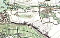 Varendorf(63)-ausschnitt-eilbek-hamm.jpg 1,406 × 908; 559 KB
-
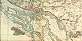
 Varendorf(63)Bergedorf Reinbek.jpg 3,608 × 3,619; 12.93 MB
-
 Hamburg 1790 Elbinseln Varendorf.jpg 3,785 × 2,836; 9.89 MB
-
 Hamburg 1790 große karte varendorf.jpg 7,040 × 3,530; 24.56 MB
-
 Karte hamburg 1790 varendorf kl.jpg 2,000 × 1,003; 1.28 MB
-
 Osterbek about1867.png 452 × 384; 411 KB
-
 Hamburg1880Gaedechens.jpeg 8,342 × 6,339; 13.81 MB
-
 Eilbek.jpg 601 × 398; 68 KB
-
 1890 - Norddeutsche Staaten.jpg 3,170 × 1,825; 5.73 MB
-
 Brockhaus and Efron Encyclopedic Dictionary b84 499-0.jpg 3,350 × 2,806; 2.92 MB
-
 Hamburg 1898 Meyers 5. Aufl..jpg 3,176 × 2,480; 7.3 MB
-
 Meyers b8 s0038a.jpg 3,184 × 2,490; 7.07 MB
-
 Hamburg 1905 Meyers 6. Aufl..jpg 3,193 × 2,479; 7.88 MB
-
 Map hamburg altona 1910.jpg 2,605 × 1,980; 1.62 MB
-
 Aussen-und-binnenalster.png 416 × 642; 288 KB
-
 Karte Außen- und Binnenalster.svg 969 × 1,387; 2.52 MB
-
 Karte Bachstraße.png 2,325 × 2,828; 711 KB
-
 Hamburg Nord Uhlenhorst.svg 165 × 187; 1.28 MB
-
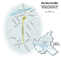 Karte Herderstraße.png 1,654 × 1,554; 341 KB
-
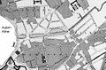
 Karte Mühlen der Wandse.png 3,388 × 912; 6.67 MB
-
 Pincerno - Mundsburg 2-2009.png 1,267 × 1,333; 48 KB
-
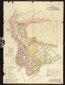
 PPN742272311 Bebauungsplan für den Stadttheil Uhlenhorst (1902).jpg 5,718 × 7,899; 6.83 MB
-
 PPN742272311 Bebauungsplan für den Stadttheil Uhlenhorst (1902).tif 6,283 × 8,160; 17.99 MB
-
 PPN742272729 Bebauungsplan für den Stadttheil Uhlenhorst (1902).jpg 5,698 × 7,919; 6.88 MB
-
 PPN742272729 Bebauungsplan für den Stadttheil Uhlenhorst (1902).tif 6,283 × 8,160; 17.56 MB
-
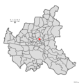
 Hamburg Wahlkreis 9.png 1,186 × 1,144; 28 KB
-
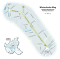 Karte Winterhuder Weg.png 2,200 × 2,160; 566 KB

-ausschnitt-eilbek-hamm.jpg)
Bergedorf_Reinbek.jpg)


.jpg)
.jpg)

