Category:Maps of Hamburg-Othmarschen
Jump to navigation
Jump to search
Wikimedia category | |||||
| Upload media | |||||
| Instance of | |||||
|---|---|---|---|---|---|
| Category combines topics | |||||
| Othmarschen | |||||
quarter in Hamburg, Germany   | |||||
| Instance of | |||||
| Location | Altona, Hamburg, Germany | ||||
| Located in or next to body of water | |||||
| Population |
| ||||
| Area |
| ||||
| Elevation above sea level |
| ||||
 | |||||
Media in category "Maps of Hamburg-Othmarschen"
The following 21 files are in this category, out of 21 total.
-
 HH-Othmarschen-quarter.jpg 843 × 746; 386 KB
-
 Othmarschen in HH.svg 1,713 × 1,689; 780 KB
-
 Pincerno - Othmarschen 11-2008.PNG 1,267 × 1,333; 48 KB
-
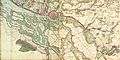
 Varendorf(62)Altona Hamburg Harburg.jpg 3,565 × 3,602; 15.77 MB
-
 Hamburg 1790 Elbinseln Varendorf.jpg 3,785 × 2,836; 9.89 MB
-
 Hamburg 1790 große karte varendorf.jpg 7,040 × 3,530; 24.56 MB
-
 Karte hamburg 1790 varendorf kl.jpg 2,000 × 1,003; 1.28 MB
-
 1890 - Norddeutsche Staaten.jpg 3,170 × 1,825; 5.73 MB
-
 Hamburg 1898 Meyers 5. Aufl..jpg 3,176 × 2,480; 7.3 MB
-
 Meyers b8 s0038a.jpg 3,184 × 2,490; 7.07 MB
-
 Hamburg 1905 Meyers 6. Aufl..jpg 3,193 × 2,479; 7.88 MB
-
 SeekarteSchweinesand1938.jpg 2,434 × 1,280; 2.86 MB
-
 Pincerno - AK Altona 2-2009.png 1,267 × 1,333; 48 KB
-
 Karte Hamburger Deckel.png 328 × 1,003; 229 KB
-
 Pincerno - Elbchaussee.png 1,267 × 1,333; 48 KB
-
 Pincerno - Elbvororte 11-2008.PNG 1,267 × 1,333; 48 KB
-
 Hamburg Altona Othmarschen.svg 229 × 186; 1.8 MB
-
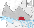
 Hamburg Stadtteil Othmarschen.svg 560 × 549; 635 KB
-
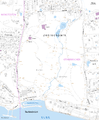 Karte Jenischpark.png 2,798 × 3,380; 512 KB
-
 Pincerno - Klein Flottbek 1-2009.PNG 1,267 × 1,333; 48 KB
-
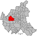 Hamburg Wahlkreis 3.png 1,186 × 1,144; 28 KB


Altona_Hamburg_Harburg.jpg)


