Category:Maps of Hamburg-Blankenese
Jump to navigation
Jump to search
Wikimedia category | |||||
| Upload media | |||||
| Instance of | |||||
|---|---|---|---|---|---|
| Category combines topics | |||||
| Blankenese | |||||
quarter in Altona, Hamburg, Germany | |||||
| Instance of | |||||
| Location |
| ||||
| Located in or next to body of water | |||||
| Area |
| ||||
| Different from | |||||
| official website | |||||
 | |||||
Media in category "Maps of Hamburg-Blankenese"
The following 18 files are in this category, out of 18 total.
-
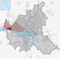
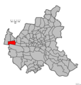
Blankenese in HH.svg 1,713 × 1,689; 780 KB
-
Hamburg Altona Blankenese.svg 229 × 186; 1.8 MB
-
Hamburg Stadtteil Blankenese.svg 560 × 549; 635 KB
-
HH-quarter-blankenese.jpg 843 × 746; 393 KB
-
Pincerno - Blankenese 11-2008.PNG 1,267 × 1,333; 48 KB
-
Wedelerau aus Joh Mejer Stormarn 1650.png 1,095 × 751; 1.62 MB
-
Pincerno - Niederelbe 1860.jpg 1,191 × 842; 315 KB
-
1890 - Norddeutsche Staaten.jpg 3,170 × 1,825; 5.73 MB
-
Hamburg 1898 Meyers 5. Aufl..jpg 3,176 × 2,480; 7.3 MB
-
Meyers b8 s0038a.jpg 3,184 × 2,490; 7.07 MB
-
Hamburg 1905 Meyers 6. Aufl..jpg 3,193 × 2,479; 7.88 MB
-
Map elbe mouth 1910.jpg 1,500 × 927; 787 KB
-
SeekarteSchweinesand1938.jpg 2,434 × 1,280; 2.86 MB
-
Baur's Park Ausschnitt Flurkarte von Blankenese 1720.jpg 1,040 × 919; 435 KB
-
Pincerno - Elbchaussee.png 1,267 × 1,333; 48 KB
-
Pincerno - Elbvororte 11-2008.PNG 1,267 × 1,333; 48 KB
-
Pincerno - Baurs Park um 1880.jpg 1,152 × 880; 251 KB
-
Hamburg Wahlkreis 4.png 1,186 × 1,144; 29 KB


