Category:Maps of Hamburg-HafenCity
Jump to navigation
Jump to search
Wikimedia category | |||||
| Upload media | |||||
| Instance of | |||||
|---|---|---|---|---|---|
| Category combines topics | |||||
| HafenCity | |||||
quarter in the district of Hamburg-Mitte in Hamburg, Germany | |||||
| Instance of | |||||
| Location | Hamburg-Mitte, Hamburg, Germany | ||||
| Located in or next to body of water | |||||
| Architect | |||||
| Area |
| ||||
| Elevation above sea level |
| ||||
| Replaces | |||||
 | |||||
Media in category "Maps of Hamburg-HafenCity"
The following 43 files are in this category, out of 43 total.
-
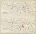
Grasbrook johnsche ecke.jpg 607 × 555; 457 KB
-
Varendorf(62)Altona Hamburg Harburg.jpg 3,565 × 3,602; 15.77 MB
-
Reiherstieg-vor-1800.jpg 1,178 × 1,378; 2.06 MB
-
Karte hamburg 1790 varendorf kl.jpg 2,000 × 1,003; 1.28 MB
-
Hamburg 1790 Elbinseln Varendorf.jpg 3,785 × 2,836; 9.89 MB
-
Hamburg 1790 große karte varendorf.jpg 7,040 × 3,530; 24.56 MB
-
Hamburg.1813 neddermeyer.Elbe.300dpi.jpg 4,824 × 1,952; 6.51 MB
-
Hamburg.Karte.1813 neddermeyer 300dpi.jpg 5,808 × 4,614; 7.63 MB
-
Hamburg-Plan1890-Ausschnitt.jpg 914 × 956; 835 KB
-
Brockhaus and Efron Encyclopedic Dictionary b84 499-0.jpg 3,350 × 2,806; 2.92 MB
-
Zollkanal.jpg 655 × 317; 269 KB
-
Hamburg.Plan.1890 retusche.png 3,000 × 1,622; 2.37 MB
-
Hamburg.Plan.1890.png 3,000 × 1,622; 2.39 MB
-
Hamburg 1898 Meyers 5. Aufl..jpg 3,176 × 2,480; 7.3 MB
-
Meyers b8 s0038a.jpg 3,184 × 2,490; 7.07 MB
-
Hamburg 1905 Meyers 6. Aufl..jpg 3,193 × 2,479; 7.88 MB
-
Karte Hamburger Hafen 1910 Ausschnitt.JPG 850 × 614; 186 KB
-
Karte Hamburger Hafen 1910.jpg 2,512 × 1,129; 3.31 MB
-
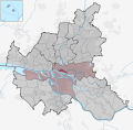
HafenCity in HH.svg 1,713 × 1,689; 780 KB
-
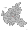
Hamburg Wahlkreis 1.png 1,186 × 1,144; 29 KB
-
HH-HafenCity-quarter.jpg 843 × 746; 390 KB
-
Pincerno - Elbphilharmonie 11-2008.PNG 1,267 × 1,333; 48 KB
-
Pincerno - HafenCity - 11-2008.PNG 1,267 × 1,333; 48 KB
-
Pincerno - Speicherstadt 11-2008.PNG 1,267 × 1,333; 48 KB
-
Ausschnitt Liegenschafts-Kataster Grasbrook um 1920.jpg 1,472 × 1,698; 952 KB
-
Hamburg Mitte HafenCity.svg 311 × 187; 1.37 MB
-
Hamburgs Bahnhöfe1880.png 2,097 × 1,804; 9.16 MB
-
Karte HafenCity-Am Lohsepark.svg 1,175 × 688; 624 KB
-
Karte HafenCity-Am Sandtorkai-Dalmannkai.svg 1,175 × 688; 624 KB
-
Karte HafenCity-Am Sandtorpark-Grasbrook.svg 1,175 × 688; 624 KB
-
Karte HafenCity-Baakenhafen.svg 1,175 × 688; 624 KB
-
Karte HafenCity-Brooktorkai-Ericus.svg 1,175 × 688; 624 KB
-
Karte HafenCity-Elbtorquartier.svg 1,175 × 688; 624 KB
-
Karte HafenCity-Oberhafen.svg 1,175 × 688; 624 KB
-
Karte HafenCity-Quartier Elbbrücken.svg 1,175 × 688; 624 KB
-
Karte HafenCity-Strandkai.svg 1,175 × 688; 624 KB
-
Karte HafenCity.svg 1,175 × 688; 624 KB
-
Karte Quartiere der HafenCity.svg 1,371 × 805; 963 KB
-
Karte Weltkulturerbe Speicherstadt und Kontorhausviertel mit Chilehaus.png 6,493 × 4,472; 3.17 MB
-
Niederhafen 1813.jpg 1,855 × 941; 1.77 MB
-
Karte HafenCity-Überseequartier.svg 1,175 × 688; 624 KB


