Category:Maps of Glasgow
Jump to navigation
Jump to search
Council areas (municipalities) of Scotland: Aberdeen · Aberdeenshire · Angus · Argyll and Bute · Clackmannanshire · Dumfries and Galloway · Dundee · East Ayrshire · East Dunbartonshire · East Lothian · East Renfrewshire · Edinburgh · Falkirk · Fife · Glasgow · Highland · Inverclyde · Midlothian · Moray · North Ayrshire · North Lanarkshire · Outer Hebrides · Orkney Islands · Perth and Kinross · Renfrewshire · Scottish Borders · Shetland Islands · South Ayrshire · South Lanarkshire · Stirling · West Dunbartonshire · West Lothian
Wikimedia category | |||||
| Upload media | |||||
| Instance of | |||||
|---|---|---|---|---|---|
| Category combines topics | |||||
| Glasgow | |||||
city in Scotland, United Kingdom | |||||
| Pronunciation audio | |||||
| Instance of | |||||
| Patron saint | |||||
| Location |
| ||||
| Located in or next to body of water | |||||
| Head of government |
| ||||
| Population |
| ||||
| Area |
| ||||
| Different from | |||||
| official website | |||||
 | |||||
Subcategories
This category has the following 4 subcategories, out of 4 total.
Media in category "Maps of Glasgow"
The following 75 files are in this category, out of 75 total.
-
1918-1949 Glasgow Camlachie.png 694 × 555; 14 KB
-
2018-01-01-00 00 2018-01-01-23 59 CORINE Land Cover Corine Land Cover (23).jpg 1,024 × 528; 278 KB
-
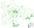
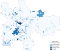
African Glasgow 2011 census.png 21,134 × 17,552; 18.26 MB
-
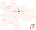
Arab Glasgow 2011 census.png 20,995 × 17,435; 18.11 MB
-
Argyll street map.png 824 × 490; 1.16 MB
-
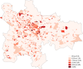
Asian Glasgow 2011 census.png 20,995 × 17,436; 18.48 MB
-
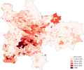
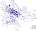
Bangladeshi Glasgow 2011 census.png 21,065 × 17,494; 17.81 MB
-
BELLGROVE 1.jpg 3,941 × 2,784; 903 KB
-
Bronze model of Cathedral Square - geograph.org.uk - 3633471.jpg 640 × 480; 160 KB
-
Bronze model of Glasgow Cathedral precincts - geograph.org.uk - 6251835.jpg 1,600 × 1,148; 469 KB
-
Buddhism Glasgow 2011 census.png 21,134 × 17,552; 18.44 MB
-
Caribbean Or Black Glasgow 2011 census.png 20,995 × 17,436; 18.11 MB
-
Chinese Glasgow 2011 census.png 20,995 × 17,436; 18.33 MB
-
Christianity Glasgow 2011 census.png 21,064 × 17,493; 18.45 MB
-
Church Of Scotland Glasgow 2011 census.png 21,134 × 17,552; 18.59 MB
-
Detail location of the Sir John Moore.jpg 751 × 382; 42 KB
-
EASTERN BOULEVARD, GLASGOW.jpg 2,650 × 4,778; 3.73 MB
-
Garnkirk and Glasgow Railway.gif 1,000 × 570; 41 KB
-
Garnkirk map 1846.gif 1,000 × 631; 54 KB
-
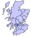
Glasgow (Location).png 553 × 933; 177 KB
-
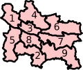
Glasgow (Scottish Parliament electoral region) (2011 numbered).svg 151 × 127; 26 KB
-
GLASGOW 1.jpg 2,599 × 4,849; 4.06 MB
-
Glasgow Baillieston ScottishParliamentConstituency.svg 162 × 143; 19 KB
-
Glasgow Cathcart (Scottish Parliament constituency).svg 151 × 127; 23 KB
-
Glasgow Govan ScottishParliamentConstituency.svg 162 × 143; 19 KB
-
Glasgow Kelvin (Scottish Parliament constituency).svg 151 × 127; 23 KB
-
Glasgow location.png 236 × 226; 47 KB
-
Glasgow Maryhill ScottishParliamentConstituency.svg 162 × 143; 19 KB
-
Glasgow Pollok (Scottish Parliament constituency).svg 151 × 127; 23 KB
-
Glasgow Provan (Scottish Parliament constituency).svg 151 × 127; 23 KB
-
Glasgow region.svg 162 × 143; 20 KB
-
Glasgow Shettleston (Scottish Parliament constituency).svg 151 × 127; 23 KB
-
Glasgow Southside (Scottish Parliament constituency).svg 151 × 127; 23 KB
-
Glasgow Springburn ScottishParliamentConstituency.svg 162 × 143; 19 KB
-
Glasgow tram map 1938.png 2,500 × 1,938; 736 KB
-
Glasgow tram map 1950.png 2,500 × 1,938; 676 KB
-
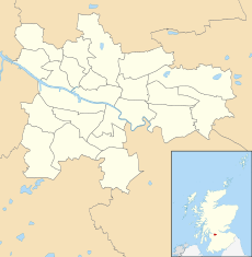
Glasgow UK blank map.svg 1,357 × 1,384; 700 KB
-
Glasgow UK constituency map (blank).svg 1,357 × 1,384; 731 KB
-
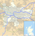
Glasgow UK location map.svg 1,357 × 1,384; 1,006 KB
-
Glasgow UK parish map (blank).svg 1,357 × 1,384; 822 KB
-
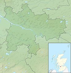
Glasgow UK relief location map (White Cart).jpg 1,037 × 1,565; 118 KB
-
Glasgow UK relief location map.jpg 2,002 × 2,043; 309 KB
-
Glasgow, Scotland (5460921673).jpg 1,000 × 1,000; 281 KB
-
Glasgow.png 1,280 × 955; 282 KB
-
Glasgowareas.jpg 1,492 × 1,151; 901 KB
-
GlasgowAttack.png 3,840 × 2,160; 7.62 MB
-
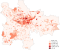
Greater Glasgow population density map, 2011 census.png 3,364 × 1,894; 7.79 MB
-
Hinduism Glasgow 2011 census.png 21,134 × 17,552; 18.3 MB
-
Indian Glasgow 2011 census.png 21,065 × 17,494; 18.44 MB
-
Irish Glasgow 2011 census.png 21,064 × 17,493; 18.77 MB
-
Islam Glasgow 2011 census.png 21,134 × 17,552; 18.43 MB
-
Jordanhill station open street maps.png 887 × 889; 348 KB
-
Judaism Glasgow 2011 census.png 21,134 × 17,552; 18.04 MB
-
Location map Scotland Glasgow Central.png 1,366 × 1,347; 1.44 MB
-
Location map United Kingdom Glasgow.png 721 × 618; 448 KB
-
Location of the Sir John Moore.jpg 863 × 590; 143 KB
-
Map of the Oscar Slater case.png 1,166 × 946; 1.84 MB
-
Noreligion Glasgow 2011 census.png 21,065 × 17,494; 16.9 MB
-
Ordnance Survey Quarter-inch sheet 6 Firth of Clyde, published 1965.jpg 9,628 × 8,893; 10.55 MB
-
Ordnance Survey Quarter-inch sheet 6 Firth of Clyde, published 1973.jpg 12,916 × 11,785; 63.56 MB
-
Other Christian Glasgow 2011 census.png 21,134 × 17,552; 18.86 MB
-
Other Religion Glasgow 2011 census.png 21,064 × 17,493; 18.05 MB
-
Pakistani Glasgow 2011 census.png 20,995 × 17,436; 17.12 MB
-
Photo-21-12-2015-11-37-19-1-710x1024.jpg 710 × 1,024; 273 KB
-
Polish Glasgow 2011 census.png 20,994 × 17,436; 18.29 MB
-
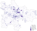
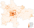
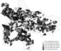
Population Density Glasgow 2011 Census.png 21,064 × 17,493; 14.3 MB
-
PortEglinton.jpg 364 × 349; 70 KB
-
Roman Catholic Glasgow 2011 Census.png 21,065 × 17,494; 18.61 MB
-
ScotlandGlasgow.png 200 × 230; 4 KB
-
Sikhism Glasgow 2011 census.png 20,994 × 17,436; 18.07 MB
-
Square Mile of Murder map.svg 836 × 800; 3.72 MB
-
White Glasgow 2011 census.png 21,204 × 17,610; 17.68 MB
-
White Other British Glasgow 2011 census.png 21,064 × 17,494; 18.61 MB
-
White Other Glasgow 2011 census.png 21,065 × 17,494; 18.48 MB
-
White Scottish Glasgow 2011 census.png 20,994 × 17,436; 17.39 MB


