Category:Maps of Dumfries and Galloway
Jump to navigation
Jump to search
Council areas (municipalities) of Scotland: Aberdeen · Aberdeenshire · Angus · Argyll and Bute · Clackmannanshire · Dumfries and Galloway · Dundee · East Ayrshire · East Dunbartonshire · East Lothian · East Renfrewshire · Edinburgh · Falkirk · Fife · Glasgow · Highland · Inverclyde · Midlothian · Moray · North Ayrshire · North Lanarkshire · Outer Hebrides · Orkney Islands · Perth and Kinross · Renfrewshire · Scottish Borders · Shetland Islands · South Ayrshire · South Lanarkshire · Stirling · West Dunbartonshire · West Lothian
Wikimedia category | |||||
| Upload media | |||||
| Instance of | |||||
|---|---|---|---|---|---|
| Category combines topics | |||||
| Dumfries and Galloway | |||||
unitary council area of Scotland    | |||||
| Instance of | |||||
| Location | Scotland | ||||
| Capital | |||||
| Legislative body |
| ||||
| Inception |
| ||||
| Population |
| ||||
| Area |
| ||||
| official website | |||||
 | |||||
Subcategories
This category has the following 6 subcategories, out of 6 total.
Media in category "Maps of Dumfries and Galloway"
The following 89 files are in this category, out of 89 total.
-
 Cumbria Z10 Mapnik OSM.png 913 × 939; 366 KB
-
 Dumfries and Galloway 1999.svg 596 × 747; 820 KB
-
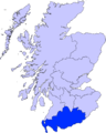
 Dumfries and Galloway council area.svg 603 × 753; 671 KB
-
 Dumfries and Galloway Council election 2012.svg 1,425 × 969; 1.67 MB
-
 Dumfries and Galloway Council election 2017.svg 2,130 × 1,289; 104 KB
-
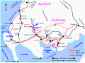
 Dumfries and Galloway map.png 1,411 × 882; 33 KB
-
 Dumfries and Galloway towns.png 450 × 300; 34 KB
-
 Dumfries and Galloway UK blank map.svg 1,425 × 969; 1.31 MB
-
 Dumfries and Galloway UK location map.svg 1,425 × 969; 1.97 MB
-
 Dumfries and Galloway UK parish map (blank).svg 1,425 × 969; 1.86 MB
-
 Dumfries and Galloway UK relief location map.jpg 2,004 × 1,363; 419 KB
-
 Dumfries and Galloway UK ward map (blank).svg 1,425 × 969; 1.6 MB
-
 Dumfries and Galloway UK ward map 2017 (blank).svg 1,425 × 969; 1.58 MB
-
 Dumfries ScottishParliamentConstituency.PNG 1,556 × 1,213; 62 KB
-
 Dumfriesshire C Ward Map 2011.svg 1,033 × 901; 222 KB
-
 Five Red Herrings - sketch map.svg 1,348 × 997; 6.41 MB
-
 Galloway and West Dumfries C Ward Map 2011.svg 1,499 × 1,065; 347 KB
-
 Garlieston-Scotland (Locator LG).png 400 × 280; 88 KB
-
 Glasserton Dumfries and Galloway UK parish map.svg 1,425 × 969; 1.86 MB
-
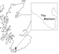 Machars.GIF 352 × 323; 7 KB
-
 Mapa dg ae.jpg 2,004 × 1,363; 605 KB
-
 Mapa dg am magh fada.jpg 2,004 × 1,363; 599 KB
-
 Mapa dg am mòine naomh.jpg 2,004 × 1,363; 605 KB
-
 Mapa dg amisfield.jpg 2,004 × 1,363; 599 KB
-
 Mapa dg an abaid ùr.jpg 2,004 × 1,363; 599 KB
-
 Mapa dg applegarthtown.jpg 2,004 × 1,363; 599 KB
-
 Mapa dg auldgirth.jpg 2,004 × 1,363; 599 KB
-
 Mapa dg Baile MhicIllFhaolain.jpg 2,004 × 1,363; 599 KB
-
 Mapa dg baile na h-eaglaise.jpg 2,004 × 1,363; 599 KB
-
 Mapa dg baile ùr a' ghall-ghaidhealaibh.jpg 2,004 × 1,363; 599 KB
-
 Mapa dg bankend.jpg 2,004 × 1,363; 599 KB
-
 Mapa dg beattock.jpg 2,004 × 1,363; 599 KB
-
 Mapa dg beeswing.jpg 2,004 × 1,363; 599 KB
-
 Mapa dg bentpath.jpg 2,004 × 1,363; 599 KB
-
 Mapa dg borgh.jpg 2,004 × 1,363; 599 KB
-
 Mapa dg bàrr na dris.jpg 2,004 × 1,363; 599 KB
-
 Mapa dg canonbie.jpg 2,004 × 1,363; 599 KB
-
 Mapa dg cathair.jpg 2,004 × 1,363; 599 KB
-
 Mapa dg chapelknowe.jpg 2,004 × 1,363; 599 KB
-
 Mapa dg cill osbairn.jpg 2,004 × 1,363; 599 KB
-
 Mapa dg cille bhrìghde.jpg 2,004 × 1,363; 599 KB
-
 Mapa dg cille chonaill.jpg 2,004 × 1,363; 599 KB
-
 Mapa dg cille phàdraig nam fleamach.jpg 2,004 × 1,363; 599 KB
-
 Mapa dg clachan eòin.jpg 2,004 × 1,363; 599 KB
-
 Mapa dg clarencefield.jpg 2,004 × 1,363; 599 KB
-
 Mapa dg collin.jpg 2,004 × 1,363; 599 KB
-
 Mapa dg comar na drise.jpg 2,004 × 1,363; 599 KB
-
 Mapa dg cuingealach.jpg 2,004 × 1,363; 599 KB
-
 Mapa dg dail bheithe.jpg 2,004 × 1,363; 599 KB
-
 Mapa dg dalswinton.jpg 2,004 × 1,363; 599 KB
-
 Mapa dg daltan.jpg 2,004 × 1,363; 599 KB
-
 Mapa dg doras na frìthe.jpg 2,004 × 1,363; 599 KB
-
 Mapa dg drochaid a' mhuillinn.jpg 2,004 × 1,363; 599 KB
-
 Mapa dg drochaid charrainn.jpg 2,004 × 1,363; 599 KB
-
 Mapa dg drochaid mhic iain.jpg 2,004 × 1,363; 599 KB
-
 Mapa dg duncow.jpg 2,004 × 1,363; 599 KB
-
 Mapa dg dòrnach.jpg 2,004 × 1,363; 599 KB
-
 Mapa dg dùn droighnein.jpg 2,004 × 1,363; 599 KB
-
 Mapa dg dùn phrìs 01.jpg 2,004 × 1,363; 599 KB
-
 Mapa dg dùn sgoir.jpg 2,004 × 1,363; 599 KB
-
 Mapa dg eaglais fheichein.jpg 2,004 × 1,363; 599 KB
-
 Mapa dg eaglesfield.jpg 2,004 × 1,363; 599 KB
-
 Mapa dg eastriggs.jpg 2,004 × 1,363; 599 KB
-
 Mapa dg eskdalemuir.jpg 2,004 × 1,363; 599 KB
-
 Mapa dg gleann chapall.jpg 2,004 × 1,363; 599 KB
-
 Mapa dg hightae.jpg 2,004 × 1,363; 599 KB
-
 Mapa dg hoddom.jpg 2,004 × 1,363; 599 KB
-
 Mapa dg holywood.jpg 2,004 × 1,363; 599 KB
-
 Mapa dg inbhir anainn.jpg 2,004 × 1,363; 599 KB
-
 Mapa dg kettleholm.jpg 2,004 × 1,363; 599 KB
-
 Mapa dg kirtlebridge.jpg 2,004 × 1,363; 599 KB
-
 Mapa dg langaim.jpg 2,004 × 1,363; 599 KB
-
 Mapa dg loch mhabain.jpg 2,004 × 1,363; 599 KB
-
 Mapa dg logarbaidh.jpg 2,004 × 1,363; 599 KB
-
 Mapa dg mouswald.jpg 2,004 × 1,363; 599 KB
-
 Mapa dg palnackie.jpg 2,004 × 1,363; 599 KB
-
 Mapa dg parkgate.jpg 2,004 × 1,363; 599 KB
-
 Mapa dg penpont.jpg 2,004 × 1,363; 599 KB
-
 Mapa dg ruthwell.jpg 2,004 × 1,363; 599 KB
-
 Mapa dg templand.jpg 2,004 × 1,363; 599 KB
-
 Mapa dg torthorwald.jpg 2,004 × 1,363; 599 KB
-
 Mapa dg tynron.jpg 2,004 × 1,363; 599 KB
-
 Mapa dg tìr na h-eaglaise.jpg 2,004 × 1,363; 599 KB
-
 Mapa dg wamphray.jpg 2,004 × 1,363; 599 KB
-
 Mapa na machrach.jpg 551 × 524; 77 KB
-
 Merrick Galloway trails.jpg 1,078 × 1,236; 163 KB
-
 NHSdumgal.png 2,733 × 3,411; 207 KB
-
 Ordnance Survey 1-250000 - NX.jpg 4,000 × 4,000; 4.66 MB
-
 Solway Firth map.png 1,000 × 622; 320 KB


.png)


.svg)
.svg)
.svg)