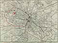
Category:Public transport maps of Glasgow
Jump to navigation
Jump to search
Media in category "Public transport maps of Glasgow"
The following 15 files are in this category, out of 15 total.
-
-
 Dalry & NJ Rly 1896.gif 2,580 × 2,460; 202 KB
-
 Dalry & NJ Rly 1905.gif 2,580 × 2,460; 228 KB
-
 GB&KJR 1873.gif 2,206 × 2,451; 183 KB
-
 GB&NDR 1848.gif 2,206 × 2,451; 147 KB
-
 Glasgow & Paisley Jt Ry 1922.gif 3,513 × 1,680; 249 KB
-
 Glasgow and Paisley Jt Ry 1841.gif 2,461 × 1,176; 99 KB
-
 Glasgow CIty Union Rly 1864b.gif 3,476 × 2,210; 192 KB
-
 Glasgow City Union Rly 1876.svg 2,105 × 1,488; 47 KB
-
 Glasgow City Union Rly 1876b.gif 3,477 × 2,211; 223 KB
-
 Glasgow CIty Union Rly 1896b.gif 3,476 × 2,210; 306 KB
-
 Glasgow SPT Subway Map-sv.svg 500 × 280; 40 KB
-
 Greater Glasgow rail passengers 2018-19.png 1,801 × 941; 2.66 MB
-
 Paisley Canal line 1886.gif 4,298 × 1,642; 235 KB
-
 Paisley Canal line.gif 3,581 × 1,368; 169 KB
_(14776109202).jpg)


