Category:Maps of Angus
Appearance
Traditional counties (shires) of Scotland: Aberdeenshire · Angus · Argyll ≈ Argyllshire · Ayrshire · Banffshire · Berwickshire · Buteshire · Caithness · Clackmannanshire · Cromartyshire · Dumbartonshire · Dumfriesshire · East Lothian · Fife · Inverness-shire · Kincardineshire · Kinross-shire · Kirkcudbrightshire · Lanarkshire · Midlothian · Moray · Nairnshire · the Orkney Islands ≈ Orkney Islands · Peeblesshire · Perthshire · Renfrewshire · Ross-shire · Roxburghshire · Selkirkshire · the Shetland Islands ≈ Shetland Islands · Stirlingshire · Sutherland · West Lothian · Wigtownshire
Council areas (municipalities) of Scotland: Aberdeen · Aberdeenshire · Angus · Argyll and Bute · Clackmannanshire · Dumfries and Galloway · Dundee · East Ayrshire · East Dunbartonshire · East Lothian · East Renfrewshire · Edinburgh · Falkirk · Fife · Glasgow · Highland · Inverclyde · Midlothian · Moray · North Ayrshire · North Lanarkshire · Outer Hebrides · Orkney Islands · Perth and Kinross · Renfrewshire · Scottish Borders · Shetland Islands · South Ayrshire · South Lanarkshire · Stirling · West Dunbartonshire · West Lothian
Wikimedia category | |||||
| Upload media | |||||
| Instance of | |||||
|---|---|---|---|---|---|
| Category combines topics | |||||
| Angus | |||||
council area of Scotland | |||||
| Instance of |
| ||||
| Part of |
| ||||
| Location |
| ||||
| Capital | |||||
| Legislative body |
| ||||
| Headquarters location | |||||
| Population |
| ||||
| Area |
| ||||
| Different from | |||||
| official website | |||||
 | |||||
Subcategories
This category has the following 4 subcategories, out of 4 total.
Media in category "Maps of Angus"
The following 29 files are in this category, out of 29 total.
-
After Action Report - Teplitz-Schönau - NARA - 100384490 (page 2).jpg 10,800 × 7,616; 11.82 MB
-
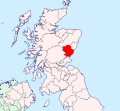
Angus - British Isles.svg 1,250 × 1,835; 1,024 KB
-
Angus Brit Isles Sect 1.svg 901 × 797; 1,004 KB
-
Angus Brit Isles Sect 2.svg 915 × 841; 1,012 KB
-
Angus map.png 1,175 × 1,152; 31 KB
-
Angus North and Mearns (Scottish Parliament constituency).svg 206 × 234; 61 KB
-
Angus South (Scottish Parliament constituency).svg 206 × 234; 61 KB
-
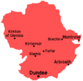
Angus towns.png 400 × 340; 25 KB
-
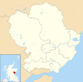
Angus UK blank map.svg 1,425 × 1,400; 834 KB
-
Angus UK location map.svg 1,425 × 1,400; 1.14 MB
-
Angus UK parish map (blank).svg 1,425 × 1,400; 1.07 MB
-
Angus UK relief location map.jpg 1,998 × 1,962; 471 KB
-
Angus UK ward map (blank).svg 1,425 × 1,400; 1.01 MB
-
Angus UK ward map 2017 (blank).svg 1,425 × 1,400; 1 MB
-
Angus-Scurdie Ness Lighthouse.jpg 1,000 × 982; 129 KB
-
Angus.png 191 × 261; 3 KB
-
AngusBrit2.PNG 608 × 604; 20 KB
-
AngusTraditional.png 420 × 520; 12 KB
-
Condado de Angus.jpg 293 × 382; 58 KB
-
Firthoftaymap.png 540 × 339; 8 KB
-
Forfarshire (County of Angus) - Scotland.svg 690 × 1,039; 1,001 KB
-
Hospital St John Baptist Location.jpg 1,091 × 1,461; 410 KB
-
Map showing the traditional, geographical county of Angus, Scotland.png 4,967 × 4,967; 7.55 MB
-
North East.PNG 2,733 × 4,002; 224 KB
-
NorthWestScotlandNumberd.PNG 955 × 1,102; 27 KB
-
Rescobie Loch Angus UK location map.jpg 1,200 × 1,179; 103 KB
-
Scot1975Angus.png 200 × 229; 30 KB
-
ScotlandAngus.png 200 × 230; 4 KB


