
Category:Maps of France in the 17th century
English: This category is about the subject of  France 1601-1700 CE: History maps showing all or a substantial part of the territory of France as it was in the 17th century.
Contemporary old maps belong into: Category:17th-century maps of France and its subcategories.
Contemporary old maps belong into: Category:17th-century maps of France and its subcategories.
Maps of the history of France: (BCE) 1st century · (CE) 1st century · 2nd century · 3rd century · 4th century · 5th century · 6th century · 7th century · 8th century · 9th century · 10th century · 11th century · 12th century · 13th century · 14th century · 15th century · 16th century · 17th century · 18th century · 19th century · 20th century · 21st century ·
Subcategories
This category has the following 4 subcategories, out of 4 total.
Media in category "Maps of France in the 17th century"
The following 26 files are in this category, out of 26 total.
-
 France frontiers 1601 1766.jpg 1,252 × 1,790; 477 KB
-
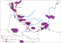
 Hugonotes1685.svg 718 × 736; 1.63 MB
-
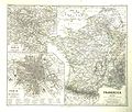
 C. 1650 France.jpg 691 × 733; 620 KB
-

-
 France vs United Provinces 1672 - 1697.jpg 1,500 × 1,957; 523 KB
-
 France1911dev.png 2,046 × 2,780; 3.94 MB
-

-
 Battle of Bantry Bay,11 May 1689-en.svg 974 × 640; 59 KB
-
 Battle of Bantry Bay,11 May 1689-es.svg 974 × 640; 263 KB
-
 Battle of Bantry Bay,11 May 1689-fr.svg 974 × 640; 48 KB
-
 Battle of Bantry Bay,11 May 1689-hu.svg 974 × 640; 48 KB
-
 Battle of Beachy Head (1690)-en.svg 1,036 × 711; 34 KB
-
 Battle of Beachy Head (1690)-es.svg 1,036 × 711; 33 KB
-
 Battle of Beachy Head (1690)-fr.svg 1,036 × 711; 34 KB
-
 Battle of Beachy Head (1690)-hu.svg 1,036 × 711; 34 KB
-
 C. 1601-1766 France (extensions of northeastern frontier).jpg 1,885 × 1,293; 1.29 MB
-
 C. 1601-1766 France (extensions of southern frontier).jpg 1,674 × 1,405; 2.24 MB
-
 C. 1601-1766 France frontiers.jpg 1,252 × 1,790; 2.53 MB
-
 C. 1790 France (1600-1790).jpg 3,000 × 4,000; 5.6 MB
-
 Conquêtes de Louis XIV de 1648 à 1681.jpeg 591 × 635; 118 KB
-
 Export1.svg 1,052 × 744; 138 KB
-
 Généralité-de-Montauban 1635-1715.jpg 1,920 × 2,062; 478 KB
-
 Plan et légende.png 1,861 × 1,258; 286 KB
-
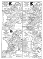
 Spruner-Menke Handatlas 1880 Karte 55.jpg 3,499 × 2,988; 1.57 MB
-
 The Upper Rhine region, with Alsace on the left bank..jpg 1,685 × 2,187; 2.73 MB
-


.jpg)


.jpg)


-en.svg)
-es.svg)
-fr.svg)
-hu.svg)
.jpg)
.jpg)

.jpg)


.jpg)