
Category:Maps of France in the 9th century
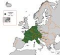
English: This category is about the subject of  France 801-900 CE: History maps showing all or a substantial part of the territory of France as it was in the 9th century.
Contemporary old maps belong into: Category:Old maps of France and its subcategories.
Contemporary old maps belong into: Category:Old maps of France and its subcategories.
Maps of the history of France: (BCE) 1st century · (CE) 1st century · 2nd century · 3rd century · 4th century · 5th century · 6th century · 7th century · 8th century · 9th century · 10th century · 11th century · 12th century · 13th century · 14th century · 15th century · 16th century · 17th century · 18th century · 19th century · 20th century · 21st century ·
Subcategories
This category has the following 9 subcategories, out of 9 total.
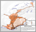
Media in category "Maps of France in the 9th century"
The following 7 files are in this category, out of 7 total.
-

-
 Carolingian Empire 481 - 814.GIF 579 × 535; 16 KB
-
 C. 888 Europe.jpg 2,305 × 1,454; 1.73 MB
-
 Historical atlas of modern Europe 1903 (135895425).jpg 9,053 × 6,961; 59.55 MB
-
 C. 814 Frankish Kingdoms.jpg 1,267 × 792; 721 KB
-
 Fraxinetum.png 2,446 × 2,174; 692 KB
-


.jpg)


.jpg)