Category:Maps of unitary councils of Scotland
Appearance
Subcategories
This category has the following 13 subcategories, out of 13 total.
D
E
M
O
R
S
W
Media in category "Maps of unitary councils of Scotland"
The following 103 files are in this category, out of 103 total.
-
Aberdeen Aberdeenshire Moray topo.png 1,760 × 1,384; 2.91 MB
-
Aberdeen council.PNG 2,733 × 3,411; 208 KB
-
Aberdeen.svg 595 × 842; 50 KB
-
Aberdeenshire, Aberdeen City.png 191 × 261; 3 KB
-
Aberdeenshire.svg 595 × 842; 50 KB
-
Angus council.PNG 2,733 × 3,411; 208 KB
-
Angus, Dundee City.png 191 × 261; 3 KB
-
Angus.svg 595 × 842; 50 KB
-
Annandale.png 191 × 261; 3 KB
-
Ardnamurchan.png 191 × 261; 3 KB
-
Argyll and Bute council.PNG 2,733 × 3,411; 221 KB
-
Argyll and Bute.png 1,972 × 1,978; 3.62 MB
-
Argyll and Bute.svg 595 × 842; 50 KB
-
Argyll.png 191 × 261; 3 KB
-
Atholl.png 191 × 261; 3 KB
-
Clackmannanshire, Perth and Kinross.png 200 × 230; 4 KB
-
Clackmannanshire.svg 595 × 842; 50 KB
-
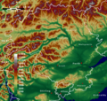
Dumfries and Galloway topo.png 1,822 × 1,175; 2.53 MB
-
Dumfries and Galloway.svg 595 × 842; 50 KB
-
Dundee council.PNG 2,733 × 3,411; 207 KB
-
Dundee.svg 595 × 842; 50 KB
-
East Ayrshire.svg 595 × 842; 50 KB
-
East Dunbartonshire, North Lanarkshire.png 200 × 230; 4 KB
-
East Lothian.svg 595 × 842; 50 KB
-
Edinburgh council.PNG 2,733 × 3,411; 208 KB
-
Edinburgh.svg 595 × 842; 50 KB
-
Falkirk.svg 595 × 842; 50 KB
-
Fife council.PNG 2,733 × 3,411; 208 KB
-
Fife.svg 595 × 842; 50 KB
-
Glasgow.svg 595 × 842; 50 KB
-
Glasgowcouncil.PNG 2,733 × 3,411; 207 KB
-
Highland topo SRTM.png 2,560 × 2,749; 9.04 MB
-
Highland.svg 595 × 842; 50 KB
-
Inverclyde.svg 595 × 842; 50 KB
-
Lothian council.PNG 2,733 × 3,411; 208 KB
-
Moray Council.PNG 2,733 × 3,411; 209 KB
-
Moray.svg 595 × 842; 50 KB
-
Na h-Eileanan Siarcouncil.PNG 2,733 × 3,411; 216 KB
-
North Ayrshire.svg 595 × 842; 50 KB
-
North Lanarkshire, South Lanarkshire.svg 603 × 753; 675 KB
-
North Lanarkshire.svg 595 × 842; 50 KB
-
Orkney.svg 595 × 842; 50 KB
-
Perth adn Kinross topo.png 1,296 × 1,228; 2.8 MB
-
Perth and Kinross council area.svg 603 × 753; 679 KB
-
Scotland Aberdeen.png 511 × 730; 11 KB
-
Scotland Aberdeenshire.png 511 × 730; 11 KB
-
Scotland Administrative Map 2009.png 1,000 × 1,625; 905 KB
-
Scotland Angus.png 511 × 730; 12 KB
-
Scotland Clackmannanshire map.png 511 × 730; 11 KB
-
Scotland Dumfries and Galloway.png 511 × 730; 11 KB
-
Scotland Dundee.png 511 × 730; 11 KB
-
Scotland East Lothian.png 511 × 730; 11 KB
-
Scotland Edynburg.png 511 × 730; 11 KB
-
Scotland Fife.png 511 × 730; 11 KB
-
Scotland Glasgow.png 511 × 730; 11 KB
-
Scotland Hebrydy Zewnętrzne.png 511 × 730; 12 KB
-
Scotland Highland.png 511 × 730; 11 KB
-
Scotland Inverclyde.png 511 × 730; 11 KB
-
Scotland Midlothian.png 511 × 730; 11 KB
-
Scotland Moray.png 511 × 730; 11 KB
-
Scotland No dark.jpg 2,200 × 3,300; 1.19 MB
-
Scotland No.svg 595 × 842; 77 KB
-
Scotland North Ayrshire.png 511 × 730; 11 KB
-
Scotland North Lanarkshire.png 511 × 730; 12 KB
-
Scotland Orkady.png 511 × 730; 11 KB
-
Scotland Stirling.png 511 × 730; 12 KB
-
ScotlandAberdeen.png 200 × 229; 28 KB
-
ScotlandAberdeenshire.png 191 × 261; 3 KB
-
ScotlandAberdeenshire.svg 1,895 × 2,462; 617 KB
-
ScotlandAngus.png 200 × 230; 4 KB
-
ScotlandArgyllBute.png 200 × 230; 4 KB
-
ScotlandClackmannanshire.png 200 × 230; 4 KB
-
ScotlandDumfriesGalloway.png 200 × 230; 4 KB
-
ScotlandDumfriesGallowayBordersSLanarks.png 200 × 230; 4 KB
-
ScotlandDundee.png 200 × 230; 4 KB
-
ScotlandEastAyrshire.png 200 × 230; 4 KB
-
ScotlandEastLothian.png 200 × 230; 4 KB
-
ScotlandEdinburgh.png 200 × 230; 4 KB
-
ScotlandFalkirk.png 200 × 230; 4 KB
-
ScotlandFife.png 200 × 230; 4 KB
-
ScotlandGlasgow.png 200 × 230; 4 KB
-
ScotlandHighlandCouncil.svg 1,895 × 2,462; 601 KB
-
ScotlandHighlands.png 200 × 230; 4 KB
-
ScotlandInverclyde.png 200 × 230; 4 KB
-
ScotlandMidLothian.png 200 × 230; 4 KB
-
ScotlandMoray.svg 1,895 × 2,462; 601 KB
-
ScotlandNorthAyrshire.png 200 × 230; 4 KB
-
ScotlandNorthLanarkshire.png 200 × 230; 4 KB
-
ScotlandOrkneyIslands.png 225 × 350; 3 KB
-
ScotlandOrkneyIslands.svg 744 × 1,052; 81 KB
-
ScotlandReferendum1979.svg 1,895 × 2,462; 632 KB
-
ScotlandShetlandIslands.png 225 × 350; 5 KB
-
ScotlandStirling.png 200 × 230; 3 KB
-
ScotlandStrathclyde1974.png 200 × 229; 22 KB
-
ScotlandWesternIsles.png 200 × 230; 4 KB
-
Scottish council areas 2011.svg 1,023 × 1,345; 2.87 MB
-
Scottish local elections 2012 (largest party).svg 1,023 × 1,345; 2.87 MB
-
Scottish local elections 2012.svg 1,023 × 1,345; 2.87 MB
-
Stirling.svg 595 × 842; 50 KB
-
Topo map Scottish Borders, Edinburgh, East Lothian, Midlothian.png 1,160 × 1,311; 2.24 MB
-
Topo map Stirling Dunbartonshire.png 830 × 849; 945 KB
-
West Lothian council area.svg 603 × 753; 675 KB
-
Western Isles.svg 595 × 842; 50 KB


