Category:Aerial photographs of Wuppertal
Jump to navigation
Jump to search
Subcategories
This category has the following 2 subcategories, out of 2 total.
Media in category "Aerial photographs of Wuppertal"
The following 47 files are in this category, out of 47 total.
-
 AK Wuppertal- Nord – A1, A43 und A46 treffen sich - panoramio.jpg 2,048 × 1,536; 2.21 MB
-
 Brausenwerther Platz in Elberfeld, Luftaufnahme von 1928.JPG 1,351 × 827; 174 KB
-

-
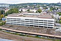 Ehemaliges Hauptpostamt Wuppertal, Kleeblatt 1-0114.jpg 5,030 × 3,351; 12.91 MB
-
 Ehemaliges Hauptpostamt Wuppertal, Kleeblatt 1-0126.jpg 4,380 × 2,464; 8.78 MB
-
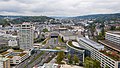 Elberfeld-Mitte, Wuppertal-0124.jpg 4,485 × 2,523; 8.12 MB
-
 Halde Lüntenbeck 01.jpg 4,000 × 3,000; 5.08 MB
-
 Halde Lüntenbeck 02.jpg 3,840 × 2,160; 2.75 MB
-
 Halde Lüntenbeck 03.jpg 3,840 × 2,160; 2.89 MB
-
 Halde Lüntenbeck 04.jpg 3,840 × 2,160; 2.67 MB
-
 Halde Lüntenbeck 05.jpg 3,840 × 2,160; 2.11 MB
-
 Halde Lüntenbeck 06.jpg 3,840 × 2,160; 2.59 MB
-
 Luftaufnahme KNIPEX-Gelände.jpg 5,616 × 3,744; 22.27 MB
-
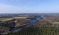
 Luftbild Beyenburger Stausee.jpg 5,460 × 3,640; 12.28 MB
-
 Luftbild Erich-Fried-Gesamtschule in Wuppertal-Ronsdorf.jpg 6,000 × 4,000; 16.17 MB
-
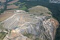 Luftbild Grube Osterholz.jpg 4,886 × 3,258; 9.22 MB
-
 Luftbild Grube Schickenberg.jpg 5,810 × 3,874; 13.89 MB
-
 Luftbild Gruben Voßbeck und Schickenberg.jpg 5,056 × 3,370; 10.48 MB
-
 Luftbild Herbringhauser Talsperre.jpg 3,999 × 2,353; 1.81 MB
-
 Luftbild Justizvollzugsschule und Landesfinanzschule NRW.jpg 5,192 × 3,462; 12.5 MB
-
 Luftbild JVA Ronsdorf.jpg 5,230 × 3,486; 11.54 MB
-
 Luftbild Mastweg.jpg 3,050 × 2,034; 4.38 MB
-
 Luftbild Müllverbrennungsanlage Wuppertal.jpg 2,906 × 1,938; 1.67 MB
-
 Luftbild Ronsdorfer Talsperre 1.jpg 3,086 × 2,058; 4.74 MB
-
 Luftbild Ronsdorfer Talsperre 2.jpg 6,000 × 4,000; 16.89 MB
-
 Luftbild Wuppertal Bück.jpg 1,707 × 1,308; 449 KB
-
 Luftbild Wuppertal Saurenhaus.jpg 1,779 × 1,340; 454 KB
-
 Luftbild Wuppertal-Küllenhahn.jpg 3,374 × 2,248; 3.72 MB
-
 Luftbild Wuppertal-Lichtscheid 2015.jpg 5,170 × 3,448; 11.47 MB
-
 Luisenviertel, Elberfeld-Mitte, Wuppertal-0123.jpg 5,221 × 3,478; 13.86 MB
-
 Nordbahntrasse 01.jpg 3,840 × 2,160; 2.57 MB
-
 Radevormwald FFSW-0948.jpg 2,363 × 1,578; 4.53 MB
-
 Reichsbahndirektion Elberfeld, Wuppertal-0113.jpg 5,464 × 3,640; 15.11 MB
-
 Tunnel Großer Busch Luftbild.jpg 6,000 × 4,000; 15.36 MB
-
 Wikimania 2018 by Rainer Halama-215425.jpg 4,575 × 3,431; 8.65 MB
-
 Wikimania 2018 by Rainer Halama-215549.jpg 5,120 × 3,840; 7.57 MB
-
 Wuppertal-Baur 01.jpg 4,000 × 3,000; 4.93 MB
-
 Wuppertal-Baur 02.jpg 4,000 × 3,000; 4.71 MB
-
 Wuppertal-Friedrichshöhe 01.jpg 4,000 × 3,000; 5.13 MB
-
 Wuppertal-Industriestraße 01.jpg 4,000 × 3,000; 4.92 MB
-
 Wuppertal-Industriestraße 02.jpg 4,000 × 3,000; 4.77 MB
-
 Wuppertal-Industriestraße 03.jpg 3,840 × 2,160; 1.93 MB
-
 Wuppertal-Kapellen 01.jpg 4,000 × 3,000; 4.68 MB
-
 Wuppertal-Lüntenbeck 02.jpg 7,344 × 2,081; 2.88 MB
-
 Wuppertal-Oberst.jpg 3,840 × 2,160; 3.86 MB
-
 Wuppertal-Vohwinkel - panoramio.jpg 1,787 × 1,435; 1.03 MB
-
 Wülfrath – ein Stück davon - panoramio.jpg 1,237 × 1,375; 733 KB


