Category:Aerial photographs of Kreis Kleve
Jump to navigation
Jump to search
Subcategories
This category has the following 5 subcategories, out of 5 total.
Media in category "Aerial photographs of Kreis Kleve"
The following 6 files are in this category, out of 6 total.
-
 Aerial image of Haus Aspel (view from the west).jpg 5,200 × 2,800; 7.2 MB
-
 Aerial image of the Goch-Asperden airfield.jpg 5,300 × 3,500; 5.03 MB
-
 Aerial image of the Niederrhein airport.jpg 5,196 × 3,200; 6.39 MB
-
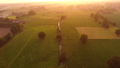 Kendel bei Hommersum.png 1,920 × 1,080; 1.66 MB
-
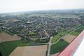
 Luchtfoto Weeze.jpg 1,000 × 684; 141 KB
-
 Uedem.JPG 4,592 × 3,056; 4.78 MB
.jpg)


