Category:Aerial photographs of Solingen
Jump to navigation
Jump to search
Media in category "Aerial photographs of Solingen"
The following 6 files are in this category, out of 6 total.
-
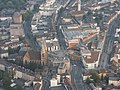 Aus der Luft by Niederkasseler - panoramio.jpg 1,024 × 768; 694 KB
-
 Luftbild A46 Haan Ost.jpg 5,096 × 3,398; 10.99 MB
-
 Luftbild Solingen, Fernmeldeturm.jpg 4,296 × 2,864; 8.12 MB
-
 Luftbild Solinger Feld bei Haan-Backesheide.jpg 4,886 × 3,258; 9.28 MB
-
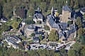
 Schloss Burg 11.02.2022.jpg 4,000 × 2,250; 4.1 MB
-
 Schlossburg 2-v2.jpg 2,086 × 1,366; 1.29 MB


