Category:Aerial photographs of Bielefeld
Jump to navigation
Jump to search
Subcategories
This category has only the following subcategory.
Media in category "Aerial photographs of Bielefeld"
The following 7 files are in this category, out of 7 total.
-
 A2 A33 Kreuz Bielefeld Luftbild.jpg 4,272 × 2,848; 3.97 MB
-
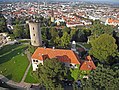
 Aerial image of Sparrenberg Castle (view from the southwest).jpg 5,000 × 3,000; 7.25 MB
-
 Aerial image of the Bielefeld airfield.jpg 4,700 × 3,000; 6.35 MB
-
 Luftbild - Bielefeld - der Osten der Stadt - 1945.jpg 11,142 × 5,384; 8.83 MB
-
 MaislabyrinthBentkämper.png 400 × 286; 316 KB
-
 Sparrenburg innovative sights.JPG 456 × 342; 196 KB
-
 Universität Bielefeld Luftaufnahme Juni 2022.jpg 4,000 × 2,250; 3.66 MB

.jpg)


