Category:Aerial photographs of Kreis Düren
Jump to navigation
Jump to search
Subcategories
This category has the following 2 subcategories, out of 2 total.
A
- Aerial views of Rurtalsperre (15 F)
H
- Aerial photographs of Heimbach (13 F)
Media in category "Aerial photographs of Kreis Düren"
The following 34 files are in this category, out of 34 total.
-
 Abtei Mariawald 010-.jpg 4,032 × 2,268; 4.91 MB
-
 Aerial image of the Düren-Hürtgenwald gliding site.jpg 4,800 × 3,200; 5.89 MB
-
 Aerial image of the Linnich-Boslar airfield.jpg 4,000 × 3,200; 6.7 MB
-
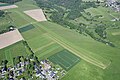
 Aerial image of the Morschenich airfield.jpg 4,000 × 3,200; 5.9 MB
-
 Aerial image of the Vettweiß-Soller airfield.jpg 4,000 × 3,400; 5.7 MB
-
 Aerial image of Zitadelle Jülich (view from the west).jpg 5,400 × 3,000; 7.68 MB
-
 Burg Blens 004-.jpg 4,032 × 2,268; 4.96 MB
-
 Burg Gödersheim 005-.jpg 4,032 × 2,268; 5.93 MB
-
 Burg Nideggen 007-.jpg 4,032 × 2,268; 5.3 MB
-
 Burg Nideggen 010-.jpg 4,032 × 2,268; 5.06 MB
-
 Burg Vlatten 003-.jpg 4,032 × 2,268; 5.46 MB
-
 CP Rurtalsperre-Wasser.jpg 1,364 × 863; 1.05 MB
-
 Froitzheim 001-.jpg 4,032 × 2,268; 4.82 MB
-
 Froitzheim 002-.jpg 4,032 × 2,268; 5.36 MB
-
 Guesten.JPG 3,456 × 2,304; 3.49 MB
-
 Kugelpanorama Indemann, Goltsteinkuppe-0189.jpg 6,149 × 4,096; 25.55 MB
-
 Luftaufnahme Fußballgolf am Indemann, Lucherberg und Lucherberger See-0193.jpg 5,463 × 3,073; 14.78 MB
-
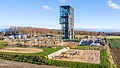 Luftaufnahme Indemann mit Spielplatz und Minigolf-0176.jpg 4,755 × 2,675; 11.63 MB
-
 Luftaufnahme Indemann mit Spielplatz und Minigolf-0181.jpg 5,464 × 3,640; 17.04 MB
-
 Luftaufnahme Indemann mit Spielplatz und Minigolf-0183.jpg 5,464 × 3,640; 15.15 MB
-
 Luftaufnahme Indemann mit Spielplatz und Minigolf-0185.jpg 5,464 × 3,640; 15.02 MB
-
 Luftaufnahme Indemann mit Spielplatz und Minigolf-0187.jpg 5,464 × 3,640; 15.17 MB
-
 Luftaufnahme Indemann mit Spielplatz und Minigolf-0191.jpg 5,463 × 3,073; 12.8 MB
-
 Luftaufnahme Indemann, Tagebau Inden-0192.jpg 5,464 × 3,640; 16.04 MB
-
 Luftaufnahme Lamersdorf und Kraftwerk Weisweiler-0194.jpg 3,813 × 2,145; 5.87 MB
-
 Luftaufnahme Lucherberg und Lucherberger See-0193.jpg 2,942 × 1,655; 3.63 MB
-
 Motocross-Kleinhau.JPG 3,328 × 1,872; 2.92 MB
-
 Muldenau 001-.jpg 4,032 × 2,268; 5.23 MB
-
 Muldenau 007-.jpg 4,032 × 2,268; 5.47 MB
-
 Schloss Merode, aerial view.jpg 3,813 × 2,693; 8.54 MB
-
 Stausee Obermaubach.JPG 3,328 × 1,872; 6.94 MB
-
 Tagebau Inden, gesehen von der Goltsteinkuppe-0178.jpg 7,222 × 3,080; 17.87 MB
-
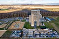
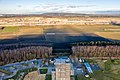
 Thum 001, Raketenstation Thum.jpg 4,032 × 2,268; 5.03 MB
-
 Wollersheim 001-.jpg 4,032 × 2,268; 4.85 MB


.jpg)


