Category:Aerial photographs of Seine-et-Marne
Jump to navigation
Jump to search
Departments of Metropolitan France: Ain [01] · Aisne [02] · Allier [03] · Alpes-de-Haute-Provence [04] · Hautes-Alpes [05] · Alpes-Maritimes [06] · Ardèche [07] · Ardennes [08] · Ariège [09] · Aube [10] · Aude [11] · Aveyron [12] · Bouches-du-Rhône [13] · Calvados [14] · Cantal [15] · Charente [16] · Charente-Maritime [17] · Cher [18] · Corrèze [19] · Corse-du-Sud [2A]† · Haute-Corse [2B]† · Côte-d’Or [21] · Côtes-d'Armor [22] · Creuse [23] · Dordogne [24] · Doubs [25] · Drôme [26] · Eure [27] · Eure-et-Loir [28] · Finistère [29] · Gard [30] · Haute-Garonne [31] · Gers [32] · Gironde [33] · Hérault [34] · Ille-et-Vilaine [35] · Indre [36] · Indre-et-Loire [37] · Isère [38] · Jura [39] · Landes [40] · Loir-et-Cher [41] · Loire [42] · Haute-Loire [43] · Loire-Atlantique [44] · Loiret [45] · Lot [46] · Lot-et-Garonne [47] · Lozère [48] · Maine-et-Loire [49] · Manche [50] · Marne [51] · Haute-Marne [52] · Mayenne [53] · Meurthe-et-Moselle [54] · Meuse [55] · Morbihan [56] · Moselle [57] · Nièvre [58] · Nord [59] · Oise [60] · Orne [61] · Pas-de-Calais [62] · Puy-de-Dôme [63] · Pyrénées-Atlantiques [64] · Hautes-Pyrénées [65] · Pyrénées-Orientales [66] · Bas-Rhin [67] · Haut-Rhin [68] · departmental district of the Rhône [69] · Haute-Saône [70] · Saône-et-Loire [71] · Sarthe [72] · Savoie [73] · Haute-Savoie [74] · Paris [75] · Seine-Maritime [76] · Seine-et-Marne [77] · Yvelines [78] · Deux-Sèvres [79] · Somme [80] · Tarn [81] · Tarn-et-Garonne [82] · Var [83] · Vaucluse [84] · Vendée [85] · Vienne [86] · Haute-Vienne [87] · Vosges [88] · Yonne [89] · Territoire de Belfort [90] · Essonne [91] · Hauts-de-Seine [92] · Seine-Saint-Denis [93] · Val-de-Marne [94] · Val-d'Oise [95]
Overseas departments and regions: Guadeloupe [971] · Martinique [972] · French Guiana [973] · Réunion [974] · Mayotte [976]
Overseas collectivities: Saint Pierre and Miquelon [975] · Saint Barthélemy [977] · Wallis and Futuna [986] · French Polynesia [987] · French Southern and Antarctic Lands [984]+
Sui generis territories: New Caledonia [988] · Clipperton Island [989]+

Subcategories
This category has the following 4 subcategories, out of 4 total.
F
V
- Views of Ussy-sur-Marne (7 F)
Media in category "Aerial photographs of Seine-et-Marne"
The following 65 files are in this category, out of 65 total.
-
 1920-09-30 - Provins - Hôtel de la Caisse d'épargne.jpg 625 × 325; 130 KB
-
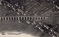 4. FONTAINEBLEAU vu en Avion, Le Viaduc de Changis-Avon.jpg 1,515 × 960; 1.38 MB
-
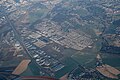
 A4-A104 french highways interchange aerialview.jpg 2,592 × 1,552; 794 KB
-
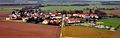
 Aerial photo of Moussy-le-Vieux, France 01.jpg 4,288 × 2,848; 8.51 MB
-
 Aerial photo of Moussy-le-Vieux, France 02.jpg 4,288 × 2,848; 8.01 MB
-
 Aerial photo of Oissery, France 01.jpg 4,288 × 2,848; 10.17 MB
-
 Aerial photo of Saint-Pathus, France 01.jpg 4,288 × 2,848; 10.07 MB
-
 Aerial photo of Saint-Pathus, France 02.jpg 4,288 × 2,848; 9.27 MB
-
 Aerial view of Dammartin-en-Goële, Lagny-le-Sec and Le Plessis-Belleville, France 01.jpg 4,288 × 2,848; 6.64 MB
-
 Aerial view of Longperrier, France 01.jpg 4,288 × 2,848; 6.75 MB
-
 Aerial view of Mauregard (cropped).jpg 3,952 × 1,251; 3.6 MB
-
 Aerial view of Mauregard.jpg 4,288 × 2,848; 6.94 MB
-
 Aerial view of Rouvres, Lagny-le-Sec and Le Plessis-Belleville, France 01.jpg 2,848 × 4,288; 7.32 MB
-
 Aerial, Mauregard (SIAE2201).jpg 1,116 × 744; 792 KB
-
 Aérodrome de Coulommiers-Voisins - vue aérienne 20190824.jpg 2,162 × 1,441; 1.57 MB
-
 Base de plein air et de loisirs de Jablines-Annet.jpg 10,000 × 5,000; 5.79 MB
-
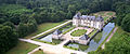 Château de Bourron - Vue aérienne.jpg 3,435 × 1,440; 5.7 MB
-
 Bussy Saint Georges Marne la vallée mars 2009 2.jpg 2,327 × 3,277; 2.63 MB
-
 Bussy Saint Georges mars 2009.jpg 3,888 × 2,592; 3.69 MB
-
 Bussy-st-Georges 2006.jpg 2,592 × 1,944; 1.9 MB
-
 Changis-sur-Marne - Saint-Jean-les-Deux-Jumeaux - vue aérienne 20190813.jpg 3,733 × 2,489; 4.81 MB
-
 Chapelle Rablais centre.jpg 624 × 468; 90 KB
-
 Charny 77 - vue aérienne 20190813.jpg 3,374 × 2,249; 3.28 MB
-
 Chauconin-Neufmontiers - vue aérienne 20170808.jpg 2,129 × 1,419; 1.48 MB
-
 Compans - ZI Mitry-Compans vue aérienne 20190813.jpg 4,382 × 2,921; 5.99 MB
-
 Compans vue du ciel.JPG 4,000 × 3,000; 2.77 MB
-
 Congis-sur-Thérouanne - vue aérienne 20190813.jpg 5,472 × 3,648; 10.65 MB
-
 Cuisy (Seine-et-Marne) - vue aérienne 20171027-01.jpg 3,241 × 2,161; 3.95 MB
-
 Cuisy (Seine-et-Marne) - vue aérienne 20171027-02.jpg 3,264 × 2,176; 5.03 MB
-
 Ensemble village 1.jpg 1,936 × 1,288; 1.46 MB
-
 Germigny-l'Évêque - vue aérienne 20170808.jpg 4,104 × 2,736; 5.79 MB
-
 Juilly (Seine-et-Marne) - vue aérienne 20171027.jpg 3,597 × 2,398; 6.08 MB
-
 L2494 - Lagny-sur-Marne - Pont en X.jpg 956 × 662; 330 KB
-
 La Ferté-sous-Jouarre vue du ciel.JPG 4,000 × 3,000; 2.85 MB
-
 Le Mesnil-Amelot - CDG Terminal 2F 20171027.jpg 2,642 × 1,761; 2.75 MB
-
 Le Mesnil-Amelot - vue aérienne.JPG 2,439 × 1,626; 1.61 MB
-
 Lognes-Émerainville LFPL aerialview.jpg 4,019 × 2,263; 2.42 MB
-
 Marchémoret - Saint-Pathus - Oissery vue aérienne 20190824.jpg 2,817 × 1,878; 2.4 MB
-
 Marcilly 77 - vue aérienne 20180504.jpg 5,472 × 3,648; 9.84 MB
-
 Meaux - vue aérienne 20170808.jpg 2,551 × 1,677; 2.27 MB
-
 Melun 2006.jpg 2,592 × 1,599; 1.77 MB
-
 Messy, Seine-et-Marne (vue aérienne).jpg 3,992 × 2,242; 1.15 MB
-
 Paris suburs.jpg 1,280 × 960; 365 KB
-
 Penchard - vue aérienne 20190813.jpg 5,472 × 3,648; 9.98 MB
-
 Photo aérienne raffinerie Grandpuits 2022 par Thomas Vautrin.jpg 4,001 × 2,942; 8.68 MB
-
 Raffinerie de Grandpuits, Aerial view.jpg 4,032 × 3,024; 1.43 MB
-
 Roissy en Brie 2006.jpg 1,809 × 2,466; 1.61 MB
-
 Saint-Jean - Changis - vue aérienne 20170808-01.jpg 3,344 × 2,229; 4.68 MB
-
 Saint-Jean - Changis - vue aérienne 20170808-02.jpg 3,885 × 2,590; 6.05 MB
-
 Saint-Jean-les-Deux-Jumeaux - Autoroute A4 - vue aérienne 20190813.jpg 5,472 × 3,648; 9.95 MB
-
 Saint-Mard 77 - vue aérienne 20180504.jpg 4,947 × 3,298; 8.02 MB
-
 Saint-Mesmes - vue aérienne 20190813.jpg 5,472 × 3,648; 8.82 MB
-
 Sammeron - Ussy-sur-Marne - vue aérienne 20190813.jpg 5,472 × 3,648; 9.51 MB
-
 Sammeron - vue aérienne 20190813.jpg 5,472 × 3,648; 11.98 MB
-
 Thieux (Seine-et-Marne) - vue aérienne 20171027-01.jpg 3,528 × 2,352; 5.45 MB
-
 Thieux (Seine-et-Marne) - vue aérienne 20171027-02.jpg 2,790 × 1,860; 3.24 MB
-
 Aerial view of Vaires 1910s.jpg 1,365 × 885; 585 KB
-
 Villeroy 77 - vue aérienne 20190813.jpg 3,625 × 2,417; 4.29 MB
-
 Vinantes - vue aérienne 20171027.jpg 2,619 × 1,746; 2.42 MB
-
 Vue aerienne.gif 723 × 448; 256 KB
-
 Vue aérienne de Barbey.jpg 2,000 × 3,008; 1.04 MB
-
 Vue aérienne SAINT-MESMES et NANTOUILLET.jpg 3,992 × 2,242; 1.36 MB
-
 Étang du Segrais au coucher du soleil.jpg 6,324 × 3,162; 5.12 MB
-
 Étangs.jpg 2,834 × 1,825; 1.6 MB
-
 Étrépilly 77 - vue aérienne 20180504.jpg 3,676 × 2,451; 4.48 MB


.jpg)


_-_vue_a%C3%A9rienne_20171027-01.jpg)
_-_vue_a%C3%A9rienne_20171027-02.jpg)


_-_vue_a%C3%A9rienne_20171027.jpg)


.jpg)


_-_vue_a%C3%A9rienne_20171027-01.jpg)
_-_vue_a%C3%A9rienne_20171027-02.jpg)


.jpg)