Category:Aerial photographs of Calvados
Jump to navigation
Jump to search
Français : photographies aériennes du Calvados
Departments of Metropolitan France: Ain [01] · Aisne [02] · Allier [03] · Alpes-de-Haute-Provence [04] · Hautes-Alpes [05] · Alpes-Maritimes [06] · Ardèche [07] · Ardennes [08] · Ariège [09] · Aube [10] · Aude [11] · Aveyron [12] · Bouches-du-Rhône [13] · Calvados [14] · Cantal [15] · Charente [16] · Charente-Maritime [17] · Cher [18] · Corrèze [19] · Corse-du-Sud [2A]† · Haute-Corse [2B]† · Côte-d’Or [21] · Côtes-d'Armor [22] · Creuse [23] · Dordogne [24] · Doubs [25] · Drôme [26] · Eure [27] · Eure-et-Loir [28] · Finistère [29] · Gard [30] · Haute-Garonne [31] · Gers [32] · Gironde [33] · Hérault [34] · Ille-et-Vilaine [35] · Indre [36] · Indre-et-Loire [37] · Isère [38] · Jura [39] · Landes [40] · Loir-et-Cher [41] · Loire [42] · Haute-Loire [43] · Loire-Atlantique [44] · Loiret [45] · Lot [46] · Lot-et-Garonne [47] · Lozère [48] · Maine-et-Loire [49] · Manche [50] · Marne [51] · Haute-Marne [52] · Mayenne [53] · Meurthe-et-Moselle [54] · Meuse [55] · Morbihan [56] · Moselle [57] · Nièvre [58] · Nord [59] · Oise [60] · Orne [61] · Pas-de-Calais [62] · Puy-de-Dôme [63] · Pyrénées-Atlantiques [64] · Hautes-Pyrénées [65] · Pyrénées-Orientales [66] · Bas-Rhin [67] · Haut-Rhin [68] · departmental district of the Rhône [69] · Haute-Saône [70] · Saône-et-Loire [71] · Sarthe [72] · Savoie [73] · Haute-Savoie [74] · Paris [75] · Seine-Maritime [76] · Seine-et-Marne [77] · Yvelines [78] · Deux-Sèvres [79] · Somme [80] · Tarn [81] · Tarn-et-Garonne [82] · Var [83] · Vaucluse [84] · Vendée [85] · Vienne [86] · Haute-Vienne [87] · Vosges [88] · Yonne [89] · Territoire de Belfort [90] · Essonne [91] · Hauts-de-Seine [92] · Seine-Saint-Denis [93] · Val-de-Marne [94] · Val-d'Oise [95]
Overseas departments and regions: Guadeloupe [971] · Martinique [972] · French Guiana [973] · Réunion [974] · Mayotte [976]
Overseas collectivities: Saint Pierre and Miquelon [975] · Saint Barthélemy [977] · Wallis and Futuna [986] · French Polynesia [987] · French Southern and Antarctic Lands [984]+
Sui generis territories: New Caledonia [988] · Clipperton Island [989]+
Subcategories
This category has the following 3 subcategories, out of 3 total.
F
H
Media in category "Aerial photographs of Calvados"
The following 46 files are in this category, out of 46 total.
-
 Aerial photo of Château de Saint-Germain-de-Livet -0214.jpg 2,441 × 1,373; 3.61 MB
-
 Aerial photo of Château de Saint-Germain-de-Livet -0230.jpg 1,403 × 789; 1.17 MB
-
 Aerial photo of Château de Saint-Germain-de-Livet -0235.jpg 2,560 × 1,705; 3.87 MB
-
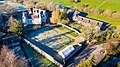
 Ardenne Abbey aerial.jpg 3,672 × 1,796; 6.24 MB
-
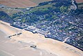 Arromanches aerial.jpg 3,696 × 2,504; 9.81 MB
-
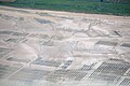 Asnelles oysters aerial.jpg 3,872 × 2,592; 7.8 MB
-
 Aérienne2.jpg 384 × 256; 75 KB
-
 Chateau vaersainvllle calvados 2.JPG 2,848 × 4,288; 1.7 MB
-
 Chateau versainvllle calvados 3.JPG 2,848 × 4,288; 1.81 MB
-
 Clecy 4.jpg 3,008 × 2,000; 4.61 MB
-
 Clecy 7.jpg 3,008 × 2,000; 3.97 MB
-
 Clecy 10.jpg 3,008 × 2,000; 5.3 MB
-
 ENVIRON DE FALAISE.JPG 4,288 × 2,848; 5.09 MB
-
 Evrecy vue du ciel.jpg 2,048 × 1,448; 1.2 MB
-
 Falaise nord.JPG 3,216 × 2,136; 1.7 MB
-
 Falaise, aux Monts d'Eraines 73.JPG 3,216 × 2,136; 1.93 MB
-
 Falaise, aux Monts d'Eraines1.JPG 3,216 × 2,136; 1.24 MB
-
 Falaise, aux Monts d'Eraines74.JPG 3,216 × 2,136; 1.49 MB
-
 Hermival Bourg Vue 1.JPG 640 × 480; 73 KB
-
 ISS019-E-9628 - View of France.jpg 2,832 × 4,256; 1.44 MB
-
 ISS019-E-9629 - View of France.jpg 2,832 × 4,256; 1.35 MB
-
 La Cambe Church Seen From Above.jpg 4,000 × 3,000; 4.44 MB
-
 Les Monts d'Eraines falaise 19.JPG 3,216 × 2,136; 1.25 MB
-
 Les Monts d'Eraines falaise 20.JPG 3,216 × 2,136; 1.31 MB
-
 Les Monts d'Eraines falaise 22.JPG 3,216 × 2,136; 1.23 MB
-
 Les Monts d'Eraines falaise 35.jpg 2,657 × 1,765; 636 KB
-
 Les Monts d'Eraines falaise 38.JPG 3,216 × 2,136; 1.55 MB
-
 Les Monts d'Eraines falaise 71.jpg 3,008 × 2,000; 3.36 MB
-
 Les Monts d'Eraines falaise 80.jpg 3,008 × 2,000; 609 KB
-
 Les Monts d'Eraines falaise 81.jpg 3,008 × 2,000; 596 KB
-
 Les Monts d'Eraines falaise 84.jpg 2,835 × 1,885; 655 KB
-
 Les Monts d'Eraines falaise 89.jpg 3,008 × 2,000; 635 KB
-
 Les Monts d'Eraines falaise 91.jpg 3,008 × 2,000; 3.27 MB
-
 Mondeville clopee vues aeriennes 1966-1972.png 2,451 × 4,959; 7.08 MB
-
 Ouistreham - Skyview.JPG 4,928 × 3,264; 5.69 MB
-
 Ouistreham aerial overview.jpg 3,732 × 2,384; 8.99 MB
-
 Ouistreham aerial.JPG 3,072 × 2,304; 2.11 MB
-
 Ouistreham church aerial.jpg 3,492 × 2,300; 8.45 MB
-
 PHOTO AERIENNE DE SAINT-CONTEST.jpg 2,098 × 1,401; 428 KB
-
 PHOTO AERIENNE HAMEAUX Malon, Bitôt, rue de la Folie et Buron.jpg 2,098 × 1,401; 276 KB
-
 Royal Air Force Bomber Command, 1942-1945. CL344.jpg 614 × 800; 113 KB
-
 Villers-Bocage destroyed.jpg 614 × 800; 99 KB
-
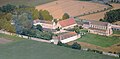
 Vue Aérienne chateau courcy.jpg 2,048 × 1,536; 1.4 MB
-
 Vue Aérienne commune de COURCY.jpg 2,048 × 1,536; 1.49 MB
-
 VUE DE GRANDCAMP.JPG 742 × 1,117; 641 KB
-
 Église de Saint-Germain-de-Livet, aerial view -0212.jpg 2,441 × 1,626; 4.24 MB


