Category:Aerial photographs of Côtes-d'Armor
Jump to navigation
Jump to search
Departments of Metropolitan France: Ain [01] · Aisne [02] · Allier [03] · Alpes-de-Haute-Provence [04] · Hautes-Alpes [05] · Alpes-Maritimes [06] · Ardèche [07] · Ardennes [08] · Ariège [09] · Aube [10] · Aude [11] · Aveyron [12] · Bouches-du-Rhône [13] · Calvados [14] · Cantal [15] · Charente [16] · Charente-Maritime [17] · Cher [18] · Corrèze [19] · Corse-du-Sud [2A]† · Haute-Corse [2B]† · Côte-d’Or [21] · Côtes-d'Armor [22] · Creuse [23] · Dordogne [24] · Doubs [25] · Drôme [26] · Eure [27] · Eure-et-Loir [28] · Finistère [29] · Gard [30] · Haute-Garonne [31] · Gers [32] · Gironde [33] · Hérault [34] · Ille-et-Vilaine [35] · Indre [36] · Indre-et-Loire [37] · Isère [38] · Jura [39] · Landes [40] · Loir-et-Cher [41] · Loire [42] · Haute-Loire [43] · Loire-Atlantique [44] · Loiret [45] · Lot [46] · Lot-et-Garonne [47] · Lozère [48] · Maine-et-Loire [49] · Manche [50] · Marne [51] · Haute-Marne [52] · Mayenne [53] · Meurthe-et-Moselle [54] · Meuse [55] · Morbihan [56] · Moselle [57] · Nièvre [58] · Nord [59] · Oise [60] · Orne [61] · Pas-de-Calais [62] · Puy-de-Dôme [63] · Pyrénées-Atlantiques [64] · Hautes-Pyrénées [65] · Pyrénées-Orientales [66] · Bas-Rhin [67] · Haut-Rhin [68] · departmental district of the Rhône [69] · Haute-Saône [70] · Saône-et-Loire [71] · Sarthe [72] · Savoie [73] · Haute-Savoie [74] · Paris [75] · Seine-Maritime [76] · Seine-et-Marne [77] · Yvelines [78] · Deux-Sèvres [79] · Somme [80] · Tarn [81] · Tarn-et-Garonne [82] · Var [83] · Vaucluse [84] · Vendée [85] · Vienne [86] · Haute-Vienne [87] · Vosges [88] · Yonne [89] · Territoire de Belfort [90] · Essonne [91] · Hauts-de-Seine [92] · Seine-Saint-Denis [93] · Val-de-Marne [94] · Val-d'Oise [95]
Overseas departments and regions: Guadeloupe [971] · Martinique [972] · French Guiana [973] · Réunion [974] · Mayotte [976]
Overseas collectivities: Saint Pierre and Miquelon [975] · Saint Barthélemy [977] · Wallis and Futuna [986] · French Polynesia [987] · French Southern and Antarctic Lands [984]+
Sui generis territories: New Caledonia [988] · Clipperton Island [989]+
Media in category "Aerial photographs of Côtes-d'Armor"
The following 50 files are in this category, out of 50 total.
-
 1943-09-25 THE SPHERE 13.jpg 2,632 × 3,765; 5.04 MB
-
 Aerial-Jaudy-river-20060527-003.jpg 3,031 × 2,006; 948 KB
-
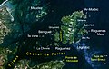 Archipel de Brehat.jpg 1,178 × 749; 161 KB
-
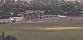 Aéroport Saint-Brieuc.jpg 768 × 373; 22 KB
-
 Barrage de la Rance 2.jpg 1,200 × 1,600; 198 KB
-
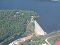 Barrage Guerledan.JPG 800 × 600; 145 KB
-
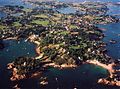 Brehat.jpg 600 × 444; 65 KB
-
 Cap Frehel Aerien.jpg 3,968 × 2,976; 3.97 MB
-
 Cap Fréhel.jpg 590 × 442; 22 KB
-
 Chateau bdls.png 1,196 × 582; 2.06 MB
-
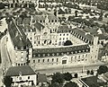
 Château de Hac aerial.jpg 2,412 × 1,788; 920 KB
-
 Communauté de Broons - Copie.jpg 971 × 785; 463 KB
-
 Côtes-d'Armor - Paimpol 1928 L93.jpg 46,000 × 44,000; 278.29 MB
-
 Drone - Coz Castel marée basse.jpg 1,015 × 533; 98 KB
-
 Erquy.jpg 320 × 240; 12 KB
-
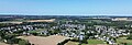 Evran.jpg 3,872 × 1,312; 1.91 MB
-
 Finistère - Baie de Morlaix 1928 L93.jpg 27,260 × 23,721; 52.35 MB
-
 Gh-grand-hotel-aerienne.jpg 500 × 600; 99 KB
-
 Jpprodgenerale.jpg 2,048 × 1,152; 1.07 MB
-
 La Cité des télécoms - Vue aérienne.jpg 1,996 × 1,496; 2.32 MB
-
 La Cité des télécoms.jpg 1,996 × 1,496; 2.28 MB
-
 La Communauté de Broons.jpg 1,152 × 824; 769 KB
-
 Lac Guerledan.JPG 800 × 600; 119 KB
-
 Landreger2.jpg 5,238 × 3,318; 14.14 MB
-
 Langoat Casteldu aérienne.jpg 800 × 588; 148 KB
-
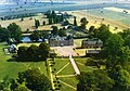
 Le château de Bienassis.jpg 512 × 384; 55 KB
-
 Le Val André, aerial view.jpg 4,234 × 2,823; 4.59 MB
-
 Lmbcard2021.jpg 1,716 × 1,206; 211 KB
-
 Vue aérienne des Ateliers Allot Frères (Façade Nord en premier plan).jpg 800 × 533; 215 KB
-

-
 Manche - Baie de St Brieuc 1926 L93.jpg 20,800 × 36,800; 114.64 MB
-
 Milliau.jpg 300 × 200; 51 KB
-
 Photo aérienne kerborgne.jpg 4,032 × 3,024; 3.86 MB
-
 Plouasne-Vue-Aerienne.jpg 3,504 × 2,336; 3.66 MB
-
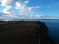
 Ploumanac'h, la pointe et le phare de Men Ruz.jpg 5,726 × 3,221; 16.23 MB
-
 Ploumanac'h, vue 360° sur la baie.jpg 8,192 × 4,096; 19.02 MB
-
 Pontrieuxaerien.jpg 400 × 248; 23 KB
-
 Quessoy église.jpg 1,201 × 816; 880 KB
-
 Talbert.jpg 700 × 525; 70 KB
-
 Trébédan - Vue du ciel.jpg 1,523 × 846; 207 KB
-
 Vue areienne.jpg 273 × 180; 24 KB
-
 Vue Illiec.jpg 4,000 × 2,250; 4.22 MB
-
 Vue Prison-Collection Henrard - 1955 (archives-Dep22) (c).PNG 1,278 × 418; 548 KB
-
 Île aux Oies.jpg 4,000 × 2,250; 4.18 MB
-
 Île des Femmes.jpg 4,000 × 2,250; 3.62 MB
-
 Île des Levrettes.jpg 4,000 × 2,250; 6.21 MB
-
 Île du Château.jpg 4,000 × 2,250; 3.7 MB
-
 Île du Milieu (Côtes-d'Armor).jpg 4,000 × 2,250; 4.32 MB
-
 Île Guiben.jpg 2,250 × 4,000; 4.3 MB
-
 Île Iliec et le sillon.jpg 4,000 × 2,250; 5.86 MB


.jpg)
..jpg)


.jpg)


_(c).PNG)