Category:Aerial photographs of Savoie
Jump to navigation
Jump to search
Departments of Metropolitan France: Ain [01] · Aisne [02] · Allier [03] · Alpes-de-Haute-Provence [04] · Hautes-Alpes [05] · Alpes-Maritimes [06] · Ardèche [07] · Ardennes [08] · Ariège [09] · Aube [10] · Aude [11] · Aveyron [12] · Bouches-du-Rhône [13] · Calvados [14] · Cantal [15] · Charente [16] · Charente-Maritime [17] · Cher [18] · Corrèze [19] · Corse-du-Sud [2A]† · Haute-Corse [2B]† · Côte-d’Or [21] · Côtes-d'Armor [22] · Creuse [23] · Dordogne [24] · Doubs [25] · Drôme [26] · Eure [27] · Eure-et-Loir [28] · Finistère [29] · Gard [30] · Haute-Garonne [31] · Gers [32] · Gironde [33] · Hérault [34] · Ille-et-Vilaine [35] · Indre [36] · Indre-et-Loire [37] · Isère [38] · Jura [39] · Landes [40] · Loir-et-Cher [41] · Loire [42] · Haute-Loire [43] · Loire-Atlantique [44] · Loiret [45] · Lot [46] · Lot-et-Garonne [47] · Lozère [48] · Maine-et-Loire [49] · Manche [50] · Marne [51] · Haute-Marne [52] · Mayenne [53] · Meurthe-et-Moselle [54] · Meuse [55] · Morbihan [56] · Moselle [57] · Nièvre [58] · Nord [59] · Oise [60] · Orne [61] · Pas-de-Calais [62] · Puy-de-Dôme [63] · Pyrénées-Atlantiques [64] · Hautes-Pyrénées [65] · Pyrénées-Orientales [66] · Bas-Rhin [67] · Haut-Rhin [68] · departmental district of the Rhône [69] · Haute-Saône [70] · Saône-et-Loire [71] · Sarthe [72] · Savoie [73] · Haute-Savoie [74] · Paris [75] · Seine-Maritime [76] · Seine-et-Marne [77] · Yvelines [78] · Deux-Sèvres [79] · Somme [80] · Tarn [81] · Tarn-et-Garonne [82] · Var [83] · Vaucluse [84] · Vendée [85] · Vienne [86] · Haute-Vienne [87] · Vosges [88] · Yonne [89] · Territoire de Belfort [90] · Essonne [91] · Hauts-de-Seine [92] · Seine-Saint-Denis [93] · Val-de-Marne [94] · Val-d'Oise [95]
Overseas departments and regions: Guadeloupe [971] · Martinique [972] · French Guiana [973] · Réunion [974] · Mayotte [976]
Overseas collectivities: Saint Pierre and Miquelon [975] · Saint Barthélemy [977] · Wallis and Futuna [986] · French Polynesia [987] · French Southern and Antarctic Lands [984]+
Sui generis territories: New Caledonia [988] · Clipperton Island [989]+
Media in category "Aerial photographs of Savoie"
The following 29 files are in this category, out of 29 total.
-
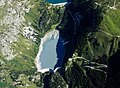
 Aerial view of Bissorte lake.jpg 3,648 × 2,432; 1.99 MB
-
 Aerial view of Bourg-Saint-Maurice.jpg 3,648 × 2,432; 2.06 MB
-
 Aerial view of Bozel.jpg 3,457 × 2,432; 1.66 MB
-
 Aerial view of Courchevel.jpg 3,523 × 2,430; 1.51 MB
-
 Aerial view Plan d'Aval.jpg 358 × 263; 40 KB
-
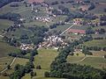 Attignat-Oncin.jpg 2,880 × 2,160; 3.8 MB
-
 Aussois Jul2011.jpg 2,353 × 1,822; 3.17 MB
-
 Aussois July 2011.jpg 1,067 × 691; 589 KB
-
 Bourg-Saint-Maurice, Savoie, France.jpg 1,400 × 1,050; 589 KB
-
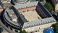 Carré curial chambéry.jpg 200 × 113; 11 KB
-
 CHCHAMBERYMINIAERIEN.JPG 289 × 249; 22 KB
-
 CHCHAMBERYPLANAERIEN.jpg 1,778 × 1,181; 591 KB
-
 Col du Sapenay en parapente.jpg 318 × 230; 29 KB
-
 Courchevel 1850.JPG 4,912 × 2,760; 5.68 MB
-
 ETH-BIB-Bramans, Roch d'étache-LBS H1-020686.tif 4,556 × 5,726; 74.71 MB
-
 ETH-BIB-Ort unbekannt-LBS H1-020753.tif 6,178 × 4,919; 87.02 MB
-
 ETH-BIB-Ort unbekannt-LBS H1-020761.tif 6,190 × 4,892; 86.71 MB
-
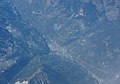
 F-GTAI FLIGHT CDG-LIN (7508813062).jpg 2,048 × 1,366; 1.58 MB
-
 Fret SNCF en Maurienne, automne 2015.JPG 3,072 × 2,304; 4.1 MB
-
 Golf hippodrome aix-les-bains.jpeg 600 × 456; 129 KB
-
 Lacs Plan d'Amont - Plan d'Aval.jpg 397 × 593; 90 KB
-
 Le Domaine de Marlioz.jpg 4,000 × 3,000; 13.54 MB
-
 Mont de Gébroulaz (2018).jpg 6,016 × 4,010; 18.31 MB
-
 Nances vu du ciel.jpg 200 × 186; 47 KB
-
 TDM à l'entrée de Montmélian.JPG 2,048 × 1,536; 829 KB
-
 Ugine (vue aérienne).JPG 2,288 × 1,712; 2.7 MB
-
 Vivers-du-Lac + Méry (Savoie).JPG 4,248 × 3,162; 5.68 MB
-
 Voglans - chef-lieu (Savoie).JPG 4,106 × 3,079; 6.82 MB
-
 Vue-aerienne-nuts.jpg 2,000 × 2,028; 974 KB


.jpg)


.jpg)


.JPG)
.JPG)
.JPG)
