Category:20th-century maps of oceans
Jump to navigation
Jump to search
Subcategories
This category has the following 11 subcategories, out of 11 total.
Media in category "20th-century maps of oceans"
The following 10 files are in this category, out of 10 total.
-
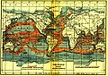 Ocean currents 1911.jpg 1,081 × 768; 1.19 MB
-
 The Earth beneath the sea - History (1963) (20936619040).jpg 3,008 × 2,048; 1.55 MB
-
 Chart of limits of seas and oceans. LOC 2010587902.jpg 11,434 × 8,575; 8.03 MB
-
 Chart of limits of seas and oceans. LOC 2010587902.tif 11,434 × 8,575; 280.51 MB
-
 Map Italy in the Mediterranean sea 1990 - Touring Club Italiano CART-TEM-003.jpg 7,000 × 4,627; 22.11 MB
-
 Ocean currents 1943 (borderless).png 2,577 × 1,306; 2.75 MB
-
 Ocean currents 1943 (borderless)3.png 2,577 × 1,306; 2.41 MB
-
 Ocean currents 1943 for colorblind users.png 2,577 × 1,306; 3.15 MB
-
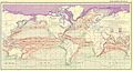 Ocean currents 1943.jpg 2,639 × 1,406; 5.14 MB
-
 Ocean currents 1943.png 2,639 × 1,406; 4.89 MB

_(20936619040).jpg)


.png)
3.png)


