Category:20th-century maps of the Indian Ocean
Jump to navigation
Jump to search
Subcategories
This category has only the following subcategory.
Media in category "20th-century maps of the Indian Ocean"
The following 15 files are in this category, out of 15 total.
-

-
 The Harmsworth atlas and Gazetter 1908 (135849966).jpg 12,508 × 9,571; 109.4 MB
-
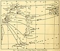 Percy Sladen Trust expedition 1905 magnetic variation transactionsofli214linn 0024.jpg 2,316 × 1,968; 491 KB
-

-
 1938 Index to Admiralty charts of the eastern Indian Ocean nla.obj-574968511.jpg 8,209 × 11,176; 16.59 MB
-
 1942 Japanese pictorial map of the Indian Ocean during World War II.tif 8,800 × 6,316; 159.05 MB
-
 Image from page 323 of "The Earth beneath the sea - History" (1963).jpg 1,472 × 1,088; 310 KB
-
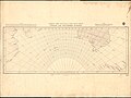 Admiralty Chart No 132 Gnomonic Chart of Indian and Southern Oceans, Published 1914.jpg 10,838 × 8,132; 22.47 MB
-

-

-
 Indian and Pacific Oceans, 1967.jpg 4,050 × 2,884; 2.3 MB
-
 Map of the Eastern Hemisphere.jpg 2,659 × 2,623; 1.66 MB
-
 Pacific and Indian Oceans, 1967.jpg 4,416 × 3,296; 2.69 MB
-

-
 خريطة كتاب سندباد عصري 1938.png 1,241 × 922; 2.18 MB

.jpg)
.jpeg)

.jpg)

_(14775763831).jpg)


.jpg)
