Category:20th-century maps of the Baltic Sea
Jump to navigation
Jump to search
Subcategories
This category has only the following subcategory.
Media in category "20th-century maps of the Baltic Sea"
The following 12 files are in this category, out of 12 total.
-
 Brockhaus and Efron Encyclopedic Dictionary b4 826-0.jpg 2,552 × 3,498; 5.18 MB
-
 Nord Ostsee Hafen.jpg 4,563 × 3,956; 6.89 MB
-
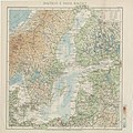
 North and Baltic Seas, 1911.png 960 × 625; 1.36 MB
-
 Russian history of the Baltic Sea, 1712-1721.jpg 1,571 × 1,894; 468 KB
-
 Russian map of the Baltic Sea showing 1809.jpg 972 × 862; 101 KB
-
 05-Deutsch-englisch-französisch-russische Seekriegskarte (1914).png 12,397 × 9,917; 172.8 MB
-
 Russland BV042519687.jpg 6,578 × 3,668; 2.34 MB
-
 Admiralty Chart No 259 Baltic Sea, Published 1919.jpg 8,700 × 9,788; 21.33 MB
-
 Jezioro ancylusowe001.jpg 349 × 372; 34 KB
-
 Map Baltic and Baltic countries 1930 - Touring Club Italiano CART-TRC-08.jpg 7,096 × 7,122; 16.92 MB
-
 Ost see.jpg 4,555 × 3,965; 6.72 MB
-


.png)


.jpg)