Category:20th-century maps of the Sea of Marmara
Jump to navigation
Jump to search
Media in category "20th-century maps of the Sea of Marmara"
The following 55 files are in this category, out of 55 total.
-
 1901 map of The Bosphorus and Constantinople (cropped).jpg 4,265 × 6,691; 6.88 MB
-
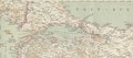
 1901 maps of The Dardanelles and the Troad and The Bosphorus and Constantinople.jpg 8,657 × 6,820; 11.09 MB
-
 Konstantinopel - K. u. k. Militärgeographisches Institut - btv1b101041283.jpg 7,101 × 9,024; 17.76 MB
-
 Kapidag Peninsula and adjacent islands (cropped).tif 1,933 × 934; 5.17 MB
-
 Kapidag Peninsula and neighbouring islands (cropped).tiff 1,338 × 573; 2.2 MB
-
 Map of Constantinople from Turkey 1 to 250,000.jpg 9,032 × 6,640; 8.76 MB
-
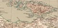
 1911 Russian map of the Sea of Marmara.jpg 919 × 573; 78 KB
-
 Shepherd-c-020 cropped Sea of Mamara.jpg 462 × 306; 78 KB
-
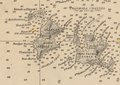
 W. & A.K. Johnston. Asia Minor. 1911 CA.jpg 972 × 577; 153 KB
-
 Kapıdağ Peninsula (cropped).tif 1,231 × 920; 3.27 MB
-
 Kapıdağ Peninsula and adjacent islands (cropped).tif 3,045 × 2,314; 20.19 MB
-
 Marmara Island (cropped).tif 1,215 × 681; 2.4 MB
-
 Paşalimanı, Avşa, Koyun, Yer and Ekinlik Islands (cropped).tif 881 × 624; 1.61 MB
-
 Queenslanders! Your country calls!.tif 6,515 × 9,522; 177.5 MB
-
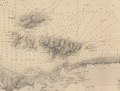
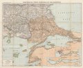
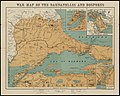
 War map of the Dardanelles and Bosporus.tif 7,767 × 6,272; 139.38 MB
-
 1915 Australian map of the Sea of Marmara (cropped).jpg 4,826 × 3,580; 10.73 MB
-
 1915 Australian maps of Gallipolli, the Dardanelles and the Sea of Marmara.jpg 5,000 × 6,783; 21.18 MB
-
 1915 Australian maps of Gallipolli, the Dardanelles and the Sea of Marmara.tif 11,837 × 16,058; 543.84 MB
-
-
 1915 French map of the Turkish Straits and the Sea of Marmara.jpg 5,000 × 3,753; 11.78 MB
-
 1915 French map of the Turkish Straits and the Sea of Marmara.tif 6,648 × 4,991; 94.95 MB
-
 1915 map - Flemmings Kriegskarte - Dardanellen, Bosporus und die Europäische Türkei.tif 10,149 × 8,312; 36.65 MB
-
 1915 Map of the Dardanelles, Sea of Marmara and Bosporus.jpg 5,000 × 3,336; 11.45 MB
-
 1915 Map of the Dardanelles, Sea of Marmara and Bosporus.tif 18,144 × 12,104; 628.34 MB
-
 1915 War map of the Dardanelles and Bosporus.tif 7,936 × 6,336; 143.93 MB
-
 20-Dardanellen, Bosporus und die europäische Türkei (1915).png 12,082 × 9,917; 150.19 MB
-
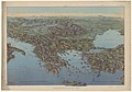
 Sea of Marmara - The theatre of war in Western Asia Minor (5003809) (cropped).jpg 2,402 × 1,006; 390 KB
-
 W & A K Johnston's war map of the Dardanelles & Bosporus (5008041).jpg 5,000 × 4,007; 2.23 MB
-

-
 1915 bird's eye view map of the Dardanelles.jpg 6,704 × 5,464; 5.63 MB
-
 1915 map - Bosphore (cropped).jpg 1,330 × 2,090; 595 KB
-
 1915 map - Dardanelles - Mer de Marmara - Bosphore.jpg 5,672 × 8,832; 8.03 MB
-
 1915 map - Mer de Marmara (cropped).jpg 4,809 × 2,968; 2.44 MB
-
 1916 bird's eye view map - Dall'Adriatico al Mar Nero.jpg 11,886 × 8,284; 13.98 MB
-

-

-
-
 Naval power in the war (1914-1917) (1918) (14597926959).jpg 2,518 × 1,568; 698 KB
-
 1920 Map of Dardanelles, Sea of Marmara, Bosporus.tif 6,390 × 8,463; 155 MB
-

-
 1922 map of the Dardanelles, Sea of Marmara and the Bosporus.jpg 5,000 × 3,264; 11.14 MB
-
 Ca. 1922 map of the Sea of Marmara (cropped).tif 4,776 × 4,716; 64.46 MB
-
 Ca. 1922 map of the Sea of Marmara and the Turkish Straits.tif 8,780 × 5,733; 144.04 MB
-
 Hellespont Shepherd 1923.JPG 680 × 668; 133 KB
-
 1944 German military map - Europäische Türkei - Sheet Evrese.jpg 12,574 × 16,355; 38.73 MB
-
 1956 map of the Marmara Island (cropped).tif 1,276 × 687; 2.53 MB
-
 Turkey-Greece, Canakkale, Series, K502, Sheet NK 35-11, 1956, 1 to 250 000.tif 8,519 × 6,653; 162.18 MB
-
 1956 map of the Kapidag Peninsula (cropped).tif 1,336 × 1,279; 4.91 MB
-
 1956 map of the Paşalimanı, Avşa, Koyun, Yer and Ekinlik Islands (cropped).tif 1,062 × 724; 2.22 MB
-

-

-

-
 The "Farmer & Settler" map of Gallipoli War area - 1915.tif 11,792 × 8,829; 297.89 MB
-
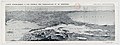
 The Quarterly journal of the Geological Society of London (1904) (14598427848).jpg 2,086 × 3,497; 665 KB
-

.jpg)


.jpg)


.png)
_(cropped).jpg)
.jpg)


.jpg)

.jpg)

_(cropped).jpg)
_(1918)_(14597926959).jpg)
.jpg)


_(14598427848).jpg)
.jpg)