Category:20th-century maps of the Aegean Sea
Jump to navigation
Jump to search
Media in category "20th-century maps of the Aegean Sea"
The following 19 files are in this category, out of 19 total.
-
 D267-Mer de Grèce.-L2-Ch8.png 1,448 × 1,730; 374 KB
-
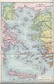 Butler marisaegaei.jpg 2,073 × 3,188; 2.17 MB
-
 Imbris 1910 year map.jpg 7,604 × 5,017; 7.55 MB
-
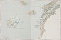
 1911 Russian map of the Aegean Sea in 1807.jpg 1,583 × 995; 149 KB
-
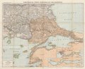 1915 map - Flemmings Kriegskarte - Dardanellen, Bosporus und die Europäische Türkei.tif 10,149 × 8,312; 36.65 MB
-
 20-Dardanellen, Bosporus und die europäische Türkei (1915).png 12,082 × 9,917; 150.19 MB
-
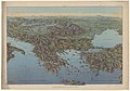
 1915 bird's eye view map - La Grèce et les Balkans.jpg 6,752 × 5,376; 5.23 MB
-
 1916 bird's eye view map - Dall'Adriatico al Mar Nero.jpg 11,886 × 8,284; 13.98 MB
-
 1916 map - Flemmings Kriegskarte von Griechenland.tif 10,149 × 8,218; 37.18 MB
-

-
 Asia Minor 1 to 250.000. Series G.S.G.S. no. 2097 - Sheet Kos.tif 13,670 × 9,896; 129.01 MB
-
 The Story of Mankind - The Island-Bridges Between Asia and Europe.png 1,895 × 2,605; 632 KB
-
 1940 German military map - Übersichtskarte Bulgarien-Griechenland.jpg 24,892 × 32,442; 132.82 MB
-
 Admiralty Chart No 180 Aegean Sea, Published 1958.jpg 11,229 × 13,537; 32.74 MB
-
 Admiralty Chart No 1647 Nísos Tínos to Nísos Ikaría, Published 1966.jpg 16,366 × 11,265; 15.44 MB
-
 30-Griechenland (1916).png 12,224 × 9,917; 153.63 MB
-
 Admiralty Chart Catalogue 1967 Page 039 Index F1.jpg 8,572 × 6,889; 9.79 MB
-
 Atlas of ancient and classical geography (1909) (14782028952).jpg 2,416 × 3,644; 2.7 MB
-


.png)


.jpg)


.png)

_(14782028952).jpg)