Category:2015 maps of Canada
Jump to navigation
Jump to search
Countries of North America: Canada · Costa Rica · Mexico · Saint Vincent and the Grenadines · United States of America‡
‡: partly located in North America
‡: partly located in North America
| ← 2010 2011 2012 2013 2014 2015 2016 2017 2018 2019 → |
English: Maps of Canada from 2015 or related to Canada in 2015
Français : Les cartes du Canada de 2015 ou se rapportant au Canada en 2015
Media in category "2015 maps of Canada"
The following 13 files are in this category, out of 13 total.
-
 2015panamvenues.jpg 555 × 599; 79 KB
-
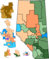
 Alberta Election Map 2015.svg 1,154 × 1,362; 323 KB
-
 Alta2015.png 3,229 × 3,871; 632 KB
-
 Can Provinces by Annual growth of education level 2000-2015.svg 512 × 496; 114 KB
-
 Can Provinces by Average Educational Attainment Index (2015).svg 512 × 496; 121 KB
-

-
 Can Provinces by life expectancy (2015).svg 512 × 496; 212 KB
-
 Canada 2015 Federal Election.svg 1,084 × 920; 486 KB
-
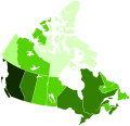
 Canadian provinces and territories by HDI (2015).svg 512 × 493; 103 KB
-
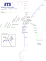
 Current Edmonton LRT.png 1,900 × 2,948; 241 KB
-
 Future Edmonton LRT.png 3,341 × 4,352; 752 KB
-
 PanAm Games Locations.svg 1,000 × 1,080; 234 KB
-
 Pei2015.png 610 × 416; 14 KB


.svg)
.svg)
.svg)

.svg)


