Category:2015 maps of Mexico
Jump to navigation
Jump to search
Countries of North America: Canada · Costa Rica · Mexico · Saint Vincent and the Grenadines · United States of America‡
‡: partly located in North America
‡: partly located in North America
Media in category "2015 maps of Mexico"
The following 18 files are in this category, out of 18 total.
-
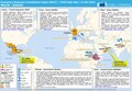
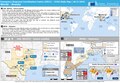 ECDM 20150526 US Mexico India.pdf 1,625 × 1,125; 838 KB
-
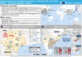
 ECDM 20150527 World Events.pdf 1,625 × 1,125; 472 KB
-
 ECDM 20150528 US Mexico India.pdf 1,625 × 1,125; 834 KB
-
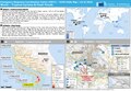
 ECDM 20150604 World.pdf 1,625 × 1,125; 800 KB
-
 ECDM 20150605 Worlds Events.pdf 1,625 × 1,125; 444 KB
-
 ECDM 20150608 Mexico ArabianSea TCs.jpg 1,040 × 720; 167 KB
-
 ECDM 20150611 World Events.pdf 1,625 × 1,125; 433 KB
-
 ECDM 20150615 World.pdf 1,625 × 1,125; 802 KB
-
 ECDM 20150616 SevereWeather.pdf 1,625 × 1,125; 635 KB
-
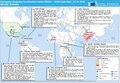
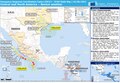
 ECDM 20151022 Mexico TCPATRICIA.pdf 1,625 × 1,125; 532 KB
-
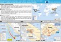
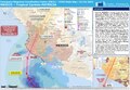 ECDM 20151023 TC PATRICIA.pdf 1,625 × 1,125; 763 KB
-
 ECHO Mexico Editable A4 Landscape.pdf 1,754 × 1,239; 496 KB
-
 ECHO Mexico Editable A4 Landscape.png 1,123 × 794; 462 KB
-
 Life expectancy map of Mexico 2015 with names.png 5,400 × 3,420; 1.23 MB
-
 Life expectancy map of Mexico 2015.png 5,400 × 3,420; 1.04 MB
-
 Mexico Base Map.png 1,104 × 697; 450 KB
-
 Mexico map (english).svg 975 × 654; 237 KB
-
 Mexico time zones map en.svg 962 × 608; 242 KB


.svg)
