Category:2011 maps of Canada
Jump to navigation
Jump to search
Countries of the Americas: Argentina · Bolivia · Canada · Mexico · Peru · Saint Vincent and the Grenadines · United States of America
Provinces and territories of Canada:
Subcategories
This category has only the following subcategory.
Media in category "2011 maps of Canada"
The following 28 files are in this category, out of 28 total.
-
2011 Yukon Election Map.png 860 × 447; 19 KB
-
2011resultsbyriding.png 1,050 × 1,325; 395 KB
-
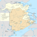
Acadia New Brunswick general map-fr.svg 2,237 × 2,199; 3.9 MB
-
Acadie Ile-du-Prince-Édouard fr.svg 1,039 × 822; 453 KB
-
Acadie Nouveau-Brunswick.svg 1,411 × 1,388; 794 KB
-
Acadie Nouvelle-Écosse.svg 1,342 × 1,096; 980 KB
-
Canada 2011 Federal Election.svg 1,084 × 920; 475 KB
-
Canada fed election 2011 results by riding.svg 1,029 × 1,312; 342 KB
-
Canada Fed election 2011 Ridings losses.svg 1,050 × 1,325; 327 KB
-
Canada Fed election 2011 Ridings.svg 1,050 × 1,325; 425 KB
-
Carte Franco-Terreneuviens.svg 1,512 × 2,162; 1.26 MB
-
Circuit Edmonton City Centre Airport 2011.svg 512 × 698; 10 KB
-
Edmonton City Road Map.svg 560 × 610; 163 KB
-
Edmonton indy new track.png 140 × 157; 7 KB
-
Edmonton indy new track.svg 140 × 157; 28 KB
-
Goderichtormap.jpg 816 × 492; 66 KB
-
LGBT flag map of Canada.svg 512 × 433; 116 KB
-
Major League Soccer club locations 2012.png 1,194 × 799; 83 KB
-
Manitoba2011results.jpg 500 × 462; 86 KB
-
MBBoundaries2011-2.jpg 500 × 462; 87 KB
-
Metro Edmonton Map.png 1,230 × 1,404; 58 KB
-
Nl2011.PNG 2,000 × 3,006; 295 KB
-
Numbered-Treaties-Map.svg 1,005 × 690; 111 KB
-
Pei2011.png 610 × 416; 21 KB
-
Radar météo canadiens 1999-2018.png 517 × 276; 70 KB
-
Sask11.PNG 949 × 980; 39 KB
-
Toronto 2011 wiki.jpg 5,290 × 2,815; 6.17 MB
-
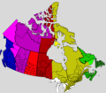
UTC hue4map CAN.png 1,388 × 1,214; 135 KB


