Category:1930s maps of Oceania
Jump to navigation
Jump to search
Temperate regions: North America · South America · Africa · Europe · Asia · Oceania – Polar regions: – Other regions:
Subcategories
This category has the following 10 subcategories, out of 10 total.
- 1931 maps of Oceania (1 F)
- 1932 maps of Oceania (3 F)
- 1935 maps of Oceania (1 F)
- 1936 maps of Oceania (2 F)
- 1937 maps of Oceania (empty)
- 1938 maps of Oceania (2 F)
- 1939 maps of Oceania (7 F)
A
H
- 1930s maps of Hawaii (3 F)
Media in category "1930s maps of Oceania"
The following 5 files are in this category, out of 5 total.
-
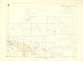 1938 Index to Admiralty charts of Western Pacific Islands and New Guinea nla.obj-574968330.jpg 11,166 × 8,240; 15.08 MB
-
 FrPolynes-Tahit-Marques-Gambier Map 1930.jpg 4,024 × 2,900; 10.95 MB
-
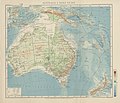 Map Australia and Pacific islands 1928-1940 - Touring Club Italiano CART-TRC-19.jpg 8,333 × 7,157; 26.44 MB
-
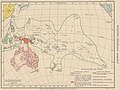 Map Ethnographic map of Oceania 1928-1940 - Touring Club Italiano CART-TRC-33.jpg 6,292 × 4,730; 15.14 MB
-


..._-_btv1b53063489z.jpg)