Category:1930s maps of North America
Jump to navigation
Jump to search
Temperate regions: North America · South America · Africa · Europe · Asia · Oceania – Polar regions: – Other regions:
Subcategories
This category has the following 16 subcategories, out of 16 total.
Media in category "1930s maps of North America"
The following 6 files are in this category, out of 6 total.
-
-

-
 Map Ethnographic map of North America 1928-1940 - Touring Club Italiano CART-TRC-30.jpg 6,611 × 7,997; 6.1 MB
-
 Map Geological Map of North America 1928-1940 - Touring Club Italiano CART-TRC-26.jpg 6,781 × 8,037; 6.41 MB
-
 Map North America 1929 - Touring Club Italiano CART-TRC-16.jpg 7,310 × 8,626; 8.27 MB
-
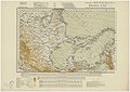
 Map Political map of North America 1929 - Touring Club Italiano CART-TRC-16 01.jpg 2,165 × 2,448; 826 KB


.jpg)
.jpg)