Category:1903 maps
Jump to navigation
Jump to search
| ← · 1900 · 1901 · 1902 · 1903 · 1904 · 1905 · 1906 · 1907 · 1908 · 1909 · → |
Deutsch: Karten mit Bezug zum Jahr 1903
English: Maps related to the year 1903
Español: Mapas relativos al año 1903
Français : Cartes concernant l’an 1903
Русский: Карты 1903 года
Subcategories
This category has the following 9 subcategories, out of 9 total.
Media in category "1903 maps"
The following 97 files are in this category, out of 97 total.
-
 1903 BERY system map.png 2,384 × 3,500; 6.41 MB
-
 1903 Boston Revere Beach and Lynn Railroad Winthrop Loop map.jpg 2,211 × 3,040; 552 KB
-
 An invitation to Delaware LOC 78696292.jpg 4,543 × 7,435; 6 MB
-
 An invitation to Delaware LOC 78696292.tif 4,543 × 7,435; 96.64 MB
-
 Bile Lake, 1903.jpg 916 × 846; 363 KB
-
 C+B-Damascus-Map.PNG 734 × 527; 212 KB
-
 Carte vicinale et administrative du département des Hautes-Pyrénées - 1903.jpg 7,872 × 10,560; 13.94 MB
-
 Caucasus map (in Russian, 1903).jpg 11,831 × 8,482; 20.08 MB
-
 China Postal Working Map.jpg 11,677 × 11,410; 15.67 MB
-
 Cotopaxi area in 1903 map from Die Vulkanberge von Mittel-Ecuador (cropped).jpg 3,268 × 3,284; 5.57 MB
-
 Denkschrift über die Donau-Main-Wasserstrasse 1903 Blatt 001.jpg 1,864 × 1,266; 569 KB
-
 Denkschrift über die Donau-Main-Wasserstrasse 1903 Blatt 004.JPG 2,026 × 1,348; 377 KB
-
 Djibouti to Lake Rudolf. Carta puta Djibouti - Rudolf-jezero. (WOMAT-AFR-ABY-25-1).jpg 7,496 × 5,406; 31.22 MB
-
 Dover, New Jersey 1903. LOC gm71005349.jpg 6,848 × 5,920; 8.54 MB
-
 Dover, New Jersey 1903. LOC gm71005349.tif 6,848 × 5,920; 115.99 MB
-
 GARWOOD MAP 640x617 148a.jpg 640 × 617; 109 KB
-
 GCRmap1903.JPG 1,536 × 2,048; 1,023 KB
-

-
 Gesandtschaftsviertel in Peking LOC 2006635249.jpg 8,555 × 5,224; 4.65 MB
-
 Gesandtschaftsviertel in Peking LOC 2006635249.tif 8,555 × 5,224; 127.86 MB
-
 Grenze GoldküsteElfenbeinküste 1902.jpg 740 × 2,201; 466 KB
-
 Handbook map of Jerusalem (FL4542118 2909270).jpg 3,642 × 3,654; 19.91 MB
-
 Heilbronn Stadtplan 1903.jpg 4,086 × 3,432; 2.46 MB
-
 History of Egypt, Chaldea, Syria, Babylonia and Assyria (1903) (14584080510).jpg 2,328 × 1,384; 1.1 MB
-
 History of Egypt, Chaldea, Syria, Babylonia and Assyria (1903) (14740579446).jpg 2,352 × 1,554; 1.19 MB
-
 History of Egypt, Chaldea, Syria, Babylonia and Assyria (1903) (14760322591).jpg 2,352 × 1,540; 1.64 MB
-
 India. LOC 98687195.jpg 2,934 × 3,586; 2.8 MB
-
 India. LOC 98687195.tif 2,934 × 3,586; 30.1 MB
-
 Indianapolis map, 1903.jpg 7,966 × 11,993; 19.3 MB
-

-
 Karta Manʹchzhurīi. LOC 2019585139.jpg 6,841 × 9,545; 8.91 MB
-
 Karta Manʹchzhurīi. LOC 2019585139.tif 6,841 × 9,545; 186.82 MB
-
 Kartenn Jeruzalem, 1903.png 1,715 × 1,486; 1.56 MB
-
 Kauai, Hawaiian Islands, 1903 - $c Walter E. Wall, surveyor ; compiled by John M. Donn. LOC 2008627967.tif 14,075 × 11,036; 444.41 MB
-
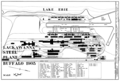 Lackawanna steel plant 1903.png 3,240 × 2,187; 124 KB
-

-
 Lake Winnipesaukee, New Hampshire (2674567122).jpg 1,200 × 716; 372 KB
-

-
 Map of Birmingham, Alabama and adjacent suburbs. LOC 73696177.jpg 6,012 × 5,823; 6.64 MB
-
 Map of Birmingham, Alabama and adjacent suburbs. LOC 73696177.tif 6,012 × 5,823; 100.16 MB
-

-
 Map of McHenry County, Illinois LOC 2013593111.jpg 12,244 × 12,063; 29.18 MB
-

-

-
-

-

-

-

-
 Map-1903-caucasus.jpg 17,694 × 11,940; 44.8 MB
-

-

-

-
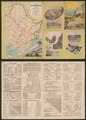
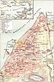
 Palestine (FL33134751 3520223).jpg 6,837 × 9,937; 77.68 MB
-
 Palästina - Norden (FL163948229 4048650).jpg 2,079 × 3,076; 6.13 MB
-
 Plan of Fort Sedgwick generally known as Fort Hell LOC 99439156.jpg 2,938 × 2,333; 642 KB
-
 Plan of Fort Sedgwick generally known as Fort Hell LOC 99439156.tif 2,938 × 2,333; 19.61 MB
-
 Planta da cidade do Porto 1903 Cortes.jpg 1,642 × 1,016; 372 KB
-

-

-
 Port Arthur. LOC 2019588253.jpg 13,450 × 2,767; 3.41 MB
-
 Port Arthur. LOC 2019588253.tif 13,450 × 2,767; 106.48 MB
-

-
 Poughill Map.png 657 × 339; 478 KB
-
 Provincia de Ñuble-1895.jpg 4,352 × 3,226; 9.86 MB
-
 PSM V62 D189 Map of alaska compared to the lower us states.png 1,635 × 1,078; 256 KB
-
 PSM V63 D030 Areas of europe settled by slavs.png 1,239 × 1,162; 408 KB
-
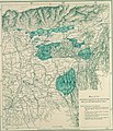
 PSM V63 D378 Forest map of the usa.png 1,622 × 991; 287 KB
-
 PSM V63 D383 Position of the discovery in the antarctic regions.png 1,182 × 1,468; 168 KB
-
 PSM V64 D357 Map of known meteorite falls and finds up to 1903.png 2,446 × 1,631; 277 KB
-
 Queens V. 5, Plate No. 27 (Map bounded by East Blvd., Boulevard, Lawrence Ave.) NYPL1957139.tiff 5,346 × 7,089, 2 pages; 108.49 MB
-
 Race track of Metropolitan Jockey Club, Jamaica. LOC 2005625755.jpg 2,179 × 2,544; 579 KB
-
 Race track of Metropolitan Jockey Club, Jamaica. LOC 2005625755.tif 2,179 × 2,544; 15.86 MB
-
 Sketch Map of the glaciers of Kangchenjunga by Edmund J. Garwood, 1903 (cropped).jpg 2,125 × 2,038; 1,008 KB
-
 Smyrna City Map 1903.jpg 530 × 803; 266 KB
-
 South-eastern Europe 1881.jpg 1,126 × 863; 357 KB
-
 Spezialkarte der Österreichisch-ungarischen Monarchie - Altenmarkt und Ogulin 1903.jpg 14,616 × 11,332; 34.04 MB
-
 Spezialkarte der Österreichisch-ungarischen Monarchie - Bischoflack und Idria 1903.jpg 12,700 × 9,212; 32.24 MB
-
 Spezialkarte der Österreichisch-ungarischen Monarchie - Eisenkappel und Kanke 1903.jpg 14,623 × 11,384; 37.64 MB
-
 Spezialkarte der Österreichisch-ungarischen Monarchie - Gurkfeld, Rann und Samobor 1903.jpg 14,656 × 11,471; 33.79 MB
-
 Spezialkarte der Österreichisch-ungarischen Monarchie - Laas und Čabar 1903.jpg 14,631 × 11,436; 36.7 MB
-
 The coral reefs of the tropical Pacific (1903) (20672689266).jpg 4,216 × 2,570; 1.37 MB
-
 The street railway review (1891) (14572087070).jpg 1,366 × 1,414; 160 KB
-
 The street railway review (1891) (14572163978).jpg 764 × 1,388; 66 KB
-
 The street railway review (1891) (14760967862).jpg 2,438 × 1,994; 589 KB
-
 L'itinéraire du premier Tour de France cycliste, en juillet 1903.jpg 1,866 × 1,939; 1.39 MB
-
 Tour de France 1904 map-es.svg 1,796 × 1,797; 353 KB
-
 Transsib-express-1903.jpg 1,245 × 822; 330 KB
-
 Trescat Lorient 1903-1703.gif 676 × 475; 225 KB
-
 Varash, 1903.jpg 1,451 × 1,036; 741 KB
-
 Wiesbaden-Kasernen ca 1903.jpg 2,450 × 2,128; 2.08 MB
-
 Würzburg Meyers6-Wm20792a.jpg 3,254 × 2,183; 1.62 MB
-
 XXth Century Citizen's Atlas map of Central Asia.png 2,548 × 1,804; 7.49 MB
-
 Yellowstone National Park. LOC 97683566.jpg 6,352 × 8,192; 11.55 MB
-
 Yellowstone National Park. LOC 97683566.tif 6,352 × 8,192; 148.88 MB
-
 ארץ ישראל (FL6881052 2519053).jpg 2,200 × 2,823; 2.83 MB
-
 מפת ארץ ישראל לספר ארץ ישראל (FL43908808 3930416).jpg 2,514 × 3,148; 6.45 MB


.jpg)

.jpg)


.jpg)


.jpg)

_(14584080510).jpg)
_(14740579446).jpg)
_(14760322591).jpg)


.jpg)
.jpg)

.jpg)


.jpg)

_(14576990459)_(cropped).jpg)


,_Tsangpo_Chu_(or_Brahmaputra_River),_Kharo_La,_Khamba_Jong,_Shingatse,_Gyangtse,_PIahte_Jong,_Nagartse_Jong_in_map_detail-_1903_Routes_between_Tibet_and_India_by_O%27Connor_(cropped).jpg)

.jpg)
.jpg)


.jpg)


.jpg)


_(20672689266).jpg)
_(14572087070).jpg)
_(14572163978).jpg)
_(14760967862).jpg)


.jpg)
.jpg)
_(14770419591).jpg)