
Category:1907 maps
| ← · 1900 · 1901 · 1902 · 1903 · 1904 · 1905 · 1906 · 1907 · 1908 · 1909 · → |
Deutsch: Karten mit Bezug zum Jahr 1907
English: Maps related to the year 1907
Español: Mapas relativos al año 1907
Français : Cartes concernant l’an 1907
Русский: Карты 1907 года
Subcategories
This category has the following 9 subcategories, out of 9 total.
Media in category "1907 maps"
The following 139 files are in this category, out of 139 total.
-
 (Arlington, N.J. LOC 75694712.jpg 8,144 × 4,928; 12.86 MB
-
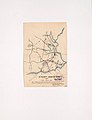
 1907 BERy system map.jpg 2,379 × 3,500; 1.05 MB
-
 1907 GPO Circulation map of Ireland.jpg 1,100 × 1,343; 348 KB
-
 JOHNSTON(1907) Sketch Map of the Republik of Liberia.jpg 600 × 687; 337 KB
-
 1907 Nepal with part of Tibet by Survey of India-1.jpg 10,454 × 7,302; 5.13 MB
-
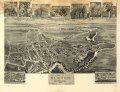
 Bird's eye view of Bristol, Conn. 1907. LOC 75693147.jpg 10,752 × 9,568; 18.37 MB
-
 Bird's eye view of Bristol, Conn. 1907. LOC 75693147.tif 10,752 × 9,568; 294.33 MB
-
 Bird's eye view of Plainville, Connecticut 1907. LOC 75693161.jpg 9,040 × 6,272; 16.8 MB
-
 Bird's eye view of Rocky Mount, North Carolina 1907 LOC gm71005370.jpg 9,120 × 6,800; 17.92 MB
-
 Bird's eye view of Rocky Mount, North Carolina 1907 LOC gm71005370.tif 9,120 × 6,800; 177.43 MB
-
 Bird's eye view of Torrington, Connecticut 1907. LOC 75693164.jpg 11,392 × 9,120; 16.45 MB
-

-

-
 Bird's-eye-view of Hickory, North Carolina. LOC gm71005334.jpg 9,048 × 6,280; 9.43 MB
-
 Bird's-eye-view of Hickory, North Carolina. LOC gm71005334.tif 9,048 × 6,280; 162.57 MB
-
 Bird's-eye-view of Statesville, North Carolina, LOC gm71005348.jpg 8,976 × 6,064; 8.82 MB
-
 Bird's-eye-view of Statesville, North Carolina, LOC gm71005348.tif 8,976 × 6,064; 155.73 MB
-
 Birds eye view of Chestertown, Kent Co., Maryland 1907. LOC 73693132.jpg 8,320 × 6,560; 13.98 MB
-
 Birds eye view of Chestertown, Kent Co., Maryland 1907. LOC 73693132.tif 8,320 × 6,560; 156.15 MB
-
 Birds eye view of Chestertown, Kent Co., Maryland 1907. LOC 76695287.jpg 8,652 × 6,816; 13.89 MB
-
 Birds eye view of Chestertown, Kent Co., Maryland 1907. LOC 76695287.tif 8,652 × 6,816; 168.72 MB
-
 Birds eye view of Havre de Grace, Maryland 1907. LOC 75694538.tif 7,024 × 6,288; 126.36 MB
-
 Messtischblatt 4407 Bottrop 1907 Rechteck.jpg 7,318 × 7,054; 13.7 MB
-
 Messtischblatt 4407 Bottrop 1907.jpg 8,275 × 8,721; 14.84 MB
-
 Brooklyn V. 9, Plate No. 13 (Map bounded by cemetery of the Evergreen, Oonway St., Broadway, Aberdeen St.) NYPL1810733.tiff 5,412 × 7,216, 2 pages; 111.79 MB
-
 Bulletin (1907) (19805839274).jpg 3,376 × 2,232; 1.79 MB
-
 Bulletin du Muséum d'histoire naturelle (1907) (20430990892).jpg 3,696 × 2,334; 1.66 MB
-
 Buzzards Bay (2676003036).jpg 2,000 × 1,574; 3.56 MB
-
 Carte de la Marne (Cahier d'écolier 1907).jpg 2,549 × 2,433; 1.26 MB
-
 Chevy Chase, D.C. LOC 88690783.jpg 9,554 × 6,318; 7.11 MB
-
 Chevy Chase, D.C. LOC 88690783.tif 9,554 × 6,318; 172.7 MB
-
 Cimislia 1907.png 855 × 698; 1.29 MB
-

-
 Messtischblatt 4410 Dortmund 1907.jpg 1,654 × 1,735; 976 KB
-
 Messtischblatt 4506 Duisburg 1907.jpg 8,268 × 8,687; 13.52 MB
-

-
 Electric railway review (1906) (14758398932).jpg 1,860 × 2,830; 972 KB
-
 Electric Railway Review-New York, Auburn and Lansing Railroad map.png 526 × 528; 156 KB
-
 Elementary physical geography (1907) (14748948196).jpg 1,710 × 2,012; 456 KB
-
 Messtischblatt 4408 Gelsenkirchen 1907 Rechteck.jpg 7,318 × 7,054; 15.43 MB
-
 Ideal map of Gettysburg battlefield LOC 99448793.jpg 6,263 × 6,524; 6.33 MB
-
 Ideal map of Gettysburg battlefield LOC 99448793.tif 6,263 × 6,524; 116.9 MB
-

-
 Italy (1907) (14764224574).jpg 1,882 × 2,046; 364 KB
-
 Jarvis' Pictorial map of Washington, D.C. LOC 87693423.jpg 7,816 × 3,773; 4.5 MB
-
 Jarvis' Pictorial map of Washington, D.C. LOC 87693423.tif 7,816 × 3,773; 84.37 MB
-
 Jerusalem (FL198245530 1143541).jpg 4,653 × 3,608; 16.03 MB
-
 Jerusalem (FL4536122 2367055).jpg 6,744 × 5,416; 49.44 MB
-
 John Bartholomew & Co., Environs of Jerusalem (FL173354572 0991247).jpg 3,869 × 3,381; 13.05 MB
-
 John Bartholomew & Co., Plan of Jerusalem (FL10527164 3446900).jpg 5,169 × 2,694; 21.01 MB
-
 Messtischblatt 4411 Kamen 1907.jpg 1,654 × 1,763; 933 KB
-
 Messtischblatt 4511 Hoerde 1907.jpg 1,654 × 1,763; 1,008 KB
-
 Kushunkotan Map of 1907.jpg 1,683 × 1,073; 598 KB
-
 Land south of squares 1131 etc. - (S.E. Washington D.C.) LOC 88690698.jpg 8,138 × 5,296; 8.29 MB
-
 Land south of squares 1131 etc. - (S.E. Washington D.C.) LOC 88690698.tif 8,138 × 5,296; 123.31 MB
-
 Lev S. Berg - Ethnographic map of Bessarabia.jpg 4,556 × 6,816; 12.53 MB
-
 Linguistic families of American Indians north of Mexico. NYPL55114.tiff 4,896 × 5,251; 73.56 MB
-
 Messtischblatt 4210 Luedinghausen 1907 Rechteck.jpg 6,705 × 6,463; 10.1 MB
-
 Messtischblatt 4210 Luedinghausen 1907.jpg 7,279 × 7,634; 11.95 MB
-
 Messtischblatt 4311 Luenen 1907.jpg 8,305 × 8,713; 13.19 MB
-
 Luristan in Russo-British Pact in 1907.jpg 803 × 651; 175 KB
-

-
 Map of Alexandria County, Virginia - formerly part of the District of Columbia LOC 89692766.tif 6,951 × 8,248; 164.03 MB
-
 Map of Fort Leavenworth, Kas. and vicinity (8347346472).jpg 686 × 800; 162 KB
-
 Map of Manitoba shewing provincial government lands for sale (14304159767).jpg 2,000 × 1,275; 3 MB
-

-

-

-
 Map of Shoshone County, Idaho LOC 2011593043.jpg 11,089 × 13,779; 12.72 MB
-

-

-

-
 Map of West Palm Beach, Lake Worth, and Palm Beach, Florida. LOC 2003627031.jpg 8,805 × 6,571; 8.82 MB
-
 Map of West Palm Beach, Lake Worth, and Palm Beach, Florida. LOC 2003627031.tif 8,805 × 6,571; 165.53 MB
-
 Mariana Trench Map 1907.jpg 2,915 × 2,321; 2.48 MB
-
 Messtischblatt 4308 Marl 1907 Rechteck.jpg 7,318 × 7,054; 11.17 MB
-
 Messtischblatt 4308 Marl 1907.jpg 8,427 × 8,862; 14.37 MB
-
 Mende Großer Verkehrs-Plan Berlin und seine Vororte 1907.jpg 7,050 × 5,400; 19.01 MB
-

-
 Messtischblatt 4507 Muelheim 1907 Rechteck.jpg 7,318 × 7,054; 12.86 MB
-
 Messtischblatt 4507 Muelheim 1907.jpg 8,123 × 8,693; 14.1 MB
-
 National Forests and National Parks in California (1907).jpg 4,248 × 5,232; 3.03 MB
-
 Nice from Baedeker.jpg 2,000 × 1,514; 5.27 MB
-
 Organisation militaire françaises 1907.png 1,247 × 1,169; 3.73 MB
-

-
 Planta da Cidade de São Paulo - 1 (4), Acervo do Museu Paulista da USP.jpg 7,216 × 5,412; 29.53 MB
-
 Queensland published by Geo. F. Cram.jpg 3,923 × 6,000; 3.55 MB
-
 Messtischblatt 25 Horneburger Strasse 1907 vs 2013.png 5,329 × 2,027; 20.19 MB
-
 Messtischblatt 25 Horneburger Strasse Uebersicht.png 5,329 × 2,027; 2.2 MB
-
 Messtischblatt 25 Oer-Erkenschwick 1907 vs 2013.pdf 1,752 × 1,595, 2 pages; 13.58 MB
-
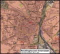
 Messtischblatt 25 Recklinghausen-Innenstadt 1907 vs 2013.png 2,120 × 2,003; 7.84 MB
-
 Messtischblatt 25 Recklinghausen-Innenstadt Stadtplan 1907 vs 2015.png 1,370 × 1,233; 2.98 MB
-
 Messtischblatt 25 Recklinghausen-Innenstadt Stadtplan.png 1,370 × 1,233; 808 KB
-
 Messtischblatt 25 Recklinghausen-Innenstadt Uebersicht.png 2,120 × 2,003; 1,021 KB
-
 Messtischblatt 25 Recklinghausen-Oststadt 1907 vs 2013.png 2,536 × 2,734; 12.59 MB
-
 Messtischblatt 25 Recklinghausen-Oststadt Uebersicht.png 2,536 × 2,734; 1.37 MB
-
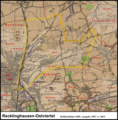 Messtischblatt 25 Recklinghausen-Ostviertel 1907 vs 2013.png 2,539 × 2,587; 11.84 MB
-
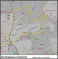 Messtischblatt 25 Recklinghausen-Ostviertel Uebersicht.png 2,539 × 2,587; 1.26 MB
-
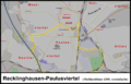
 Messtischblatt 25 Recklinghausen-Paulusviertel 1907 vs 2013.png 2,195 × 1,412; 5.68 MB
-
 Messtischblatt 25 Recklinghausen-Paulusviertel Uebersicht.png 2,195 × 1,412; 815 KB
-
 Messtischblatt 25 Recklinghausen-Suderwich 1907 vs 2013.png 3,025 × 2,347; 12.79 MB
-
 Messtischblatt 25 Recklinghausen-Suderwich Uebersicht.png 3,025 × 2,347; 1.34 MB
-
 Messtischblatt 25 Recklinghausen-Weststadt 1907 vs 2013.png 2,207 × 2,735; 11.04 MB
-
 Messtischblatt 25 Recklinghausen-Weststadt Uebersicht.png 2,207 × 2,735; 1.39 MB
-
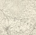 Messtischblatt 4309 Recklinghausen 1907 Rechteck.jpg 7,318 × 7,054; 12 MB
-
 Messtischblatt 4309 Recklinghausen 1907 vs 2013.png 6,130 × 6,174; 73.25 MB
-
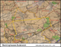
 Messtischblatt 4309 Recklinghausen 1907.jpg 8,417 × 8,850; 13.48 MB
-
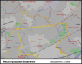
 Messtischblatt 4309 Recklinghausen Uebersicht.png 6,130 × 6,174; 6.24 MB
-
 Reno, the commercial center of Nevada LOC 2010587480.jpg 15,925 × 10,765; 24.67 MB
-
 RMNCPanoramicMap1907.jpg 1,024 × 763; 660 KB
-
 Shell Keys Reservation EO 682 illustration.jpg 2,082 × 2,853; 558 KB
-
 Spezialkarte der Österreichisch-ungarischen Monarchie - Radmannsdorf 1907.jpg 12,564 × 9,171; 31.72 MB
-
 Sydney Mines LOC 2017585995.jpg 4,968 × 6,462; 2.54 MB
-
 Sydney Mines LOC 2017585995.tif 4,968 × 6,462; 91.85 MB
-
 Tern Islands Reservation EO 675 illustration.jpg 1,834 × 2,892; 659 KB
-
 The birds of Tierra del Fuego (1907) (20198647949).jpg 3,782 × 2,512; 2.08 MB
-
 The British warblers (Pl. 15) (9200917186).jpg 2,176 × 1,436; 333 KB
-
 The greater Washington's Garden City, Fairfax Co., Virginia, 1907. LOC 89692727.jpg 7,538 × 9,688; 4.91 MB
-
 The greater Washington's Garden City, Fairfax Co., Virginia, 1907. LOC 89692727.tif 7,538 × 9,688; 208.94 MB
-
 The heart of St. Louis. LOC 75694666.jpg 7,696 × 6,064; 10.64 MB
-
 The heart of St. Louis. LOC 75694666.tif 7,696 × 6,064; 133.52 MB
-
 The Post-Office annual Glasgow directory (1907) (14779523691).jpg 1,566 × 3,050; 1.09 MB
-
 Topographische Karte 1 25000 Blatt 177 (8225) Kisslegg 1907.jpg 8,304 × 7,616; 78.13 MB
-
 Tour de France 1907 map-fr.svg 1,796 × 1,797; 292 KB
-
 Tour de France 1907.png 599 × 599; 314 KB
-
 Utica and vicinity LOC 2007625777.jpg 15,411 × 11,191; 18.96 MB
-
 View of Elkton, Maryland 1907. LOC 73693109.jpg 7,120 × 5,440; 10.36 MB
-
 View of Elkton, Maryland 1907. LOC 73693109.tif 7,120 × 5,440; 110.82 MB
-
 View of Elkton, Maryland. LOC 76695286.jpg 8,480 × 6,684; 11.16 MB
-
 View of Elkton, Maryland. LOC 76695286.tif 8,480 × 6,684; 162.16 MB
-
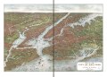
 View of the city of New York and vicinity LOC 78692903.jpg 12,720 × 9,136; 25.74 MB
-
 View of the city of New York and vicinity LOC 78692903.tif 12,720 × 9,136; 332.48 MB
-
 Messtischblaetter 4309-4410 Altbuergermeisterei Castrop um 1910.jpg 10,793 × 8,016; 20.85 MB
-
 Messtischblaetter 4309-4410 Altbuergermeisterei Castrop um 1910.pdf 1,754 × 1,302; 15.49 MB
-
 Messtischblatt 4310 Waltrop 1907 Rechteck.jpg 7,318 × 7,054; 12.24 MB
-
 Messtischblatt 4310 Waltrop 1907.jpg 8,100 × 8,545; 13.11 MB
-
 Messtischblatt 4208 Wulfen 1907.jpg 8,355 × 8,778; 14.22 MB
-
 יצחק בן אליהו פסח גולדהר, רושם דכל ארץ ישראל (FL199993514 2369239).jpg 10,183 × 13,626; 183.53 MB
-
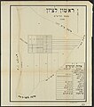 ראשון לציון בשנת תרמב (FL17237368 2709042).jpg 5,552 × 6,280; 52.89 MB


_Sketch_Map_of_the_Republik_of_Liberia.jpg)


_(19805839274).jpg)
_(20430990892).jpg)
.jpg)
.jpg)


.jpg)
_(14758398932).jpg)

_(14748948196).jpg)


_(14761304516).jpg)
_(14764224574).jpg)

.jpg)
.jpg)
.jpg)
.jpg)


_LOC_88690698.jpg)


.jpg)
.jpg)


_latest_data_at_the_Office_of_the_Engineer_Commissioner,_District_of_Columbia_LOC_87691451.jpg)


.jpg)


.jpg)


,_Acervo_do_Museu_Paulista_da_USP.jpg)


_(20198647949).jpg)
_(9200917186).jpg)


_(14779523691).jpg)
_Kisslegg_1907.jpg)


.jpg)
.jpg)