Category:1909 maps
Appearance
| ← · 1900 · 1901 · 1902 · 1903 · 1904 · 1905 · 1906 · 1907 · 1908 · 1909 · → |
Deutsch: Karten mit Bezug zum Jahr 1909
English: Maps related to the year 1909
Español: Mapas relativos al año 1909
Français : Cartes concernant l’an 1909
Русский: Карты 1909 года
Subcategories
This category has the following 9 subcategories, out of 9 total.
Media in category "1909 maps"
The following 103 files are in this category, out of 103 total.
-
1909 Habana districts map by Baedeker.png 918 × 701; 1.34 MB
-
1909 Volokolamsk.jpg 5,316 × 6,379; 10.82 MB
-
Adventure-travel-exploration (1909) (17751349108).jpg 1,832 × 2,808; 1.42 MB
-
Aero view of Willimantic, Connecticut 1909. LOC 75693169.jpg 10,432 × 8,896; 13.94 MB
-
Alaska 1909.jpg 7,650 × 5,671; 55.49 MB
-
Amsterdam in New Netherland, 1653-1664 NYPL1812316.tiff 4,324 × 6,414; 79.38 MB
-
Banjaluka. NYPL1226921.tiff 4,640 × 5,475; 72.69 MB
-
Bene (Meburg). NYPL1226807.tiff 4,464 × 5,355; 68.4 MB
-
Beregszasz und Mezo-Tarpa. NYPL1226544.tiff 4,384 × 5,339; 66.97 MB
-
Bruneck (Tirol). NYPL1226685.tiff 4,432 × 5,315; 67.4 MB
-
Brusau und Gewitsch. NYPL1226366.tiff 4,760 × 5,627; 76.64 MB
-
Budweis und Cratzen. NYPL1226443.tiff 4,584 × 5,355; 70.24 MB
-
Celinac und Ratkovo. NYPL1226939.tiff 5,203 × 4,488; 52.3 MB
-
Chrudimský kraj 1909.jpg 1,368 × 1,016; 382 KB
-
Crivelli World Map.png 4,000 × 3,055; 33.61 MB
-
D. Landsberg und Wolfsberg. NYPL1226691.tiff 4,432 × 5,315; 67.4 MB
-
Devonport Dockyard in 1909 plan original.jpg 716 × 1,139; 194 KB
-
Deät Lun300B.JPG 2,818 × 2,377; 582 KB
-
Drohobycz. NYPL1226408.tiff 4,552 × 5,347; 69.64 MB
-
G. Kanizsa und Zakany. NYPL1226761.tiff 4,376 × 5,227; 65.45 MB
-
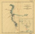
General Map showing the Explorations and Surveys of the Expedition, 1907-09. LOC 2002624045.tif 5,215 × 5,112; 76.27 MB
-
Grobming und St. Nicolai. NYPL1226623.tiff 4,496 × 5,419; 69.71 MB
-
Grosz-Becskerek. NYPL1226884.tiff 4,616 × 5,547; 73.26 MB
-
Hallein und Berchtesgaden. NYPL1226586.tiff 4,376 × 5,187; 64.95 MB
-
Hatszeg. NYPL1226862.tiff 4,616 × 5,547; 73.26 MB
-
Hradecký kraj r. 1909.jpg 887 × 745; 393 KB
-
Imotski und Macarsca. NYPL1227011.tiff 4,376 × 5,139; 64.35 MB
-
Kirchenprovinz Kalocsa 1909.jpg 1,491 × 898; 266 KB
-
Kornyareva. NYPL1226913.tiff 4,640 × 5,475; 72.69 MB
-
Kovaszna. NYPL1226839.tiff 4,496 × 5,379; 69.2 MB
-
Krakau. NYPL1226321.tiff 4,808 × 5,539; 76.2 MB
-
Krapina und Zlatar. NYPL1226789.tiff 4,464 × 5,355; 68.4 MB
-
Krassova und Teregova. NYPL1226912.tiff 4,640 × 5,475; 72.69 MB
-
Kufstein. NYPL1226584.tiff 4,376 × 5,187; 64.95 MB
-
L'enceinte de Rosabaouen.jpg 461 × 397; 62 KB
-
Le camp fortifié de Lesneven (d'après Delaporte).jpg 617 × 417; 77 KB
-
Lerchendal allé 1909.jpg 967 × 836; 304 KB
-
LgTelephoneMap.jpg 22,829 × 15,502; 99.54 MB
-
Madras Prov North 1909.jpg 1,000 × 816; 236 KB
-
Map Kirribilli Point 1909.jpg 800 × 602; 168 KB
-
Map of Alaska LOC 2012586808.tif 7,650 × 5,671; 124.12 MB
-
Map of Platt National Park, Murray County, Oklahoma LOC 2018585320.jpg 9,952 × 4,481; 3.53 MB
-
Map of Platt National Park, Murray County, Oklahoma LOC 2018585320.tif 9,952 × 4,481; 127.59 MB
-
Map showing holdings along Eastern Branch LOC 88690690.jpg 26,727 × 8,405; 27.02 MB
-
Maps illustrating cruises of John Paul Jones in British waters (10175546456).jpg 4,029 × 5,175; 3.86 MB
-
N O Railway Light Tourist Map New Orleans 1909.jpg 1,600 × 1,085; 332 KB
-
New Salem, home of Abraham Lincoln 1831 to 1837. LOC 75693219.tif 9,856 × 5,952; 167.84 MB
-
Orsova und Turnu-Severin. NYPL1226950.tiff 4,360 × 5,235; 65.31 MB
-
Papa. NYPL1226630.tiff 10,326 × 7,758, 2 pages; 229.46 MB
-
Protectorat Nigeria 1909.png 870 × 777; 247 KB
-
PSM V74 D107 Proposed plan for johns hopkins university.png 1,671 × 1,053; 236 KB
-
PSM V74 D521 Map of the antarctic region showing shackleton route.png 1,623 × 1,326; 285 KB
-
PSM V74 D535 Systems of semi daily tides around the world based on gmt.png 2,877 × 1,637; 1.2 MB
-
PSM V74 D537 Cotidal lines of the atlantic ocean.png 2,016 × 3,226; 1,024 KB
-
PSM V74 D538 Cotidal lines of the indian ocean.png 1,920 × 3,237; 823 KB
-
PSM V74 D539 Cotidal lines of the pacific ocean.png 1,931 × 3,242; 991 KB
-
PSM V74 D540 Cotidal lines for new york harbor and approaches.png 2,406 × 1,631; 342 KB
-
PSM V74 D605 Southeastern georgia and the okefenokee swamp.png 1,630 × 1,368; 403 KB
-
Puspok-Ladany. NYPL1226637.tiff 4,496 × 5,419; 69.71 MB
-
QuibbleIsland.jpg 148 × 129; 42 KB
-
Rosenberg und Rutka. NYPL1226426.tiff 4,552 × 5,411; 70.48 MB
-
Route and Surveys of the South Magnetic Polar Party, 1908-09. LOC 2002624043.jpg 4,499 × 6,286; 3.3 MB
-
Route and Surveys of the South Magnetic Polar Party, 1908-09. LOC 2002624043.tif 4,499 × 6,286; 80.91 MB
-
Route and Surveys of the Southern Journey Party, 1908-09. LOC 2002624044.jpg 4,954 × 7,697; 3.44 MB
-
Route and Surveys of the Southern Journey Party, 1908-09. LOC 2002624044.tif 4,954 × 7,697; 109.09 MB
-
Rudnik und Ranizow. NYPL1226300.tiff 4,816 × 5,635; 77.65 MB
-
Ruskberg (Ruszkahegy). NYPL1226861.tiff 4,616 × 5,547; 73.26 MB
-
Ruszpolyana. NYPL1226575.tiff 4,456 × 5,203; 66.34 MB
-
Schleswig-Holstein 1909 Mayers Kon Lex.jpg 4,977 × 6,229; 21.78 MB
-
Sebenico und Trau. NYPL1226996.tiff 4,320 × 5,147; 63.62 MB
-
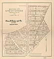
Section no. 2, Chevy Chase, Maryland LOC 2011593737.jpg 6,998 × 7,674; 6.43 MB
-
Section no. 2, Chevy Chase, Maryland LOC 2011593737.tif 6,998 × 7,674; 153.64 MB
-
Sisek und Sunja. NYPL1226876.tiff 4,616 × 5,547; 73.26 MB
-
Solden und St. Leonhard (Tirol). NYPL1226683.tiff 4,432 × 5,315; 67.4 MB
-
Spezialkarte der Österreichisch-ungarischen Monarchie - Bischoflack und Idria 1909.jpg 14,683 × 11,469; 38.02 MB
-
Spezialkarte der Österreichisch-ungarischen Monarchie - Flitsch 1909.jpg 14,734 × 10,765; 36.88 MB
-
Spezialkarte der Österreichisch-ungarischen Monarchie - Pragerhof und Wind. Feistritz 1909.jpg 14,740 × 11,396; 32.75 MB
-
Spezialkarte der Österreichisch-ungarischen Monarchie - Sesana und St. Peter 1909.jpg 13,096 × 9,173; 31.09 MB
-
Stars of the first 5 magnitudes visible in Northern latitudes LOC 2013593148.jpg 6,328 × 5,765; 5.51 MB
-
Stars of the first 5 magnitudes visible in Northern latitudes LOC 2013593148.tif 6,328 × 5,765; 104.37 MB
-
Stars of the first 5 magnitudes visible in Northern latitudes LOC 2013593149.jpg 4,873 × 4,352; 3.99 MB
-
Stars of the first 5 magnitudes visible in Northern latitudes LOC 2013593149.tif 4,873 × 4,352; 60.67 MB
-
Szczucin. NYPL1226298.tiff 4,816 × 5,635; 77.65 MB
-
Szencz und Pistyan (Ungarn). NYPL1226476.tiff 4,536 × 5,491; 71.27 MB
-
The Commercial and financial chronicle (1909) (14766438744).jpg 2,596 × 4,278; 2.45 MB
-
The Commercial and financial chronicle (1909) (14768572012).jpg 4,300 × 2,640; 3.38 MB
-
Uetersen 1909 Mayers Kon Lex.jpg 851 × 664; 377 KB
-
Ujradna und Jakobeny. NYPL1226645.tiff 4,496 × 5,419; 69.71 MB
-
Unc. Hradisch und Unc. Brod. NYPL1226423.tiff 4,552 × 5,411; 70.48 MB
-
Warez. NYPL1226284.tiff 4,792 × 5,491; 75.29 MB
-
Werschetz und Alibunar. NYPL1226910.tiff 4,640 × 5,475; 72.69 MB
-
Zalatna. NYPL1226803.tiff 4,464 × 5,355; 68.4 MB
-
Zirl und Nassereith. NYPL1226617.tiff 4,496 × 5,419; 69.71 MB
-
Čáslavský kraj 1909.jpg 1,174 × 1,412; 478 KB


