Category:1906 maps
Appearance
| ← · 1900 · 1901 · 1902 · 1903 · 1904 · 1905 · 1906 · 1907 · 1908 · 1909 · → |
Deutsch: Karten mit Bezug zum Jahr 1906
English: Maps related to the year 1906
Español: Mapas relativos al año 1906
Français : Cartes concernant l’an 1906
Русский: Карты 1906 года
Subcategories
This category has the following 8 subcategories, out of 8 total.
Media in category "1906 maps"
The following 89 files are in this category, out of 89 total.
-
1904 Land Office Map of Niihau, Hawaii - Geographicus - Niihau-lo-1904.jpg 3,804 × 5,000; 2.66 MB
-
1906 Alicante.jpg 1,229 × 786; 424 KB
-
1906 G&S map.png 2,076 × 1,604; 81 KB
-
1906 Lisbonne centre.jpg 1,600 × 1,394; 876 KB
-
1906 Lisbonne ensemble.jpg 1,600 × 856; 509 KB
-
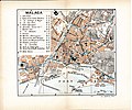
1906 Malaga.jpg 1,474 × 1,227; 627 KB
-
1906 Pampelune.jpg 1,600 × 1,257; 695 KB
-
1906 Porto.jpg 1,600 × 1,023; 684 KB
-
1906 Ségovie.jpg 1,600 × 1,037; 498 KB
-
1906 Séville.jpg 1,546 × 1,224; 829 KB
-
1906 Tarragone.jpg 1,600 × 1,016; 496 KB
-
1906 Tolède.jpg 1,600 × 1,257; 745 KB
-
1906 Valladolid.jpg 1,600 × 1,262; 733 KB
-
Alois Musil, Karte von Arabia Petraea 01-dead-sea (FL25570177 2493507).jpg 17,244 × 13,465; 303.5 MB
-
Alois Musil, Karte von Arabia Petraea 02 (FL25570178 2493507).jpg 9,921 × 13,465; 155.84 MB
-
Alois Musil, Karte von Arabia Petraea 03 (FL25570179 2493507).jpg 16,942 × 13,365; 228.33 MB
-
Alois Musil, Karte von Arabia Petraea 04-gulf-of-aqaba (FL25570180 2493507).jpg 10,037 × 13,637; 159.46 MB
-
Anales de la Sociedad Científica Argentina (1906) (17544158524).jpg 2,476 × 3,264; 1.51 MB
-
Austria-Hungary LOC 2007627460.jpg 8,471 × 6,365; 9.61 MB
-
Borodyno (Gulevich) 1906.jpg 9,213 × 6,208; 29.89 MB
-
BriarcliffOutlookV1-Oct.1906-Mar.1907Image1.jpg 1,003 × 680; 200 KB
-
BriarcliffOutlookV1-Oct.1906-Mar.1907Image2.jpg 2,416 × 1,668; 3.52 MB
-
Bukowsko - mapa katastralna (1906).jpg 2,006 × 1,501; 1.14 MB
-
Course 1903 copy.jpg 624 × 836; 352 KB
-
Course 1903a copy.jpg 600 × 800; 428 KB
-
Cultru - Un empereur de Madagascar au XVIIIe siècle - Benyowszky, figure page7.png 1,480 × 2,533; 317 KB
-
Darling Point Original Crown Grants.jpg 2,787 × 1,658; 1.66 MB
-
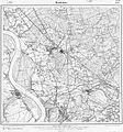
Messtischblatt 4406 Dinslaken 1906.jpg 1,654 × 1,766; 960 KB
-
Messtischblatt 4306 Drevenack 1906.jpg 1,654 × 1,744; 959 KB
-
Ellendalemap1906.jpg 936 × 724; 110 KB
-
Frankfurt am Main Messtischblatt df dk 0010001 5818 1906.jpg 8,382 × 8,778; 11.34 MB
-
Greatrsyria.png 1,913 × 1,349; 121 KB
-
Hell Gate Forest Reserve. LOC 2012593366.jpg 7,456 × 5,937; 6.91 MB
-
Hell Gate Forest Reserve. LOC 2012593366.tif 7,456 × 5,937; 126.65 MB
-
Messtischblatt 4409 Herne 1906.jpg 1,654 × 1,791; 929 KB
-
Hilton of cadboll site os map 25inch 1906.jpeg 5,000 × 5,000; 1.36 MB
-
Jaluit Atoll map Kraemer1896 204.jpg 1,889 × 2,333; 1.14 MB
-
James Edward Hanauer, Cook's plan of Jerusalem and environs (FL4542279 2654423).jpg 3,198 × 2,065; 9.41 MB
-
Khalili Collection Hajj and Arts of Pilgrimage arc.pt 0626.jpg 2,500 × 3,718; 528 KB
-
La forêt sous-marine de Loctudy.jpg 626 × 803; 252 KB
-
Latin American States, 1823.jpg 904 × 1,355; 403 KB
-
Map of Everett and vicinity (2674380763).jpg 2,000 × 1,637; 3.15 MB
-
Map of Rock Creek Park showing roads & bridle paths - (Washington D.C.) LOC 88693047.jpg 3,961 × 11,093; 4.14 MB
-
Map of Rock Creek Park showing roads & bridle paths - (Washington D.C.) LOC 88693047.tif 3,961 × 11,093; 125.71 MB
-
Mapa obras del puerto de bs as 1906.jpg 1,808 × 1,044; 185 KB
-
Meyers Konversationslexikon - Karte München 1906.jpg 1,428 × 1,171; 2.07 MB
-
Nypl.digitalcollections.7b047324-ccf5-18d4-e040-e00a18066697.001.g.jpg 4,527 × 6,633; 4.75 MB
-
Plan du château de Kergunus.jpg 639 × 607; 212 KB
-
Plan Saint-Sauveur de Dinan.jpg 459 × 302; 61 KB
-
Plano detalle 1906.JPG 1,003 × 664; 140 KB
-
Pocahontas-28.jpg 1,228 × 500; 179 KB
-
PSM V68 D573 Entrance floor of the engineering building.png 1,682 × 1,464; 195 KB
-
PSM V68 D573 Tenth floor occupied by the electrical engineers.png 1,643 × 1,262; 117 KB
-
Qingdao-map-1906.jpg 1,536 × 977; 192 KB
-
Rasguño de las provincias de la Nueva México LOC 2010585450.jpg 6,862 × 4,884; 3.79 MB
-
Rasguño de las provincias de la Nueva México LOC 2010585450.tiff 6,862 × 4,884; 95.88 MB
-
Spezialkarte der Österreichisch-ungarischen Monarchie - Flitsch 1906.jpg 12,631 × 9,197; 33.88 MB
-
Standard Guide ready reference map of Washington LOC 87691450.jpg 7,542 × 3,867; 5.22 MB
-
Standard Guide ready reference map of Washington LOC 87691450.tif 7,542 × 3,867; 83.44 MB
-
The beautifying of Honolulu (1906) (20358865015).jpg 4,328 × 3,261; 1.58 MB
-
The Commercial and financial chronicle (1906) (14781705862).jpg 4,176 × 2,556; 1.44 MB
-
The Four Voyages of Columbus, 1492–1503.jpg 1,731 × 1,336; 864 KB
-
The Maryville Tribune's map of Nodaway County, Missouri. LOC 2012593046.jpg 13,325 × 16,671; 32.85 MB
-
The Post-Office annual Glasgow directory (1906) (14803088653).jpg 1,598 × 3,108; 1.2 MB
-
The Street railway journal (1906) (14574540870).jpg 3,092 × 2,258; 1.2 MB
-
Tiefenkarte Chiemsee 1906.jpg 930 × 778; 162 KB
-
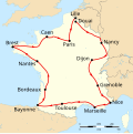
Tour de France 1906 map-fr.svg 1,796 × 1,797; 365 KB
-
Tour de France 1906.png 599 × 599; 227 KB
-
Umgebungskarte München von Wagner & Debes 1906.jpg 982 × 1,497; 1.8 MB
-
Vsekhsviatskoe garden 1906.jpg 4,132 × 5,731; 2.47 MB
-
W. & A.K. Johnston Limited, The Environs of Paris, 1906 - David Rumsey.jpg 2,151 × 1,989; 2.89 MB
-
Wagner & Debes, Jerusalem (FL4541397 2370366).jpg 3,144 × 2,756; 14.08 MB
-
Messtischblatt 4510 Witten 1906.jpg 7,775 × 8,707; 13.65 MB
-
Woiska, Idria, Bischoflack 1906.jpg 3,635 × 2,647; 11.56 MB
-
Zhejiang yan hai yao kou quan tu LOC 2002626763.jpg 10,573 × 16,306; 14.49 MB
-
Zhejiang yan hai yao kou quan tu LOC 2002626763.tif 10,573 × 16,306; 493.25 MB


