Category:18th-century maps of the Netherlands
Jump to navigation
Jump to search
Subcategories
This category has the following 16 subcategories, out of 16 total.
#
- 1750s maps of the Netherlands (33 F)
- 1770s maps of the Netherlands (10 F)
- 1780s maps of the Netherlands (14 F)
- 1790s maps of the Netherlands (17 F)
A
M
R
- 18th-century maps of Rotterdam (11 F)
S
- Sanson maps of the Netherlands (12 F)
Z
Media in category "18th-century maps of the Netherlands"
The following 19 files are in this category, out of 19 total.
-

-
 Totius Rheni tractus - CBT 5873387.jpg 5,715 × 4,750; 9.06 MB
-
 A map of the Netherlands Wellcome V0049918.jpg 2,988 × 2,353; 3.23 MB
-
 A new and exact map of the United Provinces, or Netherlands etc NYPL1630448.tiff 7,230 × 5,124; 105.99 MB
-
 Atlas Curieux-Niederlande Provinzen.jpg 930 × 737; 596 KB
-

-
 Belgium Austracum.png 1,350 × 1,080; 200 KB
-
 Belgium Federatum.png 1,314 × 1,080; 163 KB
-

-

-

-

-
 Kaart Ring van Putten 1700.jpg 5,823 × 4,968; 7.2 MB
-
 Plan Tres Exact De La Fameuse Ville Marchande D'Amsterdam.jpg 13,352 × 7,898; 24.63 MB
-

-
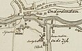 Regthuis van Menkeweer te Onderdendam.jpg 558 × 347; 113 KB
-

-
 T Nieuw Hand-Kaartje XVII Nederlandsche provincien... - btv1b525095222.jpg 5,002 × 6,334; 5.33 MB
-

_-_Geographicus_-_Germaniae-covensmortier-1720.jpg)


_Map.jpg)


_Descriptio_geographica_archiepiscopatus_Mechliniensis.gif)


