Category:18th-century maps of Zeeland
Jump to navigation
Jump to search
Provinces of the Netherlands: Groningen · Zeeland
Subcategories
This category has the following 2 subcategories, out of 2 total.
A
H
- Hattinga's Atlas van Zeeland (7 F)
Media in category "18th-century maps of Zeeland"
The following 32 files are in this category, out of 32 total.
-
 Kaart van Biervliet (1716).jpg 4,962 × 3,918; 5.15 MB
-
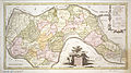
 Staats Vlaanderen 1745 ² Hattinga.jpg 6,714 × 4,411; 23.88 MB
-
 Staats Vlaanderen 1745 ¹ Hattinga.jpg 6,714 × 4,411; 21.26 MB
-
 1747 Zeeland Tirion.jpg 1,562 × 1,333; 1.9 MB
-
 1748 De la Ze lande² Covens & Mortier.jpg 4,221 × 4,796; 6.24 MB
-
 Isaak-Tirion-Hedendaegsche historie MG 0705.tif 4,087 × 3,571; 41.79 MB
-
 1748 Topo graphy le Rouge.jpg 9,556 × 8,277; 38.3 MB
-
 Beveland 1753 Hattinga Tirion.jpg 3,419 × 1,897; 3.4 MB
-
 Beveland N 1753 Hattinga Tirion².jpg 2,372 × 1,859; 2.22 MB
-
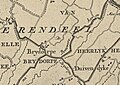 Brijdorpe.jpg 750 × 534; 99 KB
-

-
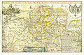
 Zeeland 1753 Hattinga.jpg 4,841 × 4,345; 27.06 MB
-
 Heerlijkheid Oosterland.jpg 1,028 × 1,403; 290 KB
-

-

-
-

-

-

-
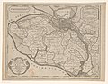
 Kaart van Walcheren Kaart van het Eiland Walcheren (titel op object), RP-P-AO-15-113.jpg 3,373 × 3,004; 2.06 MB
-

-
 De VII Vereenigde Nederlandsche Provinciën COLLBN Port 3 N 87 - sheet 3.tif 8,449 × 6,330; 153.01 MB
-
 1785 Zelande LeRouge 9x GAV copy.jpg 8,818 × 7,707; 21.8 MB
-
 1787 Kaarte Covens.jpg 3,299 × 2,886; 6.77 MB
-
 Atlas Van der Hagen-KW1049B11 059-BRABANTIAE PARS-SEPTENTRIONALIS ....jpeg 5,500 × 4,687; 4.7 MB
-

-

-

-
 Atlas Van der Hagen-KW1049B11 094-COMITATVS ZELANDIAE Novissima Delineatio per.jpeg 5,500 × 4,667; 4.67 MB
-
 Comitatus Zelandiae accurata & novissima delineatia COLLBN Port 33 N 52, COLLBN Port 33 N 52.tif 6,879 × 6,273; 123.46 MB
-
 Comitatus Zelandiae novissima delineatio - CBT 6605903.jpg 5,658 × 4,761; 9.95 MB
-

.jpg)


,_RP-P-AO-15-93-1.jpg)
,_RP-P-AO-15-93-2.jpg)
,_RP-P-AO-15-116-1.jpg)
,_RP-P-AO-15-112.jpg)
,_RP-P-AO-15-17-1.jpg)
,_RP-P-AO-15-17-2.jpg)
,_RP-P-AO-15-113.jpg)
.jpg)


,_RP-P-AO-15-116-2.jpg)