Category:1790s maps of the Netherlands
Jump to navigation
Jump to search
Countries of Europe: Albania · Armenia‡ · Austria · Belarus · Belgium · Bosnia and Herzegovina · Bulgaria · Croatia · Cyprus‡ · Denmark · Estonia · France‡ · Georgia‡ · Germany · Greece · Hungary · Republic of Ireland · Italy · Latvia · Lithuania · Moldova · Netherlands‡ · Norway · Poland · Portugal‡ · Romania · Russia‡ · Serbia · Slovakia · Slovenia · Spain‡ · Sweden · Switzerland · Turkey‡ · Ukraine · United Kingdom
Limited recognition: Abkhazia‡
‡: partly located in Europe
Limited recognition: Abkhazia‡
‡: partly located in Europe
Provinces of the Netherlands:
Media in category "1790s maps of the Netherlands"
The following 17 files are in this category, out of 17 total.
-

-
 Oostzaandam kaart.jpg 5,663 × 7,439; 11.83 MB
-
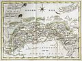
 Reilly Karte von der Republik der Vereinigten Niederlande.jpg 705 × 578; 126 KB
-
 1799 Cary Map of the Netherlands - Geographicus - Netherlands-cary-1799.jpg 5,000 × 4,472; 7.88 MB
-

-

-

-
 Dep van de eems.jpg 640 × 480; 270 KB
-
 Reilly Allgemeiner Postatlas Westfalen, Burgund.jpg 1,768 × 1,432; 935 KB
-

-
 Hottinger - Het Maar.jpg 1,312 × 1,116; 1.5 MB
-
 Hottinger - Rivierenbuurt.jpg 1,312 × 1,116; 650 KB
-
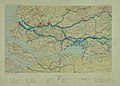 Kaart Zuid-Hollandse eilanden 1795.jpg 1,000 × 717; 297 KB
-
 Map of Germany and Switzerland in 1791 by Reilly 092.jpg 1,137 × 1,056; 532 KB
-
 Map of Germany and Switzerland in 1791 by Reilly 092b.jpg 643 × 568; 144 KB
-
 Onbekend - Nederlands.jpg 1,691 × 2,141; 999 KB
-
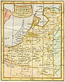
 Reilly 263.jpg 1,149 × 969; 520 KB


%27_(11168451406).jpg)


