Category:18th-century maps of Gibraltar
Jump to navigation
Jump to search
Countries of Europe: Albania · Armenia‡ · Austria · Azerbaijan‡ · Belarus · Belgium · Bosnia and Herzegovina · Bulgaria · Croatia · Cyprus‡ · Czech Republic · Denmark · Estonia · Finland · France‡ · Georgia‡ · Germany · Greece · Hungary · Iceland · Republic of Ireland · Italy · Latvia · Lithuania · Luxembourg · Malta · Moldova · Montenegro · Netherlands‡ · North Macedonia · Norway · Poland · Portugal‡ · Romania · Russia‡ · Serbia · Slovakia · Slovenia · Spain‡ · Sweden · Switzerland · Turkey‡ · Ukraine · United Kingdom
Specific status: Gibraltar · Isle of Man – Limited recognition: Abkhazia‡
‡: partly located in Europe
Specific status: Gibraltar · Isle of Man – Limited recognition: Abkhazia‡
‡: partly located in Europe
Media in category "18th-century maps of Gibraltar"
The following 69 files are in this category, out of 69 total.
-
 1704 - Louis Boudan - Taking of Gibraltar.jpg 6,896 × 5,616; 6.5 MB
-
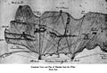
 1704 - Paths taken by Simon Susarte.jpg 3,844 × 2,092; 5.67 MB
-
 1704 Gib port - Chez Daumont.jpg 640 × 458; 81 KB
-
 1720 De La Feuille Map and View of Gibraltar - Geographicus - Gibraltar-lafeuille-1720.jpg 5,549 × 2,230; 2.61 MB
-
 1727 - Gib Map Guillaume Danet.JPG 640 × 517; 147 KB
-
 1727 - Gibraltar - Spanish - (unknown).jpg 559 × 340; 59 KB
-
 1727 - Renaud - Map bay of gbraltar.jpg 640 × 506; 125 KB
-
 1727 c Nouveau plan de Gibraltar - Jean Covens et Corneille Mortier.jpg 640 × 555; 166 KB
-

-
 1730 - Unknown - Campo de Gibraltar.jpg 634 × 640; 157 KB
-
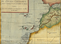
 1730 map of Andalusia and Gibraltar by Matthaus Seutter.jpg 1,850 × 1,600; 811 KB
-
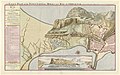
 A Plan of the Town and Fortifications of Gibraltar - btv1b53056338s.jpg 6,904 × 3,008; 3.39 MB
-
 1744 - R.Erskine and G. Knowles Admiralty map.jpg 640 × 285; 70 KB
-

-
 1747 Ratelband Map of Gibraltar - Geographicus - Gibraltar-ratelband-1747.jpg 5,000 × 2,033; 1.39 MB
-

-
 1762 - Tomas Lopez - Detail of Town.JPG 640 × 387; 135 KB
-
 Carta de la bahia de Gibraltar - por Don Tomas López... - btv1b532270197 (1 of 2).jpg 7,746 × 5,912; 4.86 MB
-
 1780 - P Santini - Map Gibraltar.jpg 1,379 × 1,600; 522 KB
-
 1781 - Spilsbry's plan of the Sortie.jpg 438 × 640; 69 KB
-
 1781 Gibraltar North Front.jpg 1,329 × 603; 430 KB
-
 1782 Prince of Wales's Lines map.jpg 1,699 × 881; 896 KB
-
 Map of the Great Siege of Gibraltar.jpg 12,964 × 18,497; 52.56 MB
-
 1783 Captain Spilsbury Map of Gibraltar 2.JPG 640 × 510; 79 KB
-
 1783 Captain Spilsbury Map of Gibraltar.jpg 1,097 × 746; 374 KB
-
-
 1785 A plan shewing the attack of 27th of November 1781 from Gibraltar.jpg 2,189 × 3,000; 1.63 MB
-
 1799 - Barbie du Bocage Jean Denis Detail.jpg 640 × 377; 122 KB
-
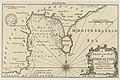
 A chart of the STRAITS of GIBRALTER NYPL1640695.tiff 7,230 × 5,428; 112.28 MB
-

-
 A New & Exact Plan of the Town of Gibraltar - By Herman Moll - btv1b530568968.jpg 8,256 × 6,560; 6.51 MB
-
 A North View of Gibraltar - 1762.jpg 1,130 × 654; 416 KB
-
-

-
 An Exact Plan of the Town Castle Moles and Bay of Gibraltar - colour.jpg 5,240 × 3,292; 4.14 MB
-
 An Exact Plan of the Town, Castle, Moles and Bay of Gibraltar.jpg 2,792 × 1,764; 2.38 MB
-
 Andaluzia - Gabriel Bodenehr.jpg 1,020 × 644; 121 KB
-
 Antique Battle Plan and Map of Gibraltar.JPG 340 × 468; 42 KB
-
 Bahía Algeciras.jpg 1,565 × 2,330; 1.03 MB
-
 Carte de la baye de Gibraltar (1762).jpg 3,000 × 2,133; 1.78 MB
-

-
 Communication Line of the Round Tower.jpg 864 × 440; 244 KB
-

-
 Fuertes de la linea3.jpg 1,158 × 572; 185 KB
-
 Geometrisk karta över Gibraltar - Skoklosters slott - 97998.tif 4,459 × 3,497; 44.63 MB
-
 Gibraltar 1727 map crop.jpg 904 × 1,280; 860 KB
-
 Gibraltar and Bay map 1750.jpg 2,049 × 2,750; 877 KB
-
 Gibraltar e istmo en 1786.jpg 440 × 920; 115 KB
-
-
 Gibraltar plan 1762.jpg 855 × 525; 114 KB
-

-

-

-
 Kungsboken-karta-gibraltar.jpg 3,531 × 3,307; 668 KB
-
 Map of Gibraltar Bay 1782.jpg 1,768 × 1,330; 1.63 MB
-
 Map of Gibraltar by Homann's heirs (1733).jpg 1,929 × 1,299; 960 KB
-
 Map of Gibratar, 1782.jpg 1,674 × 3,161; 787 KB
-
 Morass and Spanish trenches, Gibraltar 1704.jpg 770 × 594; 278 KB
-

-

-
 Nouveau plan de Gibraltar - Jean Covens et Corneille Mortier.jpg 1,276 × 1,107; 759 KB
-
 Plan de Gibraltar - Barbié du Bocage.jpg 4,137 × 1,304; 2.53 MB
-
 Plan of Gibraltar RMG F0092.tiff 5,131 × 7,339; 107.74 MB
-
 Plattegrond van Gibraltar en plattegrond van Ceuta op één kaart, objectnr A 16224.tif 6,381 × 5,323; 75.73 MB
-

-
 Prespectiva de gibraltar 1 novembre 1779.png 3,106 × 2,193; 9.34 MB
-
 Reinhard - Hardy Town.jpg 2,006 × 1,033; 1,003 KB
-
 The Harbor and Strait of Gibraltar - Johannes Covens en Cornelis Mortier.jpg 1,276 × 1,076; 777 KB
-
 The Straites Mouth of Gibralter RMG F0089.tiff 5,082 × 3,978; 57.84 MB


.jpg)


.jpg)
.jpg)

.jpg)


.jpg)


.jpg)
_-_par_le_Sr_Henry_Michelot,_pilote_r%C3%A9al_des_gal%C3%A8res_du_Roy_-_btv1b530281039_(13_of_55).jpg)


,_BI-B-FM-090-67.jpg)


,_RP-P-OB-83.395.jpg)
,_RP-P-OB-83.400.jpg)


.jpg)


,_RP-P-2018-1774.jpg)


