Category:18th-century maps of the Isle of Man
Jump to navigation
Jump to search
Media in category "18th-century maps of the Isle of Man"
The following 4 files are in this category, out of 4 total.
-
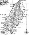
To the Honorable William, E.le. of Derby, Lord of ISLE of MAN NYPL1640578.tiff 7,230 × 5,428; 112.28 MB
-
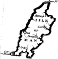
A general history of inland navigation Fleuron T118563-2.png 643 × 649; 13 KB
-
Forts around the south of the Isle of Man (1760).jpg 1,244 × 756; 95 KB


