Category:1893 maps of South Dakota
Jump to navigation
Jump to search
States of the United States: California · Florida · Georgia · Idaho · Illinois · Iowa · Kansas · Kentucky · Louisiana · Michigan · Minnesota · Mississippi · Missouri · Montana · New Mexico · New York · North Carolina · North Dakota · Ohio · Oregon · Pennsylvania · South Carolina · South Dakota · Tennessee · Texas · Virginia · Washington · Wisconsin · Wyoming – Washington, D.C.
| 1890 1891 1892 1893 1894 1896 1897 1898 1899 → |
Subcategories
This category has the following 3 subcategories, out of 3 total.
Media in category "1893 maps of South Dakota"
The following 67 files are in this category, out of 67 total.
-
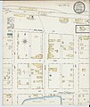
Sanborn Fire Insurance Map from Ashton, Spink County, South Dakota. LOC sanborn08203 001-1.tif 6,510 × 7,707; 143.55 MB
-
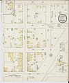
Sanborn Fire Insurance Map from Ashton, Spink County, South Dakota. LOC sanborn08203 001-2.tif 6,510 × 7,707; 143.55 MB
-
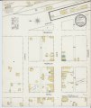
Sanborn Fire Insurance Map from Groton, Brown County, South Dakota. LOC sanborn08235 003-1.tif 6,510 × 7,707; 143.55 MB
-
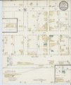
Sanborn Fire Insurance Map from Groton, Brown County, South Dakota. LOC sanborn08235 003-2.tif 6,510 × 7,707; 143.55 MB
-
Map of Minnehaha County, South Dakota LOC 2012592530.jpg 16,193 × 13,028; 26.85 MB
-
Map of Minnehaha County, South Dakota LOC 2012592530.tif 16,193 × 13,028; 603.57 MB
-
Sanborn Fire Insurance Map from Alexandria, Hanson County, South Dakota. LOC sanborn08199 001.tif 6,510 × 7,707; 143.55 MB
-
Sanborn Fire Insurance Map from Andover, Day County, South Dakota. LOC sanborn08200 001.jpg 6,510 × 7,707; 3.29 MB
-
Sanborn Fire Insurance Map from Andover, Day County, South Dakota. LOC sanborn08200 001.tif 6,510 × 7,707; 143.55 MB
-
Sanborn Fire Insurance Map from Armour, Douglas County, South Dakota. LOC sanborn08201 001.tif 6,510 × 7,707; 143.55 MB
-
Sanborn Fire Insurance Map from Artesian, Sanborn County, South Dakota. LOC sanborn08202 001.tif 6,510 × 7,707; 143.55 MB
-
Sanborn Fire Insurance Map from Bowdle, Edmunds County, South Dakota. LOC sanborn08207 001.tif 6,510 × 7,707; 143.55 MB
-
Sanborn Fire Insurance Map from Bridgewater, McCook County, South Dakota. LOC sanborn08208 001.tif 6,510 × 7,707; 143.55 MB
-
Sanborn Fire Insurance Map from Bristol, Day County, South Dakota. LOC sanborn08209 001.jpg 6,510 × 7,707; 3.37 MB
-
Sanborn Fire Insurance Map from Bristol, Day County, South Dakota. LOC sanborn08209 001.tif 6,510 × 7,707; 143.55 MB
-
Sanborn Fire Insurance Map from Britton, Marshall County, South Dakota. LOC sanborn08210 001.tif 6,510 × 7,707; 143.55 MB
-
Sanborn Fire Insurance Map from Carthage, Miner County, South Dakota. LOC sanborn08214 001.tif 6,510 × 7,707; 143.55 MB
-
Sanborn Fire Insurance Map from Columbia, Brown County, South Dakota. LOC sanborn08220 002.tif 6,510 × 7,707; 143.55 MB
-
Sanborn Fire Insurance Map from Doland, Spink County, South Dakota. LOC sanborn08226 001.jpg 6,510 × 7,707; 3.35 MB
-
Sanborn Fire Insurance Map from Doland, Spink County, South Dakota. LOC sanborn08226 001.tif 6,510 × 7,707; 143.55 MB
-
Sanborn Fire Insurance Map from Egan, Moody County, South Dakota. LOC sanborn08227 001.jpg 6,510 × 7,707; 3.38 MB
-
Sanborn Fire Insurance Map from Egan, Moody County, South Dakota. LOC sanborn08227 001.tif 6,510 × 7,707; 143.55 MB
-
Sanborn Fire Insurance Map from Elkton, Brookings County, South Dakota. LOC sanborn08229 001.tif 6,510 × 7,707; 143.55 MB
-
Sanborn Fire Insurance Map from Faulkton, Faulk County, South Dakota. LOC sanborn08231 001.tif 6,510 × 7,707; 143.55 MB
-
Sanborn Fire Insurance Map from Frederick, Brown County, South Dakota. LOC sanborn08234 001.tif 6,510 × 7,707; 143.55 MB
-
Sanborn Fire Insurance Map from Hartford, Minnehaha County, South Dakota. LOC sanborn08236 001.tif 6,510 × 7,707; 143.55 MB
-
Sanborn Fire Insurance Map from Henry, Codington County, South Dakota. LOC sanborn08237 001.tif 6,510 × 7,707; 143.55 MB
-
Sanborn Fire Insurance Map from Hitchcock, Beadle County, South Dakota. LOC sanborn08239 001.tif 6,510 × 7,707; 143.55 MB
-
Sanborn Fire Insurance Map from Iroquois, Kingsbury County, South Dakota. LOC sanborn08244 001.tif 6,510 × 7,707; 143.55 MB
-
Sanborn Fire Insurance Map from Kimball, Brule County, South Dakota. LOC sanborn08245 001.tif 6,510 × 7,707; 143.55 MB
-
Sanborn Fire Insurance Map from Mellette, Spink County, South Dakota. LOC sanborn08248 001.tif 6,510 × 7,707; 143.55 MB
-
Sanborn Fire Insurance Map from Salem, McCook County, South Dakota. LOC sanborn08261 001.jpg 6,510 × 7,707; 3.73 MB
-
Sanborn Fire Insurance Map from Salem, McCook County, South Dakota. LOC sanborn08261 001.tif 6,510 × 7,707; 143.55 MB
-
Sanborn Fire Insurance Map from Volga, Brookings County, South Dakota. LOC sanborn08271 001.tif 6,510 × 7,707; 143.55 MB
-
Sanborn Fire Insurance Map from Warner, Brown County, South Dakota. LOC sanborn08272 001.jpg 6,510 × 7,707; 3.08 MB
-
Sanborn Fire Insurance Map from White, Brookings County, South Dakota. LOC sanborn08275 001.tif 6,510 × 7,707; 143.55 MB


