Category:1893 maps of Kentucky
Jump to navigation
Jump to search
States of the United States: California · Florida · Georgia · Idaho · Illinois · Iowa · Kansas · Kentucky · Louisiana · Michigan · Minnesota · Mississippi · Missouri · Montana · New Mexico · New York · North Carolina · North Dakota · Ohio · Oregon · Pennsylvania · South Carolina · South Dakota · Tennessee · Texas · Virginia · Washington · Wisconsin · Wyoming – Washington, D.C.
| ← 1890 1892 1893 1895 1896 1897 1898 1899 |
Subcategories
This category has the following 5 subcategories, out of 5 total.
S
Media in category "1893 maps of Kentucky"
The following 10 files are in this category, out of 10 total.
-
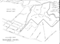 Cherokee park 1893 map.png 3,306 × 2,425; 112 KB
-
 Sanborn Fire Insurance Map from Adairville, Logan County, Kentucky. LOC sanborn03120 001.jpg 6,387 × 7,630; 3.14 MB
-
 Sanborn Fire Insurance Map from Adairville, Logan County, Kentucky. LOC sanborn03120 001.tif 6,387 × 7,630; 139.43 MB
-
 Sanborn Fire Insurance Map from Calhoun, Mclean County, Kentucky. LOC sanborn03138 002.jpg 6,450 × 7,650; 3.57 MB
-
 Sanborn Fire Insurance Map from Calhoun, Mclean County, Kentucky. LOC sanborn03138 002.tif 6,450 × 7,650; 141.17 MB
-
 Sanborn Fire Insurance Map from Greenup, Greenup County, Kentucky. LOC sanborn03173 002.jpg 6,450 × 7,650; 4.33 MB
-
 Sanborn Fire Insurance Map from Sharpsburg, Bath County, Kentucky. LOC sanborn03241 001.jpg 6,450 × 7,650; 3.38 MB
-
 Sanborn Fire Insurance Map from Sharpsburg, Bath County, Kentucky. LOC sanborn03241 001.tif 6,450 × 7,650; 141.17 MB
-
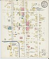 Sanborn Fire Insurance Map from Vanceburg, Lewis County, Kentucky. LOC sanborn03252 002.jpg 6,450 × 7,650; 3.66 MB
-
 Sanborn Fire Insurance Map from Vanceburg, Lewis County, Kentucky. LOC sanborn03252 002.tif 6,450 × 7,650; 141.17 MB


