
Category:1890s maps of Pittsburgh
Media in category "1890s maps of Pittsburgh"
The following 5 files are in this category, out of 5 total.
-
 Mowry2.0.png 534 × 642; 711 KB
-
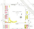 Recreation Park 1893.jpg 7,420 × 6,320; 3.95 MB
-
 High res composite excerpt of Lee's 1894 map of Pittsburgh region with rivers in blue.jpg 2,395 × 1,256; 2.57 MB
-
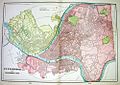
 Allegheny City map.jpg 1,586 × 1,077; 770 KB
-
 Allegheny City.jpg 500 × 353; 36 KB


