Category:1890s maps of Washington, D.C.
Jump to navigation
Jump to search
States of the United States: Alabama · Alaska · Arizona · Arkansas · California · Colorado · Connecticut · Delaware · Florida · Georgia · Hawaii · Idaho · Illinois · Indiana · Iowa · Kansas · Kentucky · Louisiana · Maine · Maryland · Massachusetts · Michigan · Minnesota · Mississippi · Missouri · Montana · Nebraska · Nevada · New Hampshire · New Jersey · New Mexico · New York · North Carolina · North Dakota · Ohio · Oklahoma · Oregon · Pennsylvania · Rhode Island · South Carolina · South Dakota · Tennessee · Texas · Utah · Vermont · Virginia · Washington · West Virginia · Wisconsin · Wyoming – Washington, D.C.
Puerto Rico
Puerto Rico
Subcategories
This category has the following 10 subcategories, out of 10 total.
- 1890 maps of Washington, D.C. (33 F)
- 1892 maps of Washington, D.C. (49 F)
- 1893 maps of Washington, D.C. (17 F)
- 1894 maps of Washington, D.C. (14 F)
- 1895 maps of Washington, D.C. (15 F)
Media in category "1890s maps of Washington, D.C."
The following 22 files are in this category, out of 22 total.
-
 Near Northeast Detail Map.png 936 × 976; 2.18 MB
-

-

-

-
 Birds eye view of Barnes & Weaver's addition to Brookland LOC 78694261.jpg 7,152 × 5,744; 9.25 MB
-
 Birds eye view of Barnes & Weaver's addition to Brookland LOC 78694261.tif 7,152 × 5,744; 117.53 MB
-
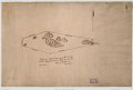
 Copy from actual survey of the 3 Sisters - (Potomac River, Washington D.C.) LOC 88693173.jpg 5,434 × 3,662; 2.02 MB
-
 Copy from actual survey of the 3 Sisters - (Potomac River, Washington D.C.) LOC 88693173.tif 5,434 × 3,662; 56.93 MB
-

-

-
 East Deanewood, District of Colubmia LOC 88690806.jpg 6,655 × 4,908; 3.6 MB
-
 East Deanewood, District of Colubmia LOC 88690806.tif 6,655 × 4,908; 93.45 MB
-
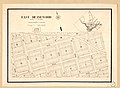
 Map of Kalorama Heights, Washington, D.C. LOC 79693407.jpg 11,623 × 7,382; 9.28 MB
-
 Map of Kalorama Heights, Washington, D.C. LOC 88690871.jpg 11,762 × 7,482; 10.23 MB
-

-

-

-

-
 The Matthews-Northrup up-to-date map of Washington, D.C. LOC 87691447.jpg 3,789 × 3,734; 2.9 MB
-
 The Matthews-Northrup up-to-date map of Washington, D.C. LOC 87691447.tif 3,789 × 3,734; 40.48 MB
-
 The Matthews-Northrup up-to-date map of Washington, D.C. LOC 88693353.jpg 3,793 × 3,197; 2.51 MB
-
 The Matthews-Northrup up-to-date map of Washington, D.C. LOC 88693353.tif 3,793 × 3,197; 34.69 MB

_(14776557945).jpg)
.jpg)
_(18249171359).jpg)

_LOC_88693173.jpg)


