
Category:1890s maps of Philadelphia
Most populous urban areas of the world: Boston [US] · Chicago [US] · Detroit [US] · Istanbul [TR] · London [GB] · Los Angeles [US] · New York City [US] · Paris [FR] · Philadelphia [US] · San Francisco [US] · São Paulo [BR] · Tokyo [JP] · Toronto [CA] · Washington, D.C. [US]
Counties of Pennsylvania : Allegheny · Philadelphia ·
Media in category "1890s maps of Philadelphia"
The following 13 files are in this category, out of 13 total.
-
 Cohoquinoque.png 790 × 482; 721 KB
-
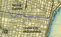
 Dock Creek.png 750 × 621; 984 KB
-
 PRR(1893) Railroad Lines PHILADELPHIA.jpg 3,155 × 2,259; 4 MB
-
 Philadelphia (the most densely settled portion). LOC 2010588130.jpg 4,664 × 3,234; 3.06 MB
-
 Philadelphia (the most densely settled portion). LOC 2010588130.tif 4,664 × 3,234; 43.15 MB
-
 Pascal Iron Works 1895.jpg 800 × 800; 854 KB
-

-

-
 League Island U.S. Navy Yard Philadelphia LOC 2006625070.jpg 11,058 × 6,701; 11.42 MB
-
 754 of 'The International Geography. ... Edited by H. R. Mill' (11168236653).jpg 1,001 × 870; 321 KB
-
 7th Ward of Philadelphia.jpg 5,097 × 1,165; 2 MB
-
 American engineer and railroad journal (1893) (14574288050).jpg 3,072 × 2,078; 1.22 MB
-


_Railroad_Lines_PHILADELPHIA.jpg)
._LOC_2010588130.jpg)


.jpg)
_(14574288050).jpg)
_(14580019629).jpg)