Category:1890s maps of Paris
Jump to navigation
Jump to search
Subcategories
This category has the following 3 subcategories, out of 3 total.
Media in category "1890s maps of Paris"
The following 38 files are in this category, out of 38 total.
-
 1890 – Carte des Environs de Paris.jpg 7,752 × 5,280; 16.14 MB
-
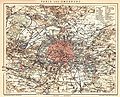
 Meyers leiner Hand-atlas 1893 (73136864).jpg 9,568 × 6,368; 11.24 MB
-
 Meyers leiner Hand-atlas 1893 (73136867).jpg 9,568 × 6,370; 11.8 MB
-
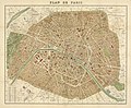
 Plan de Paris - dressé et publié par J. Forest... - btv1b530290322.jpg 10,903 × 8,380; 19.19 MB
-

-

-

-

-
 Paris Petite Ceinture 1898.jpg 2,524 × 2,041; 1.27 MB
-
 274 of 'The International Geography. ... Edited by H. R. Mill' (11288362153).jpg 1,206 × 689; 309 KB
-

-

-
 443 of 'Die Erde. Eine allgemeine Erd- und Länderkunde, etc' (11233944956).jpg 2,224 × 1,685; 1.05 MB
-
 Budushchaia vona v' tekhnicheskom (1898) - Flickr 14598665917.jpg 2,540 × 1,968; 939 KB
-
 Carte des étrangers à Paris en 1891.jpg 479 × 352; 38 KB
-
 Carte téléphonique de la région de Paris, 1er janvier 1896 - BHVP.jpg 5,470 × 3,761; 2.92 MB
-
 Environs de Paris, avec les chemins de fer, 1891 - Gallica.jpg 9,706 × 7,789; 11.42 MB
-
 Environs de Paris. Carte routière. Routes vélocipédiques. Vers 1893 - BHVP.jpg 5,636 × 4,380; 17.66 MB
-
 George Cram, Paris, 1893 - David Rumsey.jpg 9,598 × 6,350; 26.93 MB
-
 Mertens, Département de la Seine, 1890 - David Rumsey.jpg 3,964 × 2,938; 2.91 MB
-

-
 Nouveau plan de Paris monumental by L. Guilmin, 1899 - National Library of Sweden.jpg 4,170 × 3,085; 5.26 MB
-
 Nouveau plan de Paris monumental, financier, industriel et commercial, 1895 - Gallica.jpg 9,688 × 7,855; 15.06 MB
-
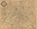
 Nouveau plan de Paris, 1891 - Stanford Libraries.jpg 13,092 × 9,548; 26.19 MB
-
 Nouveau plan de Paris, 1891 - Stanford Libraries.tif 13,092 × 9,548; 119.24 MB
-
 Paris en 1630. Le Plan de la ville, cité, université, fauxbourgs de Paris - Gallica.jpg 8,531 × 6,699; 13.03 MB
-
 Plan commode de Paris avec les lignes d'omnibus et tramways, ca. 1891 - Stanford Libraries.jpg 8,928 × 7,004; 10.77 MB
-
 Plan commode de Paris avec les lignes d'omnibus et tramways, ca. 1891 - Stanford Libraries.tif 8,928 × 7,004; 59.64 MB
-

-

-

-
 Plan de Paris - superieur et complet by Lallemand, 1894 - Stanford Libraries - Original.jpg 22,287 × 15,997; 107.43 MB
-
 Plan de Paris - superieur et complet by Lallemand, 1894 - Stanford Libraries.jpg 22,287 × 15,997; 135.35 MB
-
 Plan de Paris by Alexandre Vuillemin, 1893 - Penn State University Libraries.jpg 14,507 × 11,957; 28.67 MB
-
 Plan de Paris, 1890. Offert par l'Hôtel Moderne, Place de la République, Paris - Gallica.jpg 5,576 × 4,000; 5.01 MB
-
 Plan-Guide du pélerin à Paris, 1894 - Gallica.jpg 9,030 × 7,103; 7.62 MB
-
 Plan-vélo des environs de Paris - btv1b530277912.jpg 9,716 × 6,994; 14.3 MB
-
 Rue de Vouillé 1892 Hachette.jpg 979 × 610; 400 KB

.jpg)
.jpg)

_-_Geographicus_-_Paris-hachette-1894.jpg)

_-_btv1b8441317s_(1_of_2).jpg)
_-_btv1b53006745t_(2_of_3).jpg)

.jpg)
.jpg)
.jpg)
.jpg)
_-_Flickr_14598665917.jpg)


_(14589687668).jpg)


