Category:1870s maps of Washington, D.C.
Jump to navigation
Jump to search
States of the United States: Alabama · Alaska · Arkansas · California · Colorado · Connecticut · Delaware · Florida · Georgia · Hawaii · Idaho · Illinois · Indiana · Iowa · Kansas · Kentucky · Louisiana · Maine · Maryland · Massachusetts · Michigan · Minnesota · Mississippi · Missouri · Montana · Nebraska · Nevada · New Hampshire · New Jersey · New Mexico · New York · North Carolina · North Dakota · Ohio · Oklahoma · Oregon · Pennsylvania · Rhode Island · South Carolina · South Dakota · Tennessee · Texas · Utah · Vermont · Virginia · Washington · West Virginia · Wisconsin · Wyoming – Washington, D.C.
Puerto Rico
Puerto Rico
Subcategories
This category has the following 4 subcategories, out of 4 total.
Media in category "1870s maps of Washington, D.C."
The following 26 files are in this category, out of 26 total.
-

-
 Grant Road 1870.jpg 622 × 454; 42 KB
-
 Bird's-eye-view of Washington City, D.C. LOC 75693174.jpg 6,192 × 4,752; 4.88 MB
-
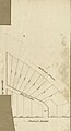 Cadastral map of block possibly in Washington D.C.. LOC 88693119.jpg 1,809 × 3,345; 591 KB
-
 Cadastral map of block possibly in Washington D.C.. LOC 88693119.tif 1,809 × 3,345; 17.31 MB
-
 Cadastral topographical map of part of N.W. Washington D.C.. LOC 88693473.jpg 10,571 × 13,663; 18.76 MB
-
 Cadastral topographical map of part of N.W. Washington D.C.. LOC 88693473.tif 10,571 × 13,663; 413.22 MB
-

-

-

-
 543 of 'Cassell's History of the United States ... Illustrated' (11107331363).jpg 1,958 × 2,635; 1.67 MB
-

-

-
-

-
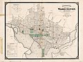
 Map of the cities of Washington and Georgetown D.C. LOC 87694046.jpg 6,529 × 5,129; 4.89 MB
-

-

-

-

-

-

-
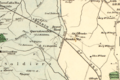 BrooklandOldLOCImage.PNG 1,232 × 821; 1.85 MB
-

-

-
 WashingtonGeorgetownMap1876.jpg 6,529 × 5,129; 6.22 MB


_of_the_United_States_of_America_LOC_88693471.jpg)
%27_(11064389266).jpg)
.jpg)


_of_the_United_States_of_America_LOC_88693468.jpg)
