Category:1870s maps of Utah
Jump to navigation
Jump to search
States of the United States: Alabama · Alaska · Arkansas · California · Colorado · Connecticut · Delaware · Florida · Georgia · Hawaii · Idaho · Illinois · Indiana · Iowa · Kansas · Kentucky · Louisiana · Maine · Maryland · Massachusetts · Michigan · Minnesota · Mississippi · Missouri · Montana · Nebraska · Nevada · New Hampshire · New Jersey · New Mexico · New York · North Carolina · North Dakota · Ohio · Oklahoma · Oregon · Pennsylvania · Rhode Island · South Carolina · South Dakota · Tennessee · Texas · Utah · Vermont · Virginia · Washington · West Virginia · Wisconsin · Wyoming – Washington, D.C.
Puerto Rico
Puerto Rico
Subcategories
This category has the following 6 subcategories, out of 6 total.
- 1870 maps of Utah (2 F)
- 1872 maps of Utah (1 F)
- 1874 maps of Utah (4 F)
- 1875 maps of Utah (8 F)
- 1876 maps of Utah (2 F)
- 1877 maps of Utah (empty)
Media in category "1870s maps of Utah"
The following 5 files are in this category, out of 5 total.
-
 North-Western Colorado and part of Utah - DPLA - 6d8072d6f2a16881c9887a67144e25b2.jpg 9,000 × 6,344; 9.54 MB
-
 Western Colorado and part of Utah - DPLA - 6d6b0bacd02b0fd78658103c2ba6b0ad.jpg 9,000 × 6,295; 8.29 MB
-
 Western Colorado and part of Utah, sheet XIV - DPLA - 4dec99291300d924eb5b4060546713a7.jpg 8,999 × 6,507; 9.92 MB
-
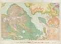
 Transactions (1871) (14597325538).jpg 2,018 × 1,514; 318 KB
-


_(14597325538).jpg)