Category:1863 maps of the United States
Jump to navigation
Jump to search
Countries of the Americas: Canada · United States of America
States of the United States: Alabama · Georgia · Illinois · Louisiana · Maryland · Massachusetts · Michigan · Mississippi · Nevada · North Carolina · Pennsylvania · South Carolina · Tennessee · Texas · Virginia · West Virginia – Washington, D.C.
Subcategories
This category has the following 20 subcategories, out of 20 total.
1
- 1863 maps of North Carolina (14 F)
- 1863 maps of South Carolina (22 F)
A
- 1863 maps of Alabama (3 F)
C
- Chattanooga region (29 F)
D
- 1863 maps of Washington, D.C. (15 F)
G
- 1863 maps of Georgia (U.S. state) (empty)
I
- 1863 maps of Illinois (2 F)
L
- 1863 maps of Louisiana (10 F)
M
- 1863 maps of Maryland (10 F)
- 1863 maps of Massachusetts (5 F)
- 1863 maps of Michigan (2 F)
- 1863 maps of Mississippi (44 F)
N
- 1863 maps of Nevada (2 F)
P
T
- 1863 maps of Tennessee (51 F)
- 1863 maps of Texas (4 F)
V
W
- 1863 maps of West Virginia (7 F)
Media in category "1863 maps of the United States"
The following 200 files are in this category, out of 372 total.
(previous page) (next page)-
 (Map of Arkansas Post, Ark.) LOC 2006635252.jpg 5,247 × 6,905; 5.29 MB
-
 (Map of Arkansas Post, Ark.) LOC 2006635252.tif 5,247 × 6,905; 103.66 MB
-

-

-

-

-
-

-

-
 (Map of Shenandoah County between Mt. Jackson and New Market, Virginia). LOC 2005625057.tif 1,697 × 2,638; 12.81 MB
-
 (Map of the Battle of Chancellorsville, Va). LOC gvhs01.vhs00389.jpg 1,854 × 1,235; 222 KB
-
 (Map of the Battle of Chancellorsville, Va). LOC gvhs01.vhs00389.tif 1,854 × 1,235; 6.55 MB
-
 (Sketch of the United States Ford on the Rappahannock River). LOC 2005625047.jpg 1,719 × 2,132; 423 KB
-
 (Sketch of the United States Ford on the Rappahannock River). LOC 2005625047.tif 1,719 × 2,132; 10.49 MB
-

-
 1863 Fisk and Russell Map of New York City - Geographicus - NYC-fiskrussell-1863.jpg 4,000 × 4,232; 3.18 MB
-

-
 1866 Johnson Map of Florida - Geographicus - Florida-johnson-1866.jpg 3,500 × 2,724; 2.8 MB
-
 1907 Taneytown Road.png 472 × 1,479; 1.47 MB
-
 2nd attack on Fort McAllister on the Ogeechee River, Georgia LOC gvhs01.vhs00278.jpg 2,806 × 4,848; 1.99 MB
-
 2nd attack on Fort McAllister on the Ogeechee River, Georgia LOC gvhs01.vhs00278.tif 2,806 × 4,848; 38.92 MB
-

-

-

-
 Approaches to Fort Butte La Rose, Louisiana, LOC 99447199.jpg 5,145 × 4,549; 2.22 MB
-
 Approaches to Vicksburg and Rebel defences LOC 99447421.jpg 4,880 × 7,112; 8.28 MB
-
 Approaches to Vicksburg and Rebel defences LOC 99447421.tif 4,880 × 7,112; 99.3 MB
-

-

-

-

-

-

-

-

-
-

-

-

-

-

-

-

-
-
 Bacon's steel plate map of America, political, historical & military. LOC 99447105.jpg 10,250 × 7,080; 14.8 MB
-
 Bacon's steel plate map of America, political, historical & military. LOC 99447105.tif 10,250 × 7,080; 207.62 MB
-

-
 Bacon's topographical map of the seat of war in Virginia, Maryland and Pennsylvania LOC lva0000028.tif 10,422 × 7,696; 229.48 MB
-

-

-
 Battle of Chancellorsville. LOC 99439121.jpg 6,008 × 8,975; 8.85 MB
-
 Battle of Chancellorsville. LOC 99439121.tif 6,008 × 8,975; 154.27 MB
-
 Battle of Chickamauga, Ga., Sept. 19 and 20, 1863 LOC 94683238.jpg 4,455 × 5,141; 2.68 MB
-
 Battle of Chickamauga, Ga., Sept. 19 and 20, 1863 LOC 94683238.tif 4,455 × 5,141; 65.53 MB
-
 Battle-field & environs of the city of Fredericksburg. LOC lva0000050.jpg 3,214 × 2,258; 1.18 MB
-
 Battle-field & environs of the city of Fredericksburg. LOC lva0000050.tif 3,214 × 2,258; 20.76 MB
-

-

-

-

-
 Bristoe Campaign LOC gvhs01.vhs00392.jpg 4,046 × 2,628; 1.27 MB
-
 Bristoe Campaign LOC gvhs01.vhs00392.tif 4,046 × 2,628; 30.42 MB
-
 1863 McCloskey Pocket Map of Brooklyn, New York - Geographicus - Brooklyn-mccloskey-1863.jpg 5,000 × 4,149; 4.16 MB
-
 Cgs05247 (9716175077).jpg 2,769 × 3,595; 5.81 MB
-
 Cgs05255 (9716190703).jpg 3,753 × 4,018; 9.57 MB
-
 Chart of the Mississippi River from the Ohio River to Gulf of Mexico (5961386478).jpg 1,572 × 2,000; 2.94 MB
-
 Chart of the Mississippi River from the Ohio River to Gulf of Mexico LOC 99447139.jpg 2,288 × 3,356; 1.26 MB
-
 Chart of the Mississippi River from the Ohio River to Gulf of Mexico LOC 99447139.tif 2,288 × 3,356; 21.97 MB
-
 Chesapeake Bay, Sheet no. 1, York River, Hampton Roads, Chesapeake entrance.. LOC 99447134.jpg 11,697 × 8,040; 16.57 MB
-
 Chesapeake Bay, Sheet no. 1, York River, Hampton Roads, Chesapeake entrance.. LOC 99447134.tif 11,697 × 8,040; 269.06 MB
-

-
 Chesapeake Bay. Sheet 6, from the mouth of York River to the entrance to bay. LOC 99447135.tif 9,131 × 6,707; 175.21 MB
-
 Civil War, 1863-1865 LOC 91684692.jpg 2,266 × 1,748; 479 KB
-
 Civil War, 1863-1865 LOC 91684692.tif 2,266 × 1,748; 11.33 MB
-
 Coast of North Carolina & Virginia LOC 99447450.jpg 8,458 × 13,012; 18.74 MB
-
 Coast of North Carolina & Virginia LOC 99447450.tif 8,458 × 13,012; 314.87 MB
-

-
 Emancipation Proclamation.PNG 1,513 × 983; 54 KB
-
 Fisheye view of Chattanooga and vicinity showing troop positions in 1863. LOC 99448455.jpg 4,534 × 5,034; 4.05 MB
-
 Fisheye view of Chattanooga and vicinity showing troop positions in 1863. LOC 99448455.tif 4,534 × 5,034; 65.3 MB
-

-

-
 Fortifications around Charleston, H.B. ... LOC lva0000154.jpg 3,144 × 2,666; 1.23 MB
-
 From Vicksburg to New Orleans (2674692374).jpg 1,593 × 2,000; 3.02 MB
-

-
 Genl. Thomas' new position 20th Septr. 3 p.m. LOC gvhs01.vhs00159.jpg 1,860 × 2,232; 695 KB
-
 Genl. Thomas' new position 20th Septr. 3 p.m. LOC gvhs01.vhs00159.tif 1,860 × 2,232; 11.88 MB
-
 Gulf coast of the United States, Key West to Rio Grande. LOC 99447137.jpg 8,910 × 8,695; 8.21 MB
-
 Gulf coast of the United States, Key West to Rio Grande. LOC 99447137.tif 8,910 × 8,695; 221.65 MB
-
 Gulf coast of the United States; Key West to Rio Grande. LOC 99447136.jpg 15,554 × 8,732; 12.02 MB
-
 Gulf coast of the United States; Key West to Rio Grande. LOC 99447136.tif 15,554 × 8,732; 388.58 MB
-
 Hazard's rail road & military map of the southern states. LOC 00552203.jpg 15,651 × 9,433; 30.65 MB
-
 Hazard's rail road & military map of the southern states. LOC 00552203.tif 15,651 × 9,433; 422.39 MB
-
 Historical sketch of the rebellion - (United States) LOC 2007626702.jpg 7,451 × 7,885; 5.52 MB
-
 Historical sketch of the rebellion - (United States) LOC 2007626702.tif 7,451 × 7,885; 168.09 MB
-
 Historical sketch of the Rebellion - (United States) LOC 79695218.jpg 7,346 × 8,479; 5.17 MB
-
 Historical sketch of the Rebellion - (United States) LOC 79695218.tif 7,346 × 8,479; 178.2 MB
-
 Historical sketch of the rebellion LOC 99447113.jpg 5,447 × 5,610; 3.34 MB
-
 Historical sketch of the rebellion LOC 99447113.tif 5,447 × 5,610; 87.43 MB
-

-

-

-

-

-
 J. H. Colton's topographical map of the seat of war in Virginia, Maryland etc. LOC 99448508.tif 5,759 × 8,154; 134.35 MB
-
-

-
 Lake de Flambeau Indian Reservation Boundary - NARA - 84786062.jpg 10,944 × 11,766; 9.6 MB
-
 Lloyd's map of the lower Mississippi River from St. Louis to the Gulf of Mexico LOC 99447114.jpg 15,926 × 11,533; 27.96 MB
-
 Lloyd's map of the lower Mississippi River from St. Louis to the Gulf of Mexico LOC 99447114.tif 15,926 × 11,533; 525.5 MB
-
-

-

-

-
 LLoyd's new map of the Mississippi River from Cairo to its mouth LOC 99447107.jpg 2,946 × 10,323; 5.13 MB
-
 LLoyd's new map of the Mississippi River from Cairo to its mouth LOC 99447107.tif 2,946 × 10,323; 87.01 MB
-
 Lloyd's new military map of the border & southern states LOC 99447111.jpg 12,879 × 9,535; 23.06 MB
-
 Lloyd's new military map of the border & southern states LOC 99447111.tif 12,879 × 9,535; 351.34 MB
-

-

-

-

-
 Lloyds new map of the Mississippi River from Cairo to its mouth (5960828391).jpg 605 × 2,000; 1.16 MB
-
 Manuscript map of Chattanooga made in 1863 - Cgs05240.jpg 3,640 × 2,853; 7.27 MB
-

-

-

-

-

-

-
 Map of Buckingham & Appomattox counties LOC 2002627425.jpg 9,360 × 7,255; 13.76 MB
-
 Map of Buckingham & Appomattox counties LOC 2002627425.tif 9,360 × 7,255; 194.28 MB
-
 Map of Cedar County, State of Iowa LOC 2012587557.jpg 11,983 × 14,740; 26.77 MB
-

-
 Map of Chancellorsville battlefield, May 3-4, 1863. LOC 2005625045.jpg 3,271 × 2,513; 1.52 MB
-
 Map of Chancellorsville battlefield, May 3-4, 1863. LOC 2005625045.tif 3,271 × 2,513; 23.52 MB
-

-

-
 Map of eastern Virginia (6094153798).jpg 1,592 × 2,000; 3.6 MB
-
 Map of eastern Virginia LOC 79696025.jpg 5,906 × 7,637; 9.22 MB
-
 Map of eastern Virginia LOC 79696025.tif 5,906 × 7,637; 129.04 MB
-
-
 Map of field of occupation of Army of the Potomac LOC 99446529.jpg 11,165 × 7,648; 10.97 MB
-
 Map of Gettysburg and vicinity LOC 99446454.jpg 15,248 × 18,009; 34.02 MB
-
 Map of Gettysburg and vicinity LOC 99446454.tif 15,248 × 18,009; 785.64 MB
-
 Map of Hancock Co., Ohio LOC 2012591120.jpg 16,441 × 16,214; 34.59 MB
-

-
 Map of Mobile showing the Rebel stronghold in the Gulf (5961390040).jpg 1,558 × 2,000; 2.91 MB
-
-

-
 Map of New Kent, Charles City, James City and York counties. LOC gvhs01.vhs00367.jpg 11,718 × 8,718; 15.36 MB
-
 Map of New Kent, Charles City, James City and York counties. LOC gvhs01.vhs00367.tif 11,718 × 8,718; 292.28 MB
-
 Map of Schuylkill County, Pennsylvania - from actual surveys LOC 2012592201.jpg 18,791 × 16,300; 48.84 MB
-
 Map of Surry, Sussex and Southampton counties, Virginia. LOC gvhs01.vhs00380.jpg 12,599 × 10,038; 15.61 MB
-
 Map of the approaches to Little Rock 1863.jpg 1,200 × 930; 172 KB
-
 Map of the battle field of Gettysburg. (July 1st, 2nd, and 3rd 1863). LOC 99439128.jpg 3,492 × 5,213; 2.72 MB
-
 Map of the battle field of Gettysburg. (July 1st, 2nd, and 3rd 1863). LOC 99439128.tif 3,492 × 5,213; 52.08 MB
-

-

-
 Map of the cost (sic) of Georgia & Florida. LOC 79695217.jpg 4,056 × 14,938; 9.5 MB
-
 Map of the cost (sic) of Georgia & Florida. LOC 79695217.tif 4,056 × 14,938; 173.35 MB
-

-

-

-
 Map of the environs of Arkansas Post, Ark. January 1863. LOC 2006635251.jpg 3,068 × 4,537; 1.78 MB
-
 Map of the environs of Arkansas Post, Ark. January 1863. LOC 2006635251.tif 3,068 × 4,537; 39.82 MB
-
-

-

-
 Map of the field of operations, November 1863. LOC gvhs01.vhs00172.jpg 1,794 × 2,253; 624 KB
-
 Map of the field of operations, November 1863. LOC gvhs01.vhs00172.tif 1,794 × 2,253; 11.56 MB
-
 Map of the lower (Shenandoah) Valley LOC 2005625051.jpg 5,666 × 8,141; 7.83 MB
-
 Map of the lower (Shenandoah) Valley LOC 2005625051.tif 5,666 × 8,141; 131.97 MB
-
 Map of the Maryland Campaign, Sept. 3rd to 29th 1862 LOC 99439115.jpg 4,107 × 4,584; 2.45 MB
-
 Map of the Maryland Campaign, Sept. 3rd to 29th 1862 LOC 99439115.tif 4,107 × 4,584; 53.86 MB
-
-
 Map of the rail-roads of the State of New York LOC 78692964.jpg 8,994 × 7,354; 8.28 MB
-
 Map of the rail-roads of the State of New York LOC 78692964.tif 8,994 × 7,354; 189.23 MB
-
 Map of the Rappahannock River fron (sic) Port Royal to Richards Ferry LOC 2003630517.jpg 10,392 × 4,926; 6.32 MB
-
 Map of the Rappahannock River fron (sic) Port Royal to Richards Ferry LOC 2003630517.tif 10,392 × 4,926; 146.46 MB
-
-

-
-

-
 Map of the State of Virginia (5960840069).jpg 2,000 × 1,284; 2.89 MB
-
 Map of the state of Virginia LOC 2006629759.jpg 10,952 × 7,202; 12.74 MB
-
 Map of the state of Virginia LOC 2006629759.tif 10,952 × 7,202; 225.67 MB
-
 Map of the State of Virginia LOC 99448886.jpg 9,276 × 5,994; 12.79 MB
-
 Map of the State of Virginia LOC 99448886.tif 9,276 × 5,994; 159.07 MB
-
 Map of the state of Virginia LOC lva0000099.jpg 10,945 × 7,265; 19.45 MB
-
 Map of the state of Virginia LOC lva0000099.tif 10,945 × 7,265; 227.5 MB
-

-
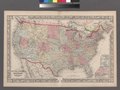
 Map of the United States - DPLA - 5f03bf3bb6db46ed511f436337daebff.jpg 8,999 × 5,551; 8.58 MB
-

-
 Map of the vicinity of Chancellorsville, Va. LOC gvhs01.vhs00393.jpg 5,424 × 2,875; 2.43 MB
-
 Map of the vicinity of Chancellorsville, Va. LOC gvhs01.vhs00393.tif 5,424 × 2,875; 44.62 MB
-

-

-
 Map of Washington City and Georgetown LOC 2013589112.jpg 3,416 × 2,633; 1.26 MB
-

_LOC_2006635252.jpg)
_Chattanooga,_Sept._12_(1863%3F)_LOC_2008628277.jpg)
_LOC_99439165.jpg)
_LOC_99439135.jpg)
._LOC_2005625057.jpg)
._LOC_gvhs01.vhs00389.jpg)
._LOC_2005625047.jpg)
.jpg)


,_Published_1858,_Corrections_to_1863.jpg)


_-_sheet_no._II,_Nantucket_to_Cape_Hatteras._LOC_2008627951.jpg)
_-_sheet_no._III,_Cape_Hatteras_to_Mosquito_Inlet._LOC_2008627953.jpg)
_-_sheet_no._III,_Cape_Hatteras_to_Mosquito_Inlet._LOC_2008628431.jpg)
_-_sheet_no._IV,_Mosquito_Inlet_to_Key_West._LOC_2008627954.jpg)
_-_sheet_no._IV,_Mosquito_Inlet_to_Key_West._LOC_2008628432.jpg)
_-_sheet_no._IV,_Mosquito_Inlet_to_Key_West._LOC_2008628433.jpg)
,_sheet_no._II,_Nantucket_to_Cape_Hatteras._LOC_99447131.jpg)


.jpg)
.jpg)
.jpg)


.jpg)
.jpg)


_LOC_2007626702.jpg)
_LOC_79695218.jpg)


_family_atlas,_with_descriptions,_geographical,_statistical,_and_historical_LOC_2006458040.jpg)


.jpg)
.jpg)


.jpg)


.jpg)
.jpg)


.jpg)
.jpg)
_etc.,_and_Charleston_Harbor_S.C._shewing_(sic)_Union_and_Rebel_forts_and_batteries,_1864._LOC_gvhs01.vhs00184.jpg)


._LOC_99439128.jpg)

.jpg)


_Valley_LOC_2005625051.jpg)

.jpg)

_Port_Royal_to_Richards_Ferry_LOC_2003630517.jpg)


.jpg)


.jpg)


_advance_of_6th_Army_Corps_(Genl._John_Sedgwick_U.S.A.)_to_assist_Gen._Hooker_at_Chancellorsville._LOC_gvhs01.vhs00132.jpg)
.jpg)
_of_Georgia_%26_Florida._LOC_79695217.jpg)