Category:1867 maps of the United States
Jump to navigation
Jump to search
States of the United States: California · Illinois · Michigan · Montana · New York · Oregon · Pennsylvania · Utah · Virginia · Wisconsin – Washington, D.C.
Subcategories
This category has the following 12 subcategories, out of 12 total.
C
- 1867 maps of California (3 F)
D
I
- 1867 maps of Illinois (7 F)
M
- 1867 maps of Michigan (4 F)
- 1867 maps of Montana (1 F)
N
O
- 1867 maps of Oregon (empty)
P
U
- 1867 maps of Utah (1 F)
V
- 1867 maps of Virginia (42 F)
W
- 1867 maps of Wisconsin (10 F)
Media in category "1867 maps of the United States"
The following 28 files are in this category, out of 28 total.
-
1867 Mitchell Map of the United States - Geographicus - UnitedStates-mitchell-1867.jpg 5,000 × 3,174; 3.42 MB
-
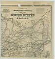
Colton's Railroad and Commercial Map of the United States and Canada - NARA - 86744258 (page 1).jpg 10,816 × 11,462; 14.89 MB
-
Colton's Railroad and Commercial Map of the United States and Canada - NARA - 86744258 (page 2).jpg 10,816 × 11,331; 16.18 MB
-
Colton's Railroad and Commercial Map of the United States and Canada - NARA - 86744258 (page 3).jpg 10,816 × 11,206; 14.41 MB
-
Colton's Railroad and Commercial Map of the United States and Canada - NARA - 86744258 (page 4).jpg 10,816 × 11,441; 14.39 MB
-
Distribution de l'or et de l'argent aux Etats Unis par Jules Marcou.jpg 1,000 × 749; 928 KB
-
National map of the territory of the United States. LOC 2002628194.jpg 17,618 × 14,695; 42.74 MB
-
National map of the territory of the United States. LOC 2002628194.tif 17,618 × 14,695; 740.71 MB
-
Northwestern America showing the territory ceded by Russia to the United States. LOC 98687109.jpg 11,170 × 7,113; 11.27 MB
-
Northwestern America showing the territory ceded by Russia to the United States. LOC 98687109.tif 11,170 × 7,113; 227.31 MB


