Category:1840s maps of North Rhine-Westphalia
Appearance
Federal states of Germany:
Subcategories
This category has the following 2 subcategories, out of 2 total.
Media in category "1840s maps of North Rhine-Westphalia"
The following 22 files are in this category, out of 22 total.
-
Ibbenbüren-Land.jpg 3,257 × 3,405; 4.77 MB
-
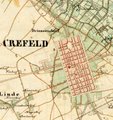
Uraufnahme karte krefeld.jpg 739 × 784; 70 KB
-
Westerkappeln-Land.jpg 1,901 × 2,917; 2.35 MB
-
PKA4808 Essen 1843.jpg 4,590 × 4,550; 5.26 MB
-
Bochum Dahlhausen Linden 1843.png 884 × 676; 1.56 MB
-
Schlacht bei Minden am 1 August 1759 01 (cropped).jpg 3,542 × 2,979; 4.23 MB
-
Schlacht bei Minden am 1 August 1759 01.jpg 5,426 × 4,686; 5.98 MB
-
Schlacht bei Minden am 1 August 1759 02.jpg 3,522 × 2,960; 4.15 MB
-
Frankenforst.jpg 824 × 884; 498 KB
-
Linn Karte Preussische Landesaufnahme 1844.jpg 479 × 206; 31 KB
-
Charte vom Königlich Preussischen Regierungsbezirk Minden.jpg 6,069 × 7,723; 15.52 MB
-
Situationsplan der Station Hagen.jpg 8,185 × 6,260; 3.72 MB
-
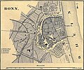
Meyer‘s Zeitungsatlas 048 – Bonn 1849.jpg 1,684 × 1,400; 1.34 MB
-
Meyer‘s Zeitungsatlas 048 – Düsseldorf 1849.jpg 1,678 × 1,387; 1.29 MB
-
Meyer‘s Zeitungsatlas 048 – Krefeld (1849).jpg 1,674 × 1,374; 1.33 MB
-
Meyer‘s Zeitungsatlas 048 – Köln 1849.jpg 2,084 × 2,091; 2.35 MB
-
Meyer‘s Zeitungsatlas 048 – Rheinprovinz Jülich-Cleve-Berg (Main map).jpg 2,254 × 3,703; 4.62 MB
-
Meyer‘s Zeitungsatlas 048 – Rheinprovinz Jülich-Cleve-Berg.jpg 5,961 × 4,927; 13.78 MB
-
Meyer‘s Zeitungsatlas 048 – späteres Wuppertal (1849).jpg 1,690 × 1,395; 1.69 MB
-
Köln - Umgebung von Köln mit Verkehrswegen.jpg 7,651 × 6,247; 19.04 MB
-
Lengerich-Land.jpg 2,940 × 2,515; 2.9 MB


